products
PAPI Lights Inspection and Calibration Check by Drone
Drone PAPI inspection. Each unit's transition angle, colour, intensity balance and surveyed position measured, with a same-day protocol to ICAO, EASA…
NOV 17 2025
12 MIN
A deep look into how we turn raw video and RTK GNSS data into regulatory-grade measurements, built to ICAO, EASA or FAA, with sub-pixel accuracy.
From raw pixels to precise angles
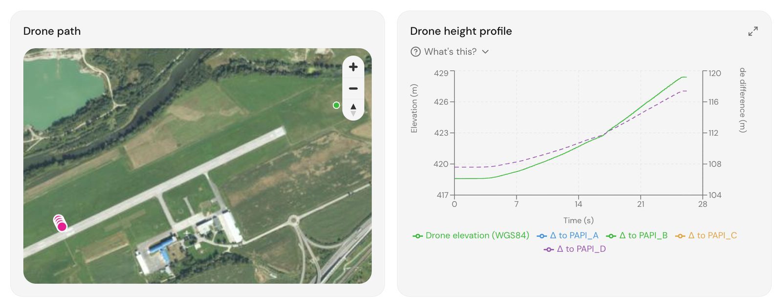
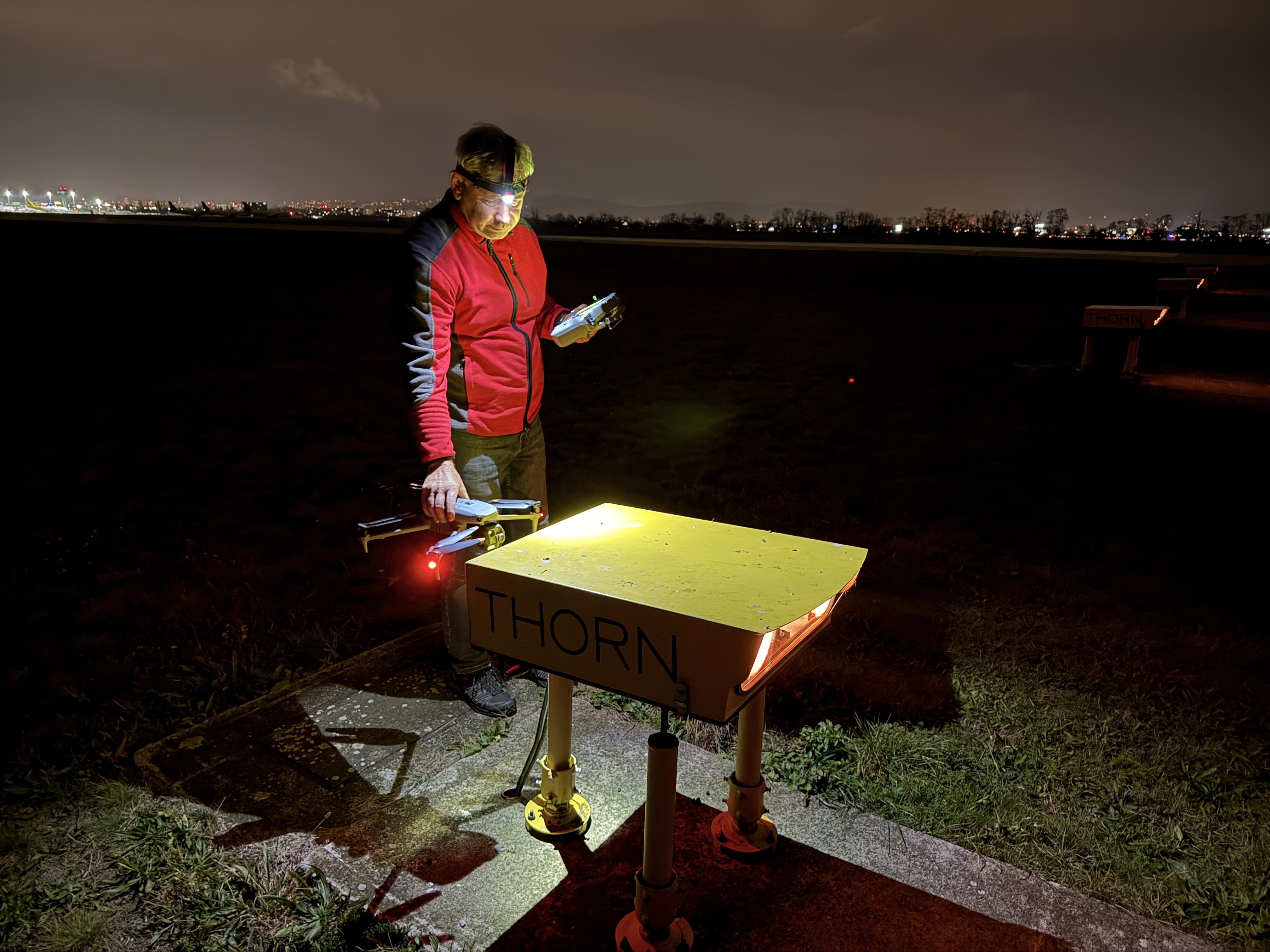
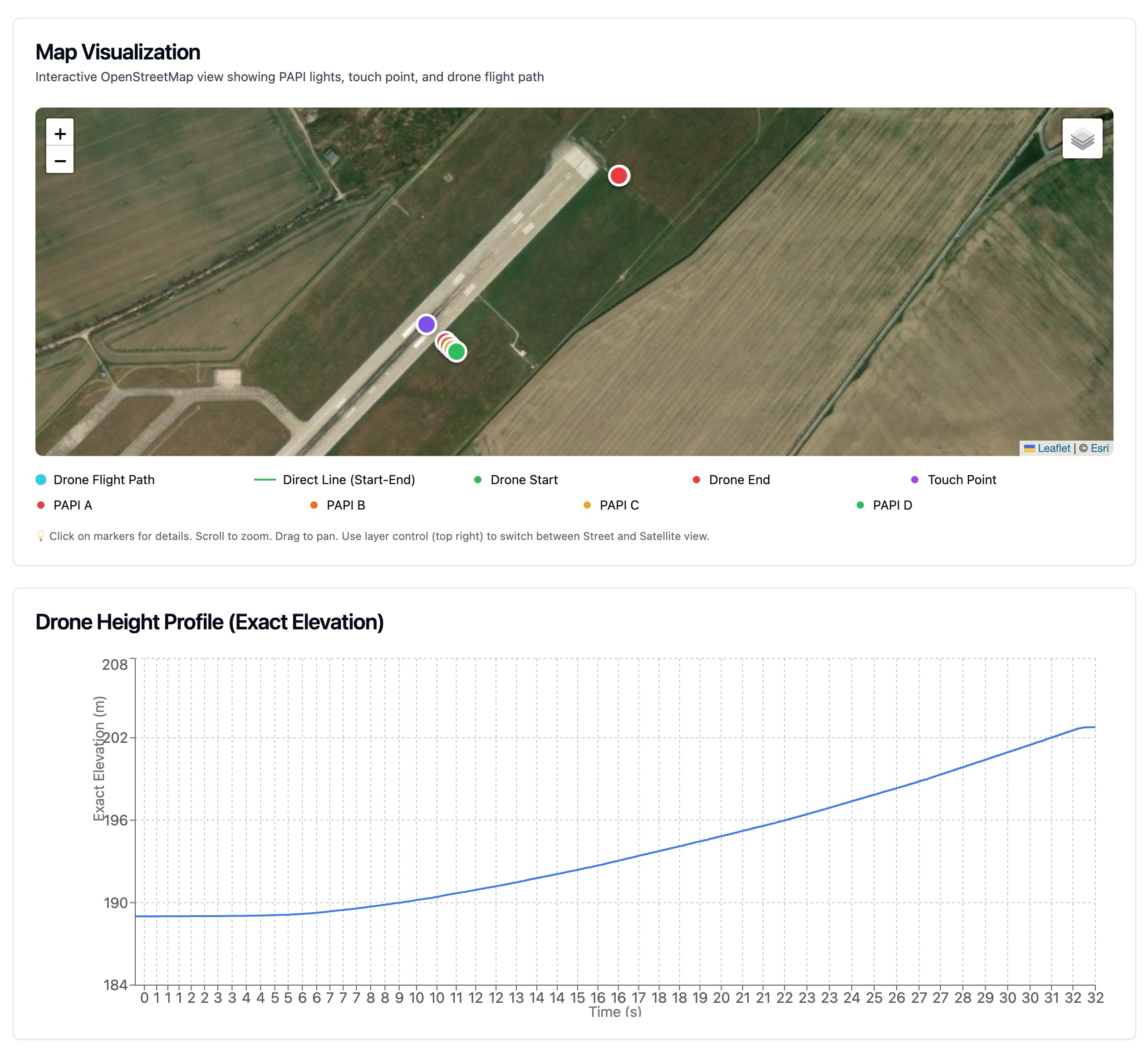
The process begins with high-bitrate 4K video captured at 60fps. Crucially, we synchronize the video frames with the drone's RTK GNSS logs using precise timestamps. This allows us to know the exact 3D position (Latitude, Longitude, Altitude) of the camera sensor for every single frame of video, down to the millisecond.
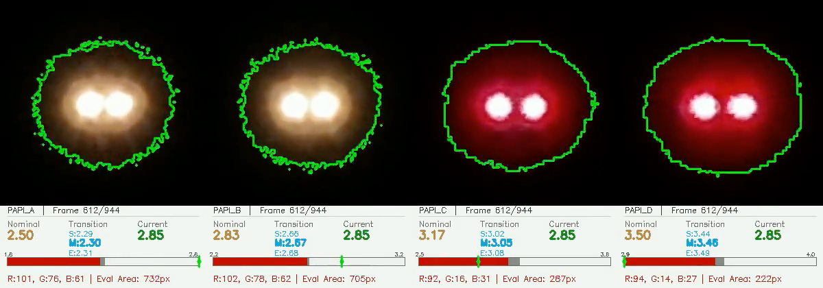
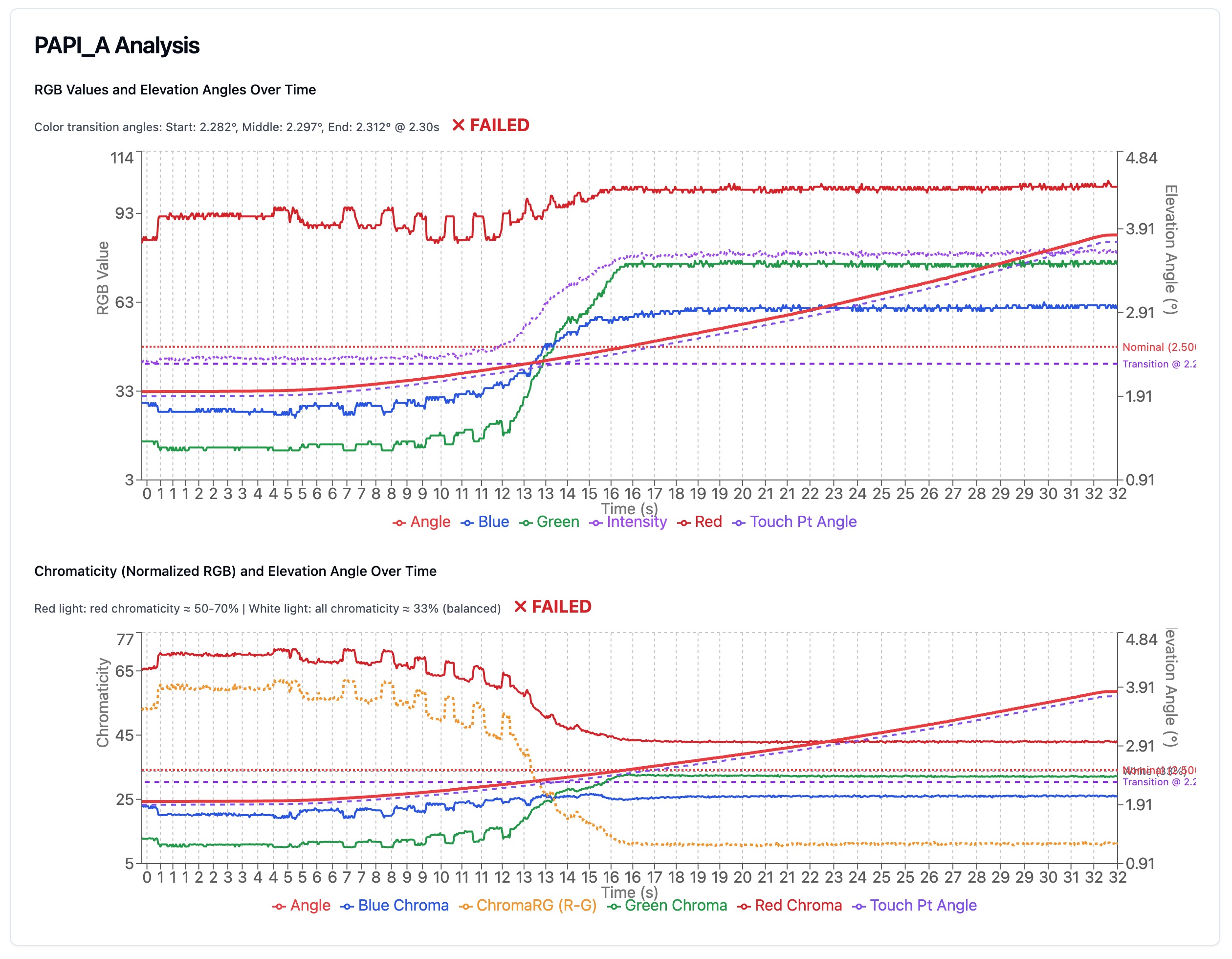
For each frame, we employ a custom blob detection algorithm. It isolates the PAPI lights based on high-intensity thresholds and chromaticity signatures. Instead of just finding the 'center pixel', we calculate the 'intensity centroid', a weighted average of the pixel cluster. This technique allows us to determine the light's position on the sensor with sub-pixel accuracy (typically < 0.1 pixels), overcoming the resolution limits of the sensor.
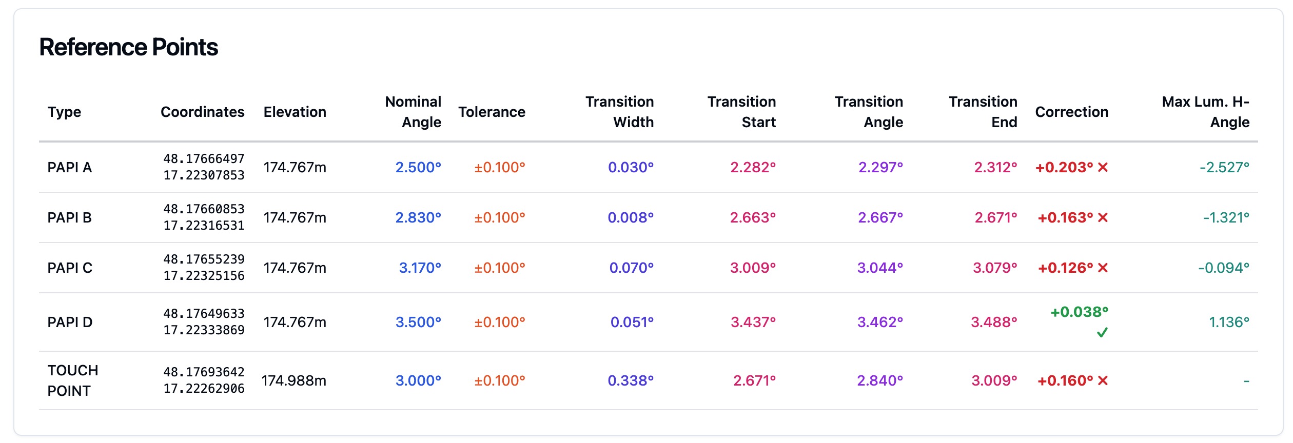
We calculate exact vertical angles relative to two key reference points: the specific PAPI light unit and the runway touchdown point (aiming point). By triangulating the drone's RTK GNSS position against these fixed ground coordinates, we verify both the individual alignment of each light housing and the effective glide path angle that guides the pilot to the correct landing spot.
Accuracy Metrics
Our system's accuracy is defined by two main factors: GNSS positioning error and optical resolution.
How the drone-based method stacks up against traditional techniques.
A detailed analysis of why each method performs the way it does and how accuracy can be maximized.
Our system achieves superior accuracy by completely eliminating human error. Unlike a pilot who must subjectively judge the color transition, our computer vision algorithms analyze the spectral signature of the light frame-by-frame. Combined with RTK GNSS stability, this removes the variability of human reaction time and perception, resulting in consistent, objective measurements that exceed ICAO, EASA or FAA standards.
Traditional flight inspection relies heavily on the pilot's visual perception to identify the transition from red to white. This introduces significant human error, as the exact 'transition point' is subjective and can vary between pilots or even on different runs. Atmospheric turbulence and the aircraft's speed further degrade the precision of these subjective observations.
Clinometers measure the physical tilt of the light unit housing, not the actual light beam. While the device itself is precise (±1 min), it assumes the light bulb and lens are perfectly aligned with the housing. Accuracy is often compromised by 'settling' of the concrete foundation or human error in reading the bubble level. Digital clinometers and laser interferometry can reduce human error but cannot account for internal optical misalignments.
Unique Advantage
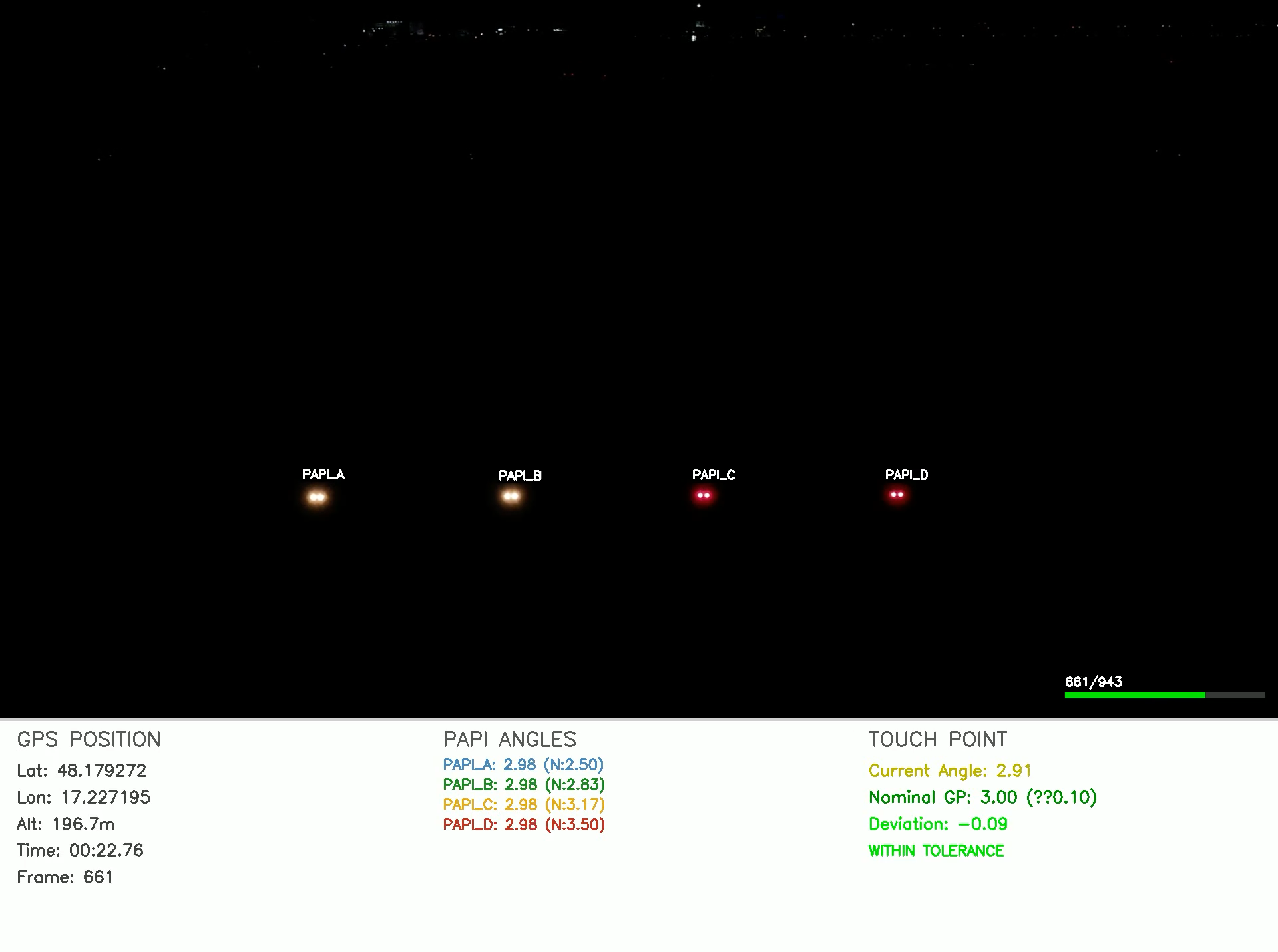
Why choose between data and visual proof when you can have both? Our system is the only solution that combines the rigorous analytical precision of a laboratory instrument with the real-world visual verification of a flight check.
We are building network of partners to revolutionize airport maintenance with cutting-edge technology.
Drone PAPI inspection. Each unit's transition angle, colour, intensity balance and surveyed position measured, with a same-day protocol to ICAO, EASA…
Advanced computer vision and ICAO-compliant reporting
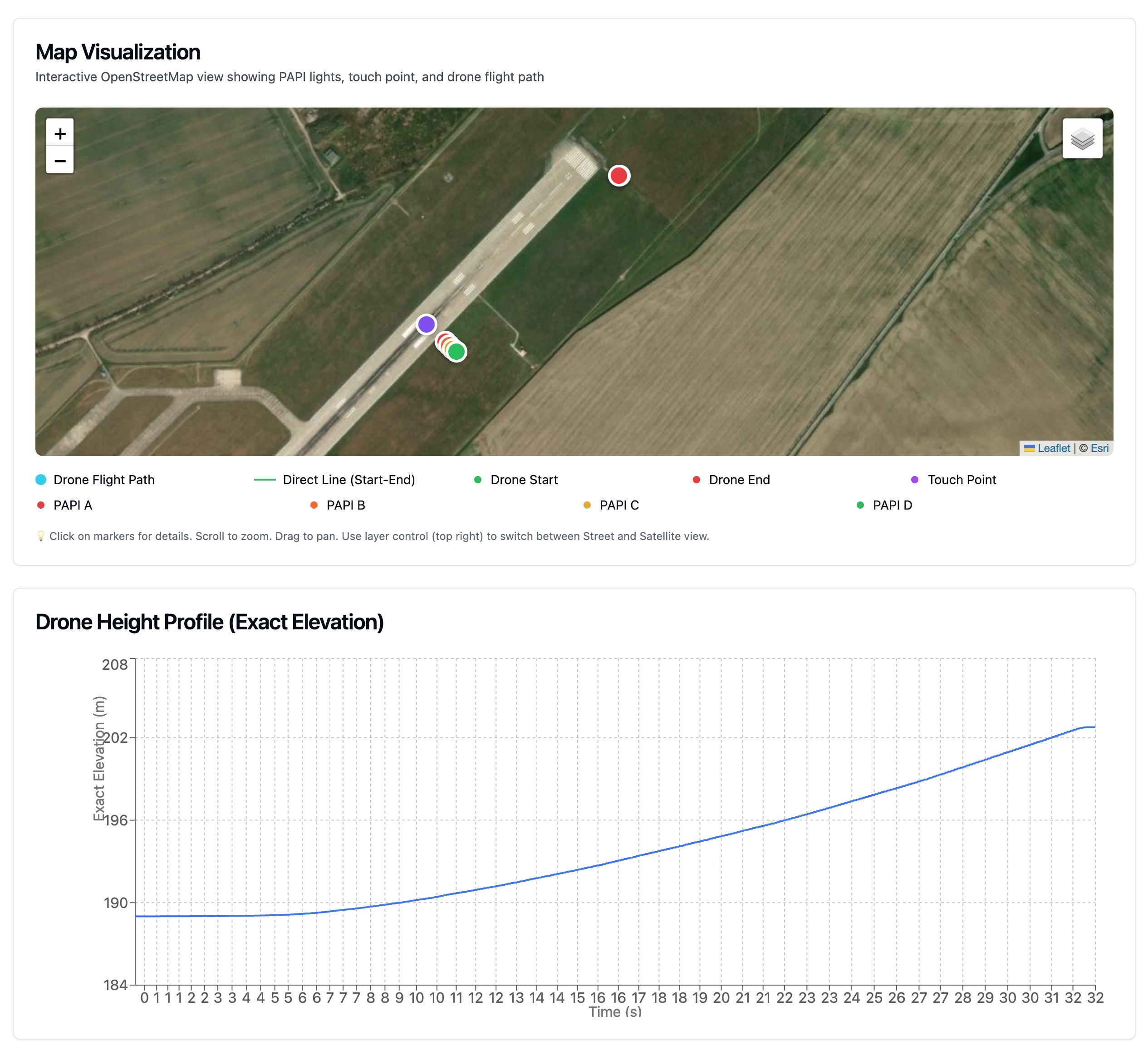
Precision mission control for repeatable results