What is Cloud Cover?
Cloud Cover – Fraction of Sky Covered by Clouds
Cloud cover is a foundational meteorological parameter describing the fraction of the sky dome obscured by clouds, as observed from a specific location on the Earth’s surface. Also known as sky cover or cloud amount, this measurement can be expressed in fractions (e.g., 0.5), percentages (e.g., 50%), or in oktas (the sky divided into eight segments). The okta system, globally standardized by the World Meteorological Organization (WMO), is the preferred method for both manual and automated weather observations.
Cloud cover plays a critical role in Earth’s climate system, weather forecasting, aviation safety, agriculture, and renewable energy. It impacts solar radiation, infrared emission, precipitation, and temperature, making its accurate measurement essential for operational and scientific purposes.
Why Is Cloud Cover Measured?
Cloud cover data is indispensable in:
- Weather forecasting: Cloud cover patterns reveal atmospheric stability, impending precipitation, and severe weather events. Increasing cumulonimbus cover, for example, signals thunderstorms.
- Aviation: Determines whether flights operate under Visual Flight Rules (VFR) or Instrument Flight Rules (IFR). The ceiling, lowest cloud base at broken or overcast levels, is critical for safe takeoff, landing, and flight.
- Maritime navigation: Cloud cover affects visibility and celestial navigation, and signals approaching storms.
- Agriculture: Controls sunlight for photosynthesis, affects temperature, soil moisture, and evapotranspiration rates. Farmers use cloud cover forecasts for planting, irrigation, and harvesting decisions.
- Solar energy: Clouds reduce solar panel output. Real-time and historical cloud cover data help with energy forecasting, grid management, and site selection for solar farms.
- Climate monitoring: Cloud cover modulates Earth’s energy budget, reflecting sunlight and trapping infrared radiation. Long-term records help scientists track climate trends and improve models.
How Is Cloud Cover Measured?
1. Visual Observation (Human Estimation)
Traditionally, trained observers divide the sky into eight segments (oktas) and estimate how many are covered by clouds. Reporting is done according to WMO standards, minimizing subjective errors through training. Human observation is valued for recognizing subtle or rapidly changing sky features, such as thin clouds or patchy cover, that instruments may miss. However, it is subject to observer bias and limitations in distinguishing overlapping cloud layers.
2. Ground-Based Instruments: Ceilometers, Sky Cameras, Radiometers
- Ceilometers emit a laser vertically and detect light reflected from the cloud base, measuring cloud height and, with advanced models, multiple layers and sky coverage.
- Sky cameras with fisheye lenses capture hemispherical images analyzed with automated algorithms (including AI) to determine cloud fraction and classify types.
- Radiometers measure atmospheric radiation in various wavelengths (visible, infrared, microwave) to infer cloud presence and properties.
These automated systems provide continuous, objective data, especially valuable where human observers are unavailable. However, instruments often observe only the zenith, may have difficulty detecting multiple layers, and require regular calibration.
3. Satellite Remote Sensing
Satellites equipped with visible, infrared, and multispectral sensors provide global, continuous cloud cover measurements. Key systems include NOAA GOES, NASA MODIS, and ESA Sentinel. Visible sensors are best for daytime, while infrared enables night observation and estimates cloud top height and temperature.
Satellites offer wide coverage, real-time monitoring, and reduced observer bias, but may struggle with thin or broken clouds, differentiating clouds from snow, and resolving small features due to resolution limits.
4. Advanced Remote Sensing and Artificial Intelligence
Modern meteorology uses machine learning to classify clouds, predict changes, and analyze enormous datasets from satellite and ground-based imagery. LiDAR systems provide high-vertical-resolution profiles, and weather radars can contribute to cloud detection, especially with dual-polarization technology. The fusion of data from multiple sources, managed by AI, enables real-time cloud monitoring and nowcasting.
Cloud Cover Classification: Oktas, METAR, and Plain Language
The Oktas System
The okta scale divides the sky into eight equal parts:
| Oktas | Fraction | Percentage | METAR Code | Public Description |
|---|---|---|---|---|
| 0 | 0/8 | 0% | SKC/CLR | Clear/Sunny |
| 1 | 1/8 | 12.5% | FEW | Few |
| 2 | 2/8 | 25% | FEW | Few |
| 3 | 3/8 | 37.5% | SCT | Scattered/Partly Cld |
| 4 | 4/8 | 50% | SCT | Scattered |
| 5 | 5/8 | 62.5% | BKN | Broken/Partly Cld |
| 6 | 6/8 | 75% | BKN | Mostly Cloudy |
| 7 | 7/8 | 87.5% | BKN | Nearly Overcast |
| 8 | 8/8 | 100% | OVC | Overcast |
| N/A | – | – | VV/SKC | Sky Obscured |
This standardization enables consistent reporting and comparison worldwide.
Aviation Codes: METAR
METAR reports use the following codes for cloud cover:
- SKC or CLR: 0 oktas (clear)
- FEW: 1–2 oktas (few)
- SCT: 3–4 oktas (scattered)
- BKN: 5–7 oktas (broken)
- OVC: 8 oktas (overcast)
- VV: Sky obscured (vertical visibility only)
Cloud layers are reported in order of increasing altitude, with their base height (in hundreds of feet) above ground level (e.g., SCT020 = scattered clouds at 2000 ft).
Plain Language for the Public
Weather apps and forecasts use simplified language:
| Oktas | Typical Description |
|---|---|
| 0 | Clear or Sunny |
| 1–2 | Mostly Clear / Few Clouds |
| 3–4 | Partly Cloudy / Scattered |
| 5 | Partly Cloudy |
| 6–7 | Mostly Cloudy |
| 8 | Overcast or Cloudy |
| N/A | Sky Obscured |
Visual Examples of Oktas
| Oktas | Description | Example Image |
|---|---|---|
| 0 | Clear (SKC/CLR) | 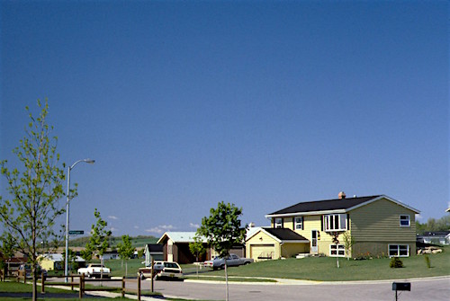 |
| 1 | Few (FEW) | 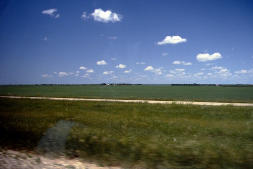 |
| 2 | Few (FEW) | 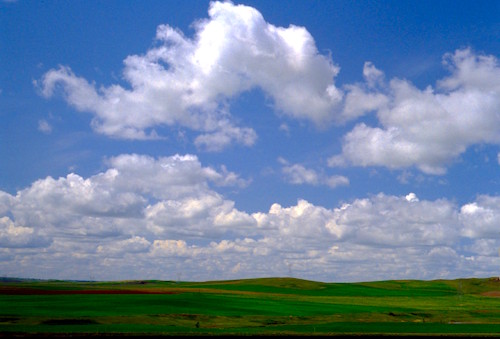 |
| 3 | Scattered (SCT) | 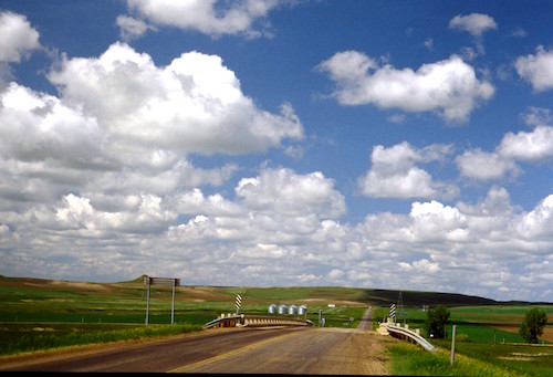 |
| 4 | Scattered (SCT) | 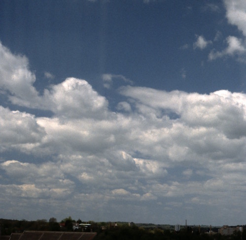 |
| 5 | Broken (BKN) | 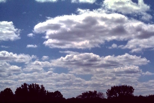 |
| 6 | Broken (BKN) | 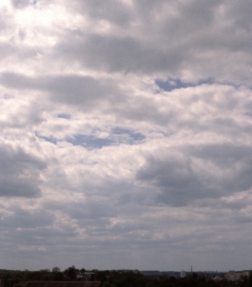 |
| 7 | Broken (BKN) | 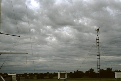 |
| 8 | Overcast (OVC) | 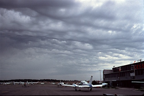 |
Cloud Cover in Practice
- Meteorologists use cloud cover to analyze weather systems and issue forecasts.
- Pilots rely on cloud cover reports for flight planning and safety.
- Farmers adjust schedules based on expected sunshine and precipitation.
- Solar energy operators depend on real-time cloud monitoring for grid management.
- Climate scientists use long-term cloud cover records for trend analysis and model improvement.
Key Takeaways
- Cloud cover is the fraction of the sky covered by clouds, measured in oktas, fractions, or percentages.
- It is vital for weather forecasting, aviation, agriculture, energy, and climate science.
- Measurement methods include visual estimation, ground-based instruments, satellite remote sensing, and advanced AI-driven analysis.
- The okta system and METAR codes standardize reporting globally, with plain language equivalents for public communication.
- Accurate cloud cover data supports safety, efficiency, and scientific understanding across multiple fields.
For further details, refer to authoritative sources like the WMO International Cloud Atlas and NOAA’s Aviation Weather Center .
Frequently Asked Questions
- How is cloud cover measured?
- Cloud cover is measured visually by dividing the sky into eight parts (oktas), with each part representing a fraction covered by clouds, or by using ground-based instruments like ceilometers, sky cameras, or satellite remote sensing. Measurement is standardized by the World Meteorological Organization (WMO) for consistency across global weather networks.
- Why is cloud cover important in aviation?
- Cloud cover impacts flight safety by determining visibility and ceiling heights. These factors are critical for takeoff, approach, and landing. Aviation weather reports use standardized codes (METAR) to communicate cloud cover, helping pilots and air traffic controllers make informed decisions.
- What are oktas?
- Oktas are the standard unit for measuring cloud cover, dividing the sky into eight equal parts. Observers estimate how many of these segments are covered by clouds, reporting a value from 0 (clear sky) to 8 (overcast). Oktas standardize cloud cover reporting worldwide.
- Can satellites measure cloud cover at night?
- Yes. Satellites use infrared sensors to detect cloud cover at night by measuring thermal emissions, allowing for 24/7 global monitoring. Visible light sensors are used during the day, while additional spectral channels help distinguish cloud types and thickness.
- How does cloud cover affect solar energy production?
- Clouds reduce the amount of sunlight reaching solar panels, lowering energy output. Real-time cloud cover data helps solar farm operators predict and manage power generation, while long-term cloud statistics guide site selection and system design.
This is a reference entry. TarmacView provides drone inspection services and doesn't sell the equipment or materials described in this glossary.