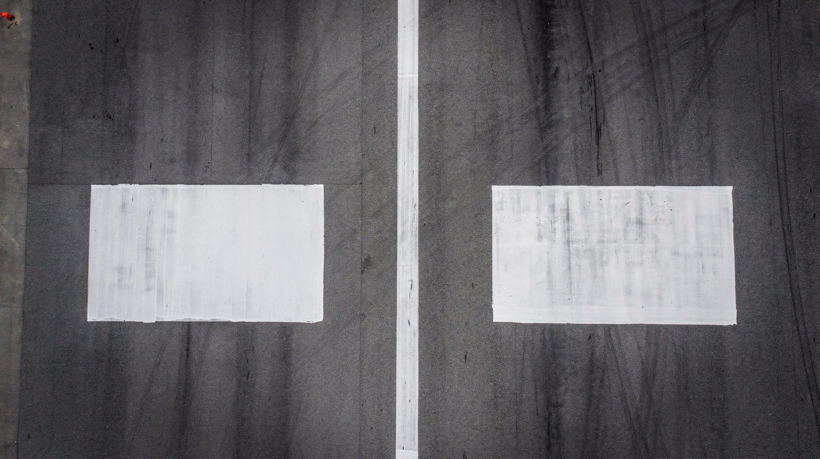
What is a Ground Control Point (GCP)?
Ground Control Point (GCP): The Foundation of Geospatial Accuracy
A Ground Control Point (GCP) is a physically marked, precisely surveyed location on the Earth’s surface, defined by known geographic coordinates, latitude, longitude, and elevation, tied to a recognized coordinate reference system (CRS). GCPs are essential for anchoring geospatial data to real-world positions, serving as the backbone of accurate mapping, surveying, photogrammetry, remote sensing, and aviation data processing.

Example of a high-contrast checkerboard GCP used in aerial photogrammetry.
Core Concepts: What is a GCP?
A Ground Control Point is more than a simple marker:
- Physical Marker: Designed for high visibility in aerial or satellite imagery, often a checkerboard, cross, or L-shape made from durable, weather-resistant material.
- Surveyed Location: Coordinates measured with high-precision GNSS (such as RTK or PPK) or total stations, typically achieving horizontal and vertical uncertainties below 3 centimeters.
- Coordinate Reference: Tied to a specific CRS (e.g., WGS84, NAD83), making it a trusted anchor for transforming digital data into geospatially accurate products.
In aviation, GCPs are mandated for airport mapping, obstacle surveys, and regulatory compliance (e.g., ICAO Annex 14 and 15), ensuring that critical infrastructure maps meet stringent positional requirements.
How GCPs Are Used in Surveying and Mapping
GCPs bridge the gap between the physical world and digital mapping. Their applications include:
- Aerial and Drone Surveys: GCPs are placed before flight, surveyed, and then identified in collected imagery or LiDAR data. Processing software uses their known positions to correct geometric distortions and align the dataset to reality.
- Orthorectification: GCPs enable correction of camera tilt, lens distortion, and topographic relief, producing georeferenced orthomosaics, digital surface models, and point clouds.
- Quality Control: Some GCPs are used for model alignment, others (checkpoints) validate the final product’s accuracy.
Key Steps:
- Placement: Strategic distribution across the project area (corners, center, elevation extremes).
- Survey: High-accuracy GNSS or total station measurement.
- Processing: Software matches GCPs in images to their real-world coordinates, correcting and validating the final map.
GCPs are indispensable in high-stakes fields: airport mapping, construction, cadastral surveys, environmental monitoring, and regulatory reporting.
GCPs, Tie Points, and Checkpoints: Understanding the Difference
| Feature | Ground Control Point (GCP) | Tie Point | Checkpoint |
|---|---|---|---|
| Definition | Marked, surveyed point with known coordinates | Visually distinct feature in overlapping images (unknown coordinates) | Marked, surveyed point not used in model alignment |
| Role | Anchors model to real-world coordinates | Connects images for internal geometry | Independently validates final accuracy |
| Physical Marker | Yes | No (natural or artificial features) | Yes |
| Accuracy Impact | External (absolute) accuracy | Internal (relative) accuracy | Independent quality assessment |
- GCPs: Provide absolute georeferencing.
- Tie Points: Help software stitch images together but do not anchor to real-world positions.
- Checkpoints: Withheld from processing to test the achieved accuracy (e.g., by RMSE).
Coordinate Reference Systems (CRS) and Georeferencing
GCP coordinates must be recorded in the same CRS as the mapping data. Common systems include:
- Global: WGS84 (ICAO standard for aviation)
- Regional/Projected: UTM, State Plane, or local engineering grids
Mismatched CRS can cause major spatial errors (offsets, rotations, scale issues). Always:
- Document CRS, datum, projection, and transformation parameters
- Specify vertical reference (ellipsoid, geoid, or local datum)
- Ensure all data sources are harmonized before integration
Proper CRS management is essential for regulatory, engineering, and safety-critical projects.
Best Practices: Selecting, Marking, and Placing GCPs
Selection Criteria
- Stable Surface: Avoid areas prone to movement, flooding, or heavy activity.
- Clear Sky View: Ensure unobstructed GNSS reception.
- Accessibility: Easy for survey crews to access.
Marking GCPs
- Pattern: High-contrast, e.g., black-and-white checkerboard or cross.
- Size: 3–10 times the ground sample distance (GSD) of the imagery (e.g., 40–60 cm for drone surveys at 5 cm GSD).
- Material: Weather-resistant, non-reflective (painted plywood, vinyl mats).
Placement and Distribution
- At Least Four: One at each project corner.
- Add Interior Points: At least one central or at elevation extremes.
- Well-Spaced: Avoid straight lines or clustering.
- Document Placement: Record exact pattern center as the reference.
Example layout:
+---------------------------+
| GCP1           GCP2       |
|                           |
|        GCP5 (center)      |
|                           |
| GCP3           GCP4       |
+---------------------------+
Practical Applications and Common Pitfalls
Applications
- Aviation: Airport mapping, obstacle surveys (ICAO compliance).
- Construction: Earthworks, volumetrics, as-built documentation.
- Agriculture: Field boundary mapping, crop analysis.
- Environmental: Change detection, shoreline monitoring.
Pitfalls to Avoid
- Too Few/Clustered GCPs: Leads to distortion, especially at edges or in high-relief areas.
- Poor Visibility: Faded, obstructed, or poorly contrasting markers are hard to identify in imagery.
- Incorrect CRS: Causes misalignment with existing data.
- Environmental Change: Markers moved, covered, or damaged before data capture.
Success comes from:
- Clear, durable marking
- Strategic placement
- Accurate, well-documented survey methods
- Rigorous CRS management
Impact on Data Accuracy: Real-World Evidence
Without GCPs
- Typical Errors: 2–5 meters horizontally, 5–20 meters vertically (consumer drones, standard GNSS)
With Well-Placed GCPs
- Achievable Accuracy: 2–5 centimeters horizontally and vertically (meets ICAO, USGS, and national standards)
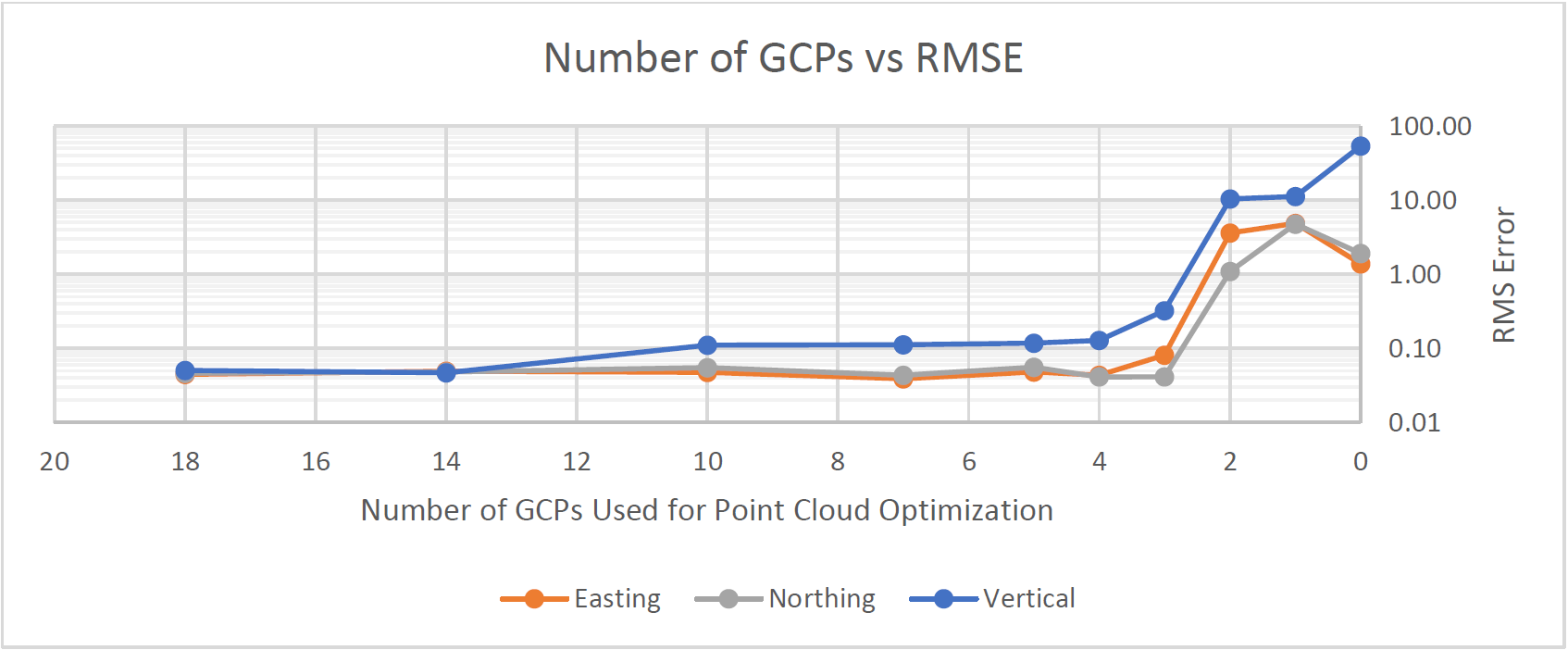
Graph showing diminishing returns as GCP count increases: quality depends on placement, not just quantity.
- Key Insight: 5–10 well-placed GCPs are optimal for most projects, more do not always yield better accuracy.
Checkpoints
- Used to independently verify achieved accuracy via RMSE, as required by regulatory standards (e.g., ICAO Annex 15, ISO 19157).
Integrating GCPs into Photogrammetry and Mapping Software
Workflow:
- Import Surveyed GCP Coordinates: In the correct format and CRS.
- Mark GCP Centers in Images: Manual or automated, with sub-pixel precision.
- Processing: Software aligns dataset using GCPs, corrects distortions, and computes final georeferenced output.
- Validate with Checkpoints: Compare surveyed vs. mapped positions, report RMSE and compliance.
Supported By: Pix4D, Agisoft Metashape, DroneDeploy, Trimble, Leica, and other industry-standard platforms.
References and Resources
- ICAO Annex 14 & 15 – Aerodrome and Aeronautical Data Standards
- ICAO DOC 9881 – Aerodrome Survey Manual
- Pix4D Knowledge Base: Best Practices for GCPs
- Propeller Aero: GCP Guide
- USGS National Map Accuracy Standards
- ISO 19157: Geographic Information, Data Quality
Ground Control Points are the linchpin of accurate, reliable, and compliant geospatial data. Whether for aviation safety, construction management, environmental monitoring, or legal boundary definition, GCPs ensure your mapping products are trusted and actionable, anchored to the real world.
If you need help planning, surveying, or deploying GCPs for your project, contact our experts or schedule a demo to see how professional GCP workflows can elevate your results.
Frequently Asked Questions
- Why are Ground Control Points (GCPs) important in surveying and mapping?
- GCPs provide the reference needed to align digital images and point clouds with real-world coordinates, ensuring that maps and models are accurate, reliable, and compliant with regulatory standards such as ICAO Annex 15. Without GCPs, spatial errors can reach several meters, making results unsuitable for engineering, aviation, or legal use.
- How are GCPs different from tie points and checkpoints?
- GCPs are surveyed, physically marked points used to georeference mapping data. Tie points are visually distinct features used by software to connect overlapping images, but lack known coordinates. Checkpoints are surveyed points withheld from processing, used solely to independently validate the final product's accuracy.
- What makes a good GCP?
- A good GCP is placed on a stable, permanent surface, is highly visible from the air, is surveyed with high-accuracy GNSS or total stations, and is documented in the correct coordinate reference system. Optimal GCP patterns feature high contrast (e.g., checkerboard or cross) and are sized appropriately for the sensor's ground sample distance.
- How many GCPs are needed for a mapping project?
- A minimum of four well-distributed GCPs (one at each project corner) is recommended, with additional points in the interior and at elevation extremes for large or complex sites. Five to ten GCPs typically achieve survey-grade accuracy, the geometric spread is more important than sheer quantity.
- What happens if the GCP coordinate reference system (CRS) does not match the mapping data?
- Mismatched CRS between GCPs and mapping data can result in systematic spatial errors, such as offsets, rotations, or scale distortions, compromising accuracy and regulatory compliance. Always ensure that GCPs and datasets use the same CRS or are properly transformed.
This is a reference entry. TarmacView provides drone inspection services and doesn't sell the equipment or materials described in this glossary.