What is Low Visibility in Aviation?
Low Visibility in Aviation
Low visibility in aviation refers to meteorological conditions where a pilot’s or observer’s ability to see and identify prominent objects is reduced below regulatory or operational thresholds. These conditions can occur due to fog, mist, haze, smoke, precipitation, blowing dust or sand, or volcanic ash. Low visibility is a primary hazard during approach, landing, taxi, and takeoff, as it directly affects the pilot’s ability to visually acquire runways, taxiways, obstacles, and other aircraft. This glossary entry provides an in-depth look at the concepts, causes, measurement, impact, and management of low visibility in aviation.
What is Visibility in Aviation?
Visibility is the measure of the distance at which an object or light can be clearly discerned. In aviation, several standardized definitions apply:
- Meteorological Visibility: The greatest distance a black object of suitable dimensions, placed near the ground, can be seen and recognized against a light background (day) or at which a light of moderate intensity can be seen and identified (night), as specified by ICAO Annex 3.
- Prevailing Visibility: The greatest visibility equaled or exceeded throughout at least half of the horizon, not necessarily continuous.
- Runway Visual Range (RVR): The maximum distance a pilot can see down the runway centerline, measured instrumentally.
Visibility is measured in statute miles (SM) in the US and meters (m) in most ICAO member states. Accurate visibility reporting is essential for safe flight operations, influencing whether pilots operate under visual or instrument flight rules.
Ceiling
Ceiling is defined as the height above ground level (AGL) of the lowest cloud layer reported as broken (BKN), overcast (OVC), or an obscuration (such as fog or smoke). Ceilings are significant for determining flight rules:
- VFR: Ceiling >3,000 ft AGL
- MVFR: 1,000–3,000 ft AGL
- IFR: 500–900 ft AGL
- LIFR: <500 ft AGL
Ceilings are reported in METARs and are critical for compliance with ATC and operational minima.
Flight Categories
Flight operations are classified by ceiling and visibility into four categories:
- VFR (Visual Flight Rules): Ceiling >3,000 ft AGL and visibility >5 SM.
- MVFR (Marginal VFR): Ceiling 1,000–3,000 ft AGL or visibility 3–5 SM.
- IFR (Instrument Flight Rules): Ceiling 500–900 ft AGL or visibility 1–3 SM.
- LIFR (Low IFR): Ceiling <500 ft AGL or visibility <1 SM.
These categories dictate operational procedures, pilot authority, and ATC requirements.
Causes of Low Visibility
Fog
Fog consists of fine water droplets suspended in the air, reducing visibility to less than 1,000 meters (5/8 SM). Types include:
- Radiation Fog: Forms overnight with clear skies and calm winds.
- Advection Fog: When moist air moves over a cooler surface.
- Upslope Fog: When moist air ascends terrain.
- Steam Fog: Cold air over warm water.
- Ice Fog: In subfreezing temperatures, with ice crystals suspended.
Fog is reported as “FG” in METARs and is a frequent cause of airport delays.
Mist
Mist (“BR” in METARs) consists of microscopic water droplets, reducing visibility to between 1,000 and 5,000 meters (5/8–3 SM). It often forms in humid, calm conditions, especially in the early morning or evening.
Haze
Haze (“HZ” in METARs) is caused by fine, dry particles such as dust, smoke, or pollutants. It reduces visibility, often with a bluish or yellowish tinge, particularly in urban or industrial areas.
Smoke
Smoke (“FU” in METARs) from wildfires, burning, or industry can reduce visibility to below 1 SM, sometimes over large areas, and pose significant operational hazards.
Precipitation
- Rain: Scatters and absorbs light, with heavy rain significantly reducing visibility, especially at night.
- Snow: Can create whiteout conditions (<1/4 SM visibility), obscuring runways and taxiways.
- Drizzle & Freezing Drizzle: Small droplets produce persistent reductions in visibility and may cause hazardous surface icing.
Blowing Dust and Sand
Strong winds in arid areas lift particles into the air, coded as “DU” (dust) or “SA” (sand) in METARs, sometimes reducing visibility to near zero.
Volcanic Ash
Volcanic ash (“VA” in METARs) from eruptions can travel thousands of kilometers and severely reduce visibility, while also causing engine and systems damage.
Measurement and Reporting Systems
Human Observers
Trained observers estimate visibility and ceiling visually, especially useful for detecting phenomena like patchy fog, haze layers, or localized smoke that may evade automated sensors.
Automated Systems
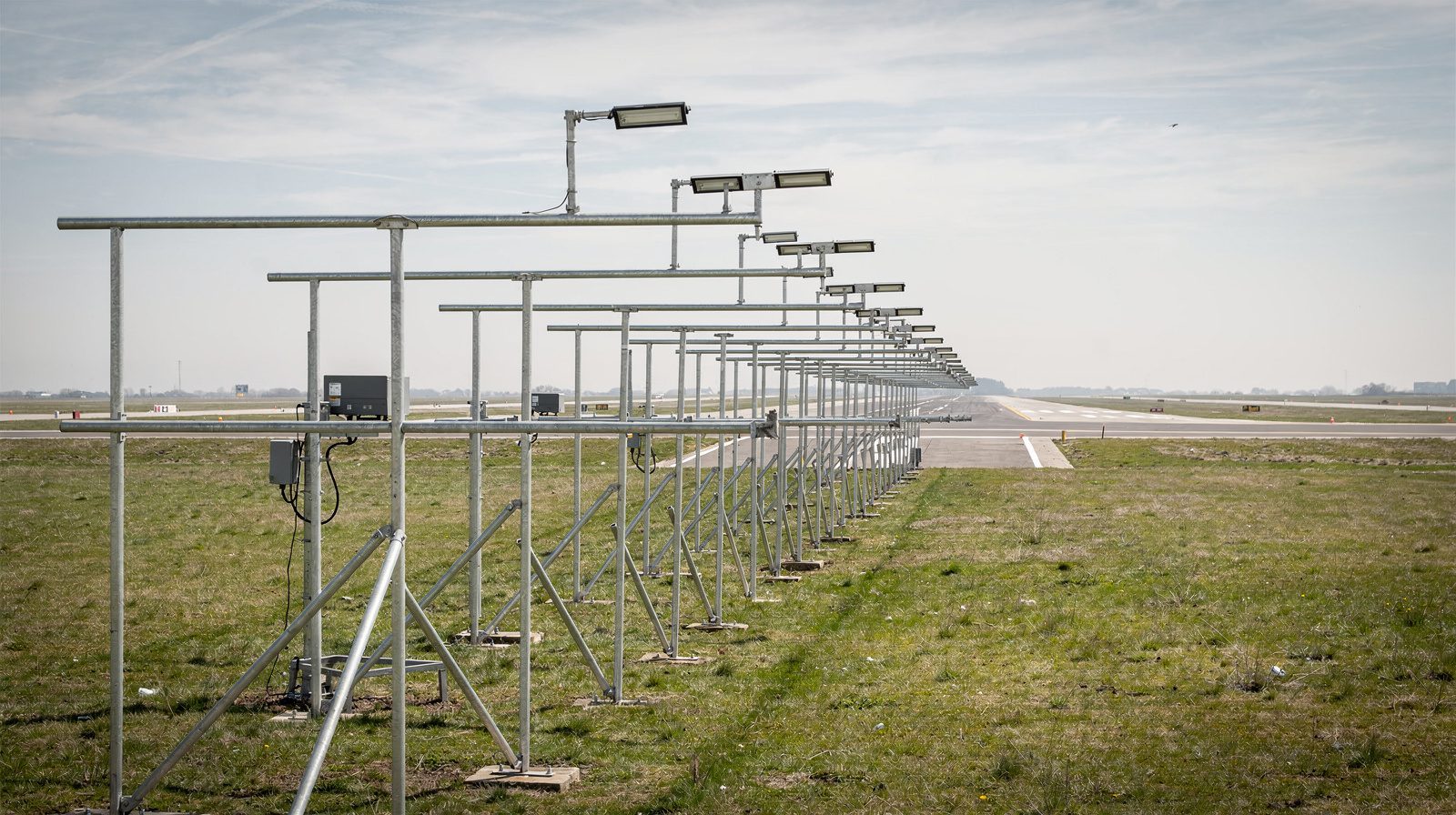
- Runway Visual Range (RVR): Uses transmissometers or scatter meters to measure the distance a pilot can see runway markings or lights. Reported in feet or meters at touchdown, midpoint, and rollout.
- ASOS/AWOS: Automated stations providing continuous visibility, ceiling, and weather data.
- ATIS: Automated Terminal Information Service broadcasts current visibility and operational status to pilots.
Operational Impact
Flight Operations
Low visibility can:
- Require use of instrument approaches and autoland systems.
- Trigger Low Visibility Operations (LVO) or Low Visibility Procedures (LVP) at airports, including Surface Movement Guidance and Control Systems (SMGCS).
- Limit flight and airport capacity, causing delays or closures.
- Require increased separation minima and special ground movement protocols.
Regulatory Minima
ICAO and FAA set specific minima for visibility and ceiling for approach, landing, and takeoff. Operations below these minima are prohibited or require special crew qualifications and equipment.
Health and Safety
In addition to flight hazards, low visibility events like smoke, haze, or dust can pose respiratory risks to airport staff and passengers, sometimes requiring protective measures.
Mitigation and Management
Managing low visibility involves:
- Advanced weather forecasting and real-time observation (human and automated).
- Use of RVR and lighting systems.
- Coordination between pilots, controllers, meteorologists, and ground staff.
- Implementation of contingency plans for rapid changes in conditions.
References
- ICAO Annex 3: Meteorological Service for International Air Navigation
- ICAO Doc 9365: Manual of All Weather Operations
- FAA Order 6750.24D: Instrument Landing System (ILS) and Runway Visual Range (RVR)
- FAA AIM (Aeronautical Information Manual)
- WMO Guide to Meteorological Instruments and Methods of Observation
Key Takeaways
- Low visibility is a critical safety and operational challenge in aviation, affecting all phases of flight and requiring meticulous management.
- Measurement relies on both automated and human observation, with RVR as the gold standard for runway operations.
- Causes include fog, mist, haze, smoke, precipitation, dust, sand, and volcanic ash, each with unique operational impacts.
- Procedures and technology, SMGCS, LVO, lighting, and instrument approaches, are essential to maintain safety and efficiency.
- Coordinated response between pilots, controllers, meteorologists, and ground staff is vital for effective management.
Low visibility is a complex but manageable risk in aviation, with established global standards and robust technological solutions ensuring operational continuity and safety.
Frequently Asked Questions
- What does 'low visibility' mean in aviation?
- Low visibility refers to weather conditions where the distance a pilot can see is below regulatory or operational thresholds, affecting flight safety during takeoff, landing, taxi, and approach. It triggers the use of instrument procedures and special airport protocols.
- How is low visibility measured at airports?
- Low visibility is typically measured using Runway Visual Range (RVR) sensors, Automated Surface Observing Systems (ASOS), and human observers. RVR gives the distance a pilot can see down the runway, which is critical for safe landings and takeoffs.
- What are the main causes of low visibility in aviation?
- Common causes include fog, mist, haze, smoke, precipitation (rain, snow, drizzle), blowing dust and sand, and volcanic ash. Each has distinct formation mechanisms and operational impacts on airport and flight safety.
- What flight categories are based on visibility and ceiling?
- Flight categories include VFR (Visual Flight Rules), MVFR (Marginal VFR), IFR (Instrument Flight Rules), and LIFR (Low IFR). Each is defined by minimum ceiling heights and visibility distances, dictating allowable operations.
- How do airports operate during low visibility?
- Airports initiate Low Visibility Operations (LVO) using specialized procedures, such as SMGCS, lighting systems, and RVR-based minima, to maintain safe ground and air movements. Pilots switch to instrument flight rules and rely on ATC guidance.
This is a reference entry. TarmacView provides drone inspection services and doesn't sell the equipment or materials described in this glossary.