products
Runway Surface Scan by Drone at a Known Resolution
Drone scan of runway and taxiway pavement at a known ground resolution. Cracks, spalls, joint defects and debris found and located to RTK precision,…
AUG 03 2026
11 MIN
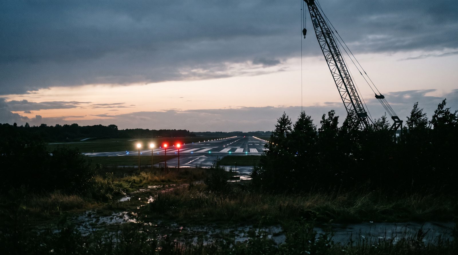
The protection surface over an approach is a plane, and the only question that matters is whether anything crosses it. We fly an arc that rides on that plane and hold the camera on a point that also lies on it, so any object breaking through visibly cuts the sightline on camera. Vegetation, a new roofline, a crane that was not there last year.
This service is bought by the person who has to sign that the approach surface a crew relies on is clear, and knows that the last survey is a statement about the day it was made. It fits the operator closing out works near the approach, the manager of a regional aerodrome with woodland under the glide path, and the aerodrome that has just re-aimed its PAPI and moved the plane with it.
Three outcomes are what the service is judged on, and each has a state you can check on delivery rather than a promise you have to trust.
The report names the surface it was run against, its origin, inner edge, divergence and slope, and states whether anything penetrates it, tested against your surveyed obstacles and again on the flown sightline.
Each object that breaks the surface comes back with its surveyed position, its measured top height with the uncertainty stated, how far above the plane it reaches and the frames that show it.
The whole arc is recorded with the drone's RTK position on every frame, so the finding that the surface is clear is a piece of evidence rather than an assertion, and can be reviewed later.
The same surface is tested twice, once against your survey data and once against what the camera sees.
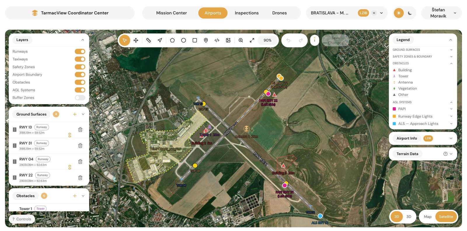
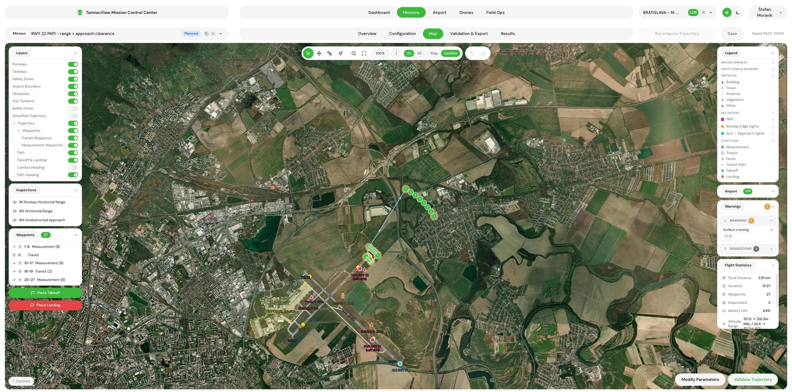
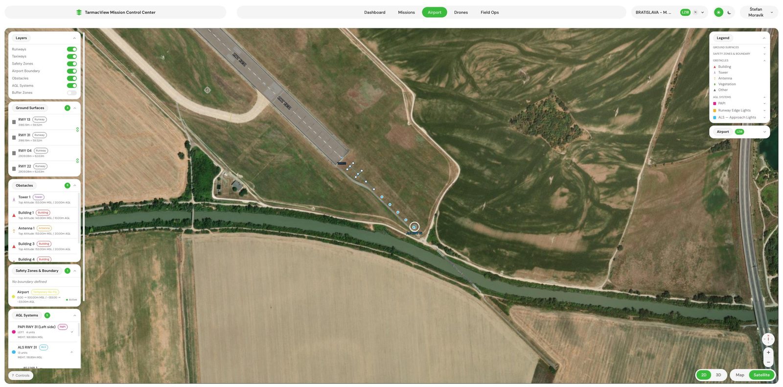
The protection surface is built for the runway direction from its own geometry: where the surface starts relative to the threshold, how wide its inner edge is, and how fast it diverges outward, using the ICAO Annex 14 values where you have not published your own. Its slope comes from your published figure, or is derived from the published glide path. Every surveyed obstacle on the airfield is then tested against that solid: does its footprint fall inside the surface, and does its top break through the plane above it. Anything that does both is named before the drone leaves the ground.
Survey data goes stale, which is the whole reason for the flight. The arc is flown at the altitude the plane reaches at that radius, with the camera locked on a safe point out on the extended centre line that sits on the same plane. That makes the sightline a physical sample of the surface: anything penetrating it passes in front of the camera rather than being inferred from a spreadsheet. The sweep either side of the runway axis covers the sector the crew uses, and the whole pass is on video, so the finding is evidence rather than an assertion.
The obstacle rows of the visual aids protocol, plus the geometry the check was run against.
No object breaks through the obstacle protection surface for the runway direction, tested against the surveyed obstacle set and again on the flown sightline.
The runway lighting and markings stay in view all the way down the approach, with nothing screening them.
The plane the check is run on, taken from your published value or derived from the published glide path.
Origin offset from the threshold, inner edge width and outward divergence used to build the surface.
The arc sweeps the sector either side of the runway axis rather than sampling the centre line alone.
Each object that breaks the surface is reported with its surveyed position and top height, so the cut or the notification can be scoped.
The full approach pass is recorded, so the clearance finding can be reviewed rather than taken on trust.
You name the runway ends, the published glide path, threshold and PAPI data, and send the obstacle register if one exists. We agree whether the check is combined with the PAPI inspection and which protocol template your authority wants. Output is a scope note that states the surface geometry the check will use.
The protection surface is built from the runway geometry and the set angle, with Annex 14 dimensions where you have not published your own. Every object in the register is tested against it as a computation. Output is the list of candidates, the objects that penetrate or come within a margin, before the drone leaves the ground.
The arc is generated on the plane at the agreed radius, with the camera aim point on the extended centreline and on the same plane, and the sweep either side of the axis. Output is a validated mission and a capture window request to your tower, plus any permission needed where the arc crosses land outside the boundary.
Flown between aircraft movements. The arc is flown with the camera locked on the aim point, and every candidate from the computation is then approached and measured with RTK positioning for its position and top height. If a movement interrupts the arc, it is reflown unchanged.
The footage is reviewed frame by frame for anything crossing the sightline, and each candidate is measured against the plane: position, top height with its uncertainty, and how far above the surface it reaches. Anything seen on the arc that was not in the register is added to it.
The obstacle rows of the visual aids protocol and the penetration register, in your authority's wording, with the surface geometry stated and the footage attached. Delivered the same day, with any penetration flagged on the day of capture so the operator can act before the report lands.
A protection surface is a geometric object, and the honest way to check one is to construct it exactly and then test things against it. The surface for a precision approach path indicator starts near the threshold at a set width, diverges outward at a fixed rate and climbs at an angle a little below the glide path the units are set to. Annex 14 gives the dimensions by runway type and code, and the aerodrome may have published its own. The check builds the plane from those figures and from the runway’s own geometry, writes the geometry it used into the report, and tests every object in the obstacle register against it as a computation. Anything that penetrates or comes within a margin is a candidate before the visit begins.
The flight is what turns the computation into evidence. The register contains what was surveyed on the day it was surveyed and nothing else, and obstacle clearance is lost to the things it does not contain: a season of growth, a mast that was not notified, a crane on a permit that expired. The arc is flown at the height the plane reaches at that radius, with the camera aimed at a point on the extended centreline that also lies on the plane, so the sightline itself lies in the surface. Anything rising through the surface between the two passes in front of the camera. That is a physical sample of the plane, not an inference from a spreadsheet.
Where something is seen, it is measured. Its position and top height come from RTK positioning , and the report states the height above the plane with the uncertainty, in metres, so the finding can be handed to a landowner or a contractor as a number rather than an impression. The whole pass is retained, so a disputed entry is re-examined against the frames rather than re-flown, and a repeat check reports what has changed against the last one.
What the check does not cover is the rest of the obstacle limitation surfaces around the aerodrome, the take-off climb, transitional, inner horizontal and conical surfaces that reach kilometres out. That is a whole-aerodrome survey and a separate purchase. The approach is the part of that picture that changes fastest and is flown most easily, which is why it is sold on its own and combined with the PAPI inspection whenever both are wanted.
There is no published rate for this service, because one approach with a current register and four approaches with a register from the certification are different days of work off the same method. The quote gives your figure, and the pricing page describes the combined visit.
Three things can stop or degrade a check, and each has an owner.
The sightline has to be read over two kilometres of approach, so haze, precipitation and low sun on the axis stop the capture, and wind above the drone's limit stops the arc. The mission is flown when the window opens rather than judged through the weather.
The arc needs tower coordination and may cross land outside the aerodrome boundary, which is a permission the operator is best placed to arrange. The surface needs the published glide path, threshold and PAPI data, because a plane built on the wrong angle tests the wrong volume. Both sit with the aerodrome operator.
A clearance statement is only as good as the surface it was made against. Where the aerodrome has published its own dimensions or slope, they are used. Where it has not, the Annex 14 defaults are, and the report says which. We settle this at scoping and write it into the scope note so the surface is never a matter of interpretation afterwards.
Drone scan of runway and taxiway pavement at a known ground resolution. Cracks, spalls, joint defects and debris found and located to RTK precision,…
How an aerodrome proves its PAPI approach is still unobstructed after resurfacing, nearby construction or a summer of tree growth, and what the record…
Drone approach lighting system inspection from the pilot's eye view. Pattern, colour, intensity, coverage and the flashing row verified unit by unit,…
Send the aerodrome, the runway ends to check, the published glide path and threshold data, and whether an obstacle register exists. That is enough to scope. You get a written scope note and a price back within two working days, and the scope note is not binding until you accept it.
Cookie Consent
We use cookies to enhance your browsing experience and analyze our traffic. See our privacy policy.