blog
Runway Surface Inspection: What a Drone Scan Actually Sees
What a drone pavement scan resolves on a runway, what it cannot, how ground sample distance sets the smallest measurable crack, and how a scan becomes…
AUG 15 2026
11 MIN
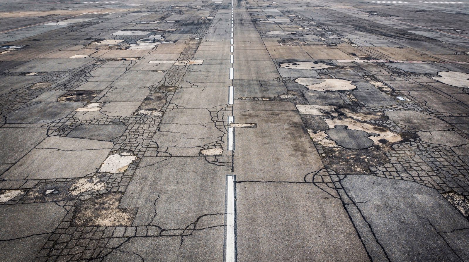
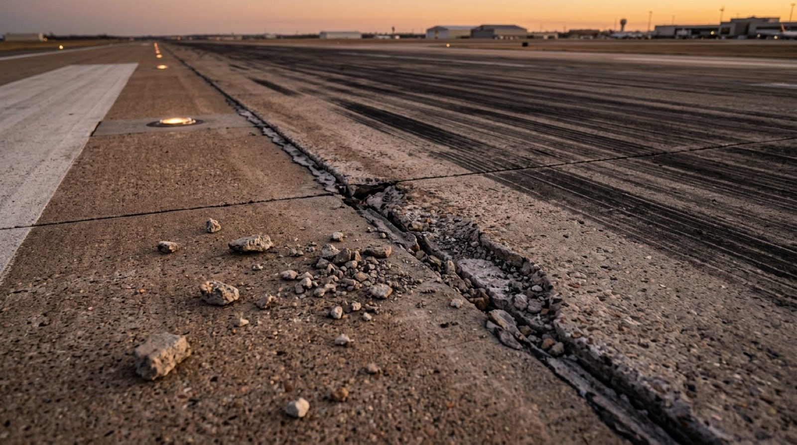
Pavement fails slowly and then all at once. A low serpentine pass images the full width of a runway or taxiway at a known ground resolution, so cracks, spalls, joint breakdown and debris are found and located while they are still maintenance rather than a closure.
This service is bought by the person who walks the runway and knows what a walk misses. It fits the maintenance manager who wants every crack and every spall at a position a crew can drive to, the engineer measuring the extent of a resealing or a rubber removal before the tender goes out, and the operator who needs a record of the surface on a date, before works, after works or after an incident.
Three outcomes are what the service is judged on, and each has a state you can check on delivery rather than a promise you have to trust.
Each crack, spall, joint defect, patch, area of loss and piece of debris on the scanned surface comes back with its type, its extent, its surveyed position and the image it was found in, so a crew can go to it rather than look for it.
The surface is imaged at the ground resolution the scope note names, with the overlap it names, from a pass whose run count and frame spacing were derived from the camera before the flight.
Findings are positioned to RTK precision and the imagery is georeferenced, so a repeat scan of the same area reports what grew, what appeared and what was repaired rather than a fresh list.
A pavement scan is only worth as much as its worst-covered strip. So the pass is derived from the camera, not from a guess.
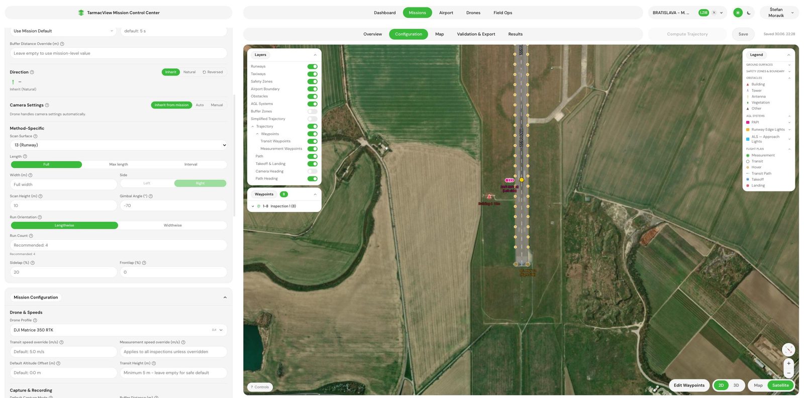
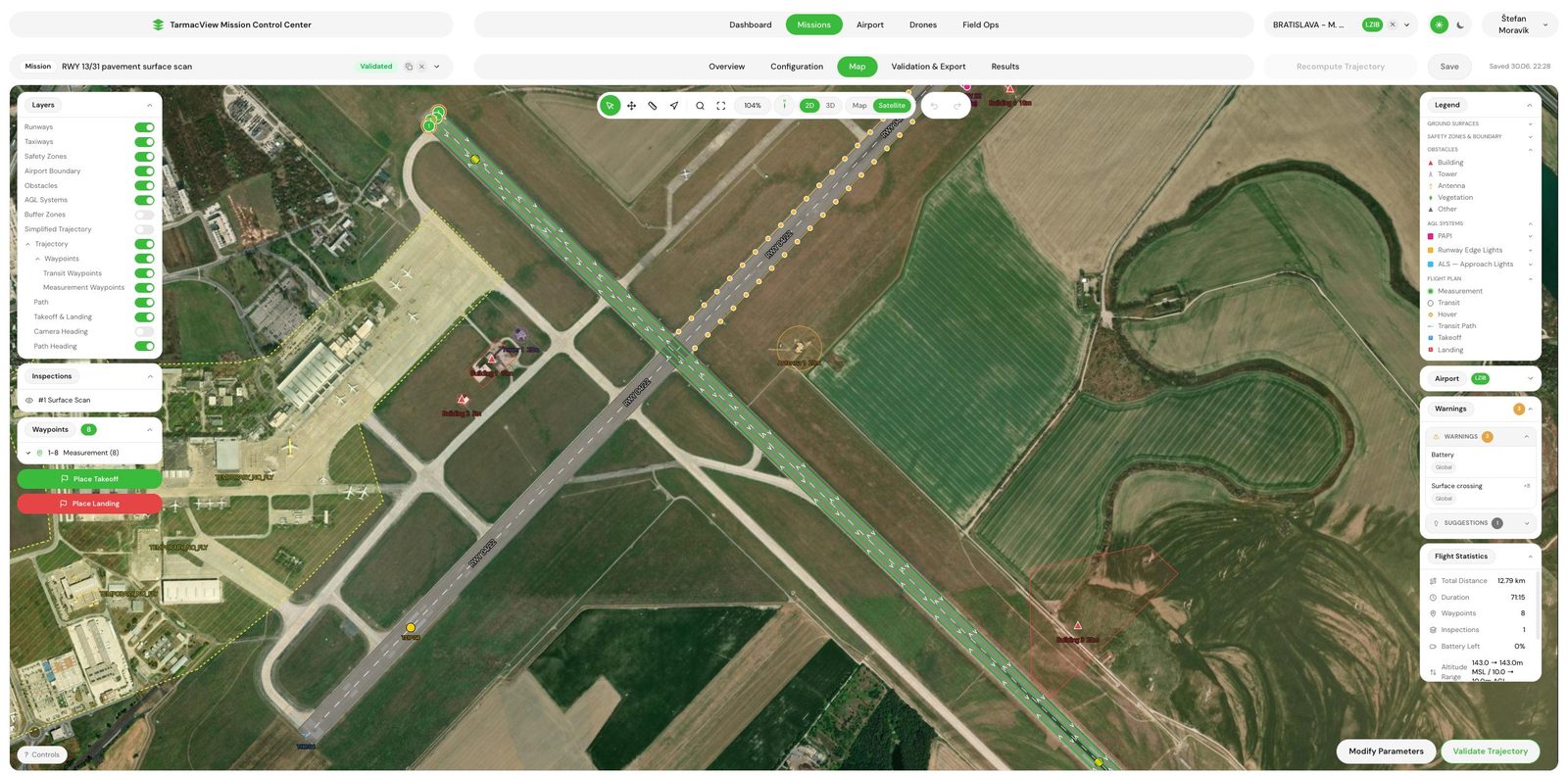
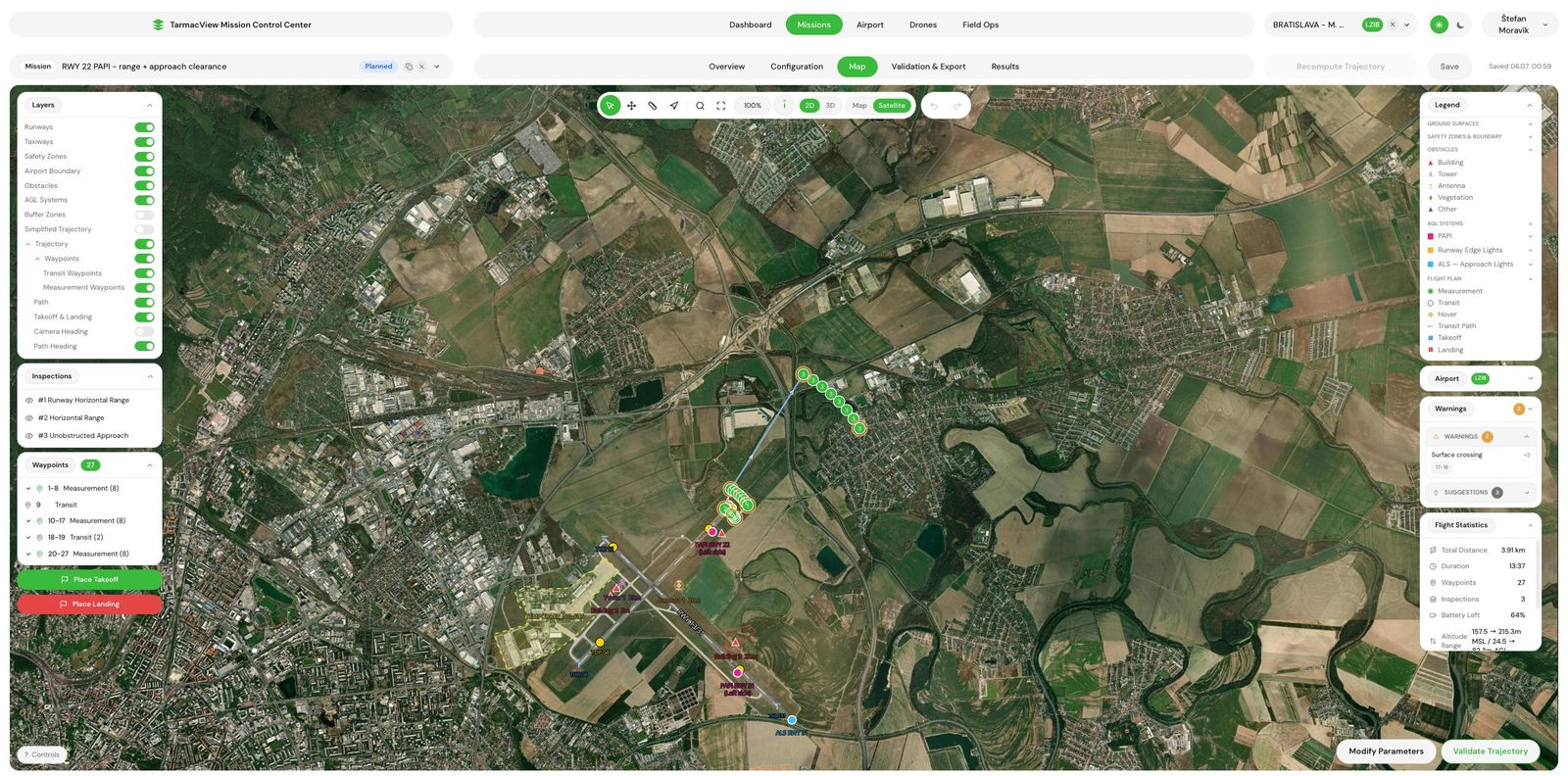
From the scan altitude, the gimbal angle and your camera's field of view, the per-image ground footprint is computed, and from that the number of parallel runs needed to cover the surface width at the overlap you asked for. Forward spacing between frames comes out of the same footprint. The flight speed is then checked against the camera frame rate using that spacing, so a high-overlap scan can never be flown too fast to actually capture every frame it plans. Altitude follows the terrain, so the commanded height above the pavement holds even where the surface falls away.
You are not limited to whole surfaces. The along-track window can be capped or trimmed at both ends and measured from either runway end, so re-checking the first 600 metres off one threshold is one setting. The band across the surface can be narrowed to a single side, which is how a shoulder or one half of a wide apron gets scanned without flying the rest. Runs can be laid along the surface or across it. This pass also satisfies the visual aids requirement to overfly the full length of the runway at low level, so the pavement scan and the pattern and obstruction check come off one sortie.
Every finding located on the surface, so the next survey compares against this one rather than starting over.
Longitudinal, transverse and block cracking located along the surface, with extent and severity recorded per crack.
Surface loss at joints, edges and slab corners, including where aggregate has begun to work loose.
Sealant loss, joint spalling and faulting between slabs, run along the full joint rather than sampled.
Loose material on the pavement at capture time, with position, so it can be cleared before it is ingested.
Rubber deposits in the touchdown zone and the condition and contrast of painted markings.
Depressions and ponding evidence where water is standing rather than running off.
The low-level pass along the full runway also confirms visual contact with the runway elements is not obstructed.
Each finding carries a surveyed position, so change between visits is measured rather than remembered.
You name the surfaces, or the part of a surface, and the question the scan has to answer. We turn the question into a ground resolution and an overlap, agree the export format and who receives the same-day debris notice. Output is a scope note that states the resolution the scan will be flown at.
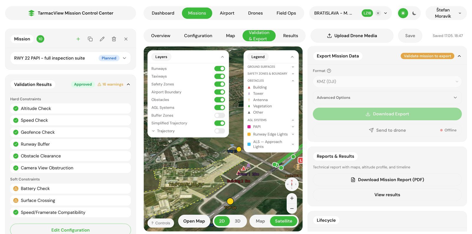
The runs are computed from the surface geometry, the resolution and the camera optics: flight height, run count, frame spacing and speed all follow from them. The height profile follows the terrain. Output is a validated mission and a capture window request to your tower.
Flown between aircraft movements, about an hour on site per runway at the default resolution. Every image carries its RTK position. If a movement interrupts a run, the run resumes from where it stopped. If weather closes the window, the mission is reflown unchanged rather than rebuilt.
Imagery goes through the surface analysis pipeline, which finds and classifies distress by type and marks loose material. Every detection is positioned from the image's georeference. Detections below the confidence floor are held for human review rather than dropped silently.
Anything that reads as an immediate operational hazard, debris on a movement area or an open spall in the touchdown zone, is reported on the day of capture with its position. This is the one part of the deliverable that does not wait for processing.
The located findings, the georeferenced imagery and the report land together in the agreed format. On a repeat scan the report states what grew, what appeared and what was repaired against the previous scan of the same area. Anything disputed is re-examined against the retained imagery rather than re-flown.
A surface scan is a claim about coverage before it is a claim about findings. A walk-down covers what the walker looks at. A scan covers what the pass was computed to cover, and the computation is done from the camera’s field of view, the flight height and the overlap, so the ground resolution is a stated figure and the worst-covered strip is as well covered as the best. That is what lets the scan say what is not there as well as what is, which a walk cannot.
The distress families the scan reports are the ones a surface image can carry: cracking in all its orientations, alligator cracking where it has set in, raveling and weathering, patching, spalling and sealant loss at the joints, rubber in the touchdown zone and the state of the markings. Loose material is reported as foreign object debris rather than as a pavement defect, with a same-day notice, because debris on a movement area is an operational finding with a different owner and a different clock. Where the debris keeps appearing, the spall it came from is usually in the same frame.
What the scan does not do is rate. A pavement condition index is a statement about a defined section, computed from distress density against ASTM D6433 categories, and that is the pavement condition assessment, which takes this scan’s inventory as its input. The scan is the evidence layer under it, and it stands on its own when the question is where and what rather than how bad and in which order.
Every finding carries a position from RTK positioning , and the imagery is retained. That is what makes a disputed finding checkable and a repeat scan comparable. A crack found this year can be found again next year by its position, and the report says whether it grew. A photograph in a folder with no position cannot be found again at all.
There is no published rate for this service, because the work scales with the area and the resolution together, and a figure that is right for one touchdown zone at a coarse resolution is wrong for a whole apron at a fine one.
Three things can stop or degrade a scan, and each has an owner.
Standing water, snow cover and heavy contamination hide the surface from a camera, and wind above the drone's limit stops the low pass. The mission is reflown rather than scanned through the obstruction. This is nobody's fault and it is the most common reason a date moves.
The scan needs tower coordination and, at most aerodromes, an escort, and a low pass along the full runway needs movement windows long enough to fly a run. If the windows do not appear, the visit does not happen. That dependency sits with the aerodrome operator and it is worth confirming before travel is booked.
A scan flown at the wrong resolution answers the wrong question, and reflying it is a second visit. We turn your question into a resolution at scoping and write it into the scope note, and the report states the resolution that was flown so the two can be compared.
What a drone pavement scan resolves on a runway, what it cannot, how ground sample distance sets the smallest measurable crack, and how a scan becomes…
Drone condition assessment for runway, taxiway and apron pavement. Distress classified to ASTM D6433 categories, a PCI proxy per section, a ranked…
Drone check of a runway approach's obstacle protection surface. Built from Annex 14 geometry, tested against your surveyed obstacles, flown on the…
Send the aerodrome, the surfaces to scan and the resolution you need, or the question you want answered if you do not know the resolution. That is enough to scope. You get a written scope note and a price back within two working days, and the scope note is not binding until you accept it.