Drone Survey vs Flight Inspection for Airfield Aids
A dimension-by-dimension comparison of drone survey and aircraft flight inspection for verifying airfield visual aids, and what flips the recommendation.
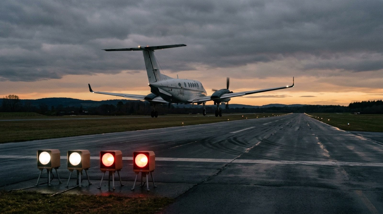
- 01 Choose the drone survey when no radio aid calibration is scheduled, because an aircraft flown in for the lights alone carries ferry both ways at sixty to seventy percent of its measurement rate.
- 02 Choose aircraft flight inspection when radio navigation aids are involved, because no drone method verifies an ILS in the environment a pilot flies.
- 03 The standard arrangement is that the lights ride along on the ILS or VOR visit, and the reason is ferry avoidance rather than convenience.
- 04 Neither method occupies the runway, so occupancy is an argument against ground-based photometry rather than between these two.
- 05 On the fee the two are close in Central Europe, which leaves the decision to which parameters end up in the record.
Disclosure TarmacView sells the drone-based survey compared on this page and does not sell aircraft flight inspection, so read the drone column as a first-party claim and check it against the sources listed at the end.
- Drone-based survey
- Aerodromes with no radio navigation aid to calibrate, where an aircraft would have to be flown in for the lights alone and charge its transit both ways, and where the parameter list runs wider than the glide slope indicators.
- Aircraft flight inspection
- Aerodromes where an ILS or VOR calibration is already scheduled, since the aircraft is at the field and the indicators, approach lighting and runway lighting are verified on the same visit for around 3,000 EUR with no transit to pay for.
- What flips this
- The case turns on scope, not on price. Once the parameter list runs past a verification of the indicators and the lighting systems to every light measured unit by unit, the markings, the pavement and a record that reproduces between visits, the aircraft's hour does not produce it and the second purchase is not a duplicate.
Scope, disclosure and method
This page compares two ways of verifying aerodrome aids: a drone-based survey flown between aircraft movements, and a conventional flight inspection performed by a crewed aircraft. It covers the Central European market, where the price evidence in it comes from, and it was verified on 10 September 2026.
The disclosure comes before the first claim. TarmacView sells the drone-based survey and does not sell aircraft flight inspection. Everything in the drone column is therefore a first-party claim, and the honest way to read this page is to check the drone column against the sources listed at the end rather than against the confidence of the prose.
The method behind the table is narrow on purpose. Each row states one fact per option with its unit, and where a fact is a vendor claim rather than an independent measurement it says so. Prices are the hardest row: neither method has a published tariff, so the aircraft figures come from an operator working in this market rather than from a rate card, and the drone figure is a starting price with the total quoted per aerodrome.
Drone survey against aircraft flight inspection
| Dimension | Drone-based survey | Aircraft flight inspection |
|---|---|---|
| Visual aids covered | Glide slope indicators, approach lighting, edge and threshold arrays, taxiway lighting, markings and the approach obstacle surface | PAPI transition angles, approach lighting and runway lighting, verified together in about an hour |
| Radio navigation aids | Not covered by this method yet. Radio aid verification by drone is in development | Instrument landing system, VOR, DME and related aids, which is the method's primary purpose |
| Absolute photometric intensity | Not measured directly. Needs a reference reading on site or a cross-calibration against a certified instrument | Not measured. An inspection aircraft carries no photometer |
| Relative intensity and colour | Measured as channel ratios across units on one flight, which is independent of exposure | Assessed by the inspector's eye against the expected picture |
| Positioning reference | RTK GNSS tied to a base station and a geodetic frame, quoted at centimetre level | Aircraft navigation and reference systems, quoted at the accuracy the inspection manual requires |
| Runway occupancy | None booked. Flown between aircraft movements, roughly 30 minutes per set as a published vendor claim | None. The aircraft flies approaches and the runway stays open throughout |
| Transit to the aerodrome | By road, inside the operator network, charged as travel | Ferry, charged in flight hours at 60 to 70 percent of the measurement rate, unless the visit is shared with a radio aid calibration |
| Weather and light window | Constrained by wind, precipitation and visibility for the small aircraft | Constrained by weather minima for the inspection aircraft and by the procedure being checked |
| Regulatory basis | Standards name parameters and tolerances rather than instruments. Some authorities have explicitly accepted drone methods for glide slope indicators | Long-established, with suggested periodicities per aid in the ICAO radio navigation aids testing manual and national flight inspection standards |
| Repeatability between visits | The same autonomous mission is regenerated from the aerodrome profile, so two visits are directly comparable | Repeatable to the extent a flown approach is repeatable, which is a looser reproduction of the same path |
| Evidence retained | Raw video and positioning log retained, so a disputed value can be recomputed without reflying | The inspection report and the recorded parameters, per the operator's own retention policy |
| Price evidence | No published rate. The drone service compared here starts at 800 EUR per runway direction, total quoted per aerodrome | No published tariff. About 3,000 EUR per measurement flight hour in Slovakia, Czechia and Hungary, so roughly 3,000 EUR for one bidirectional runway when the aircraft is already on site |
| Who performs it | A licensed drone operator with airfield experience, under the aerodrome's coordination | A civil aviation authority approved flight inspection organisation with a crewed aircraft |
Dimension by dimension
Visual aids covered
The drone covers more of the visual aid inventory, and that is the strongest thing in its column. It flies the approach for the glide slope indicators , images the approach lighting array from the pilot eye position, covers every unit in an edge light row rather than a sample, and can look at the pavement and the obstacle surface on the same sortie. The aircraft is not confined to the indicators either, and this is where most drone marketing understates it: in about an hour it verifies the PAPI transition angles and also the approach lighting and the runway lighting. What it does not produce is a measurement of each light unit by unit, or anything on the markings, the pavement or the obstacle surface. If the parameter list you have to satisfy runs to a dozen items across four systems, the drone answers more of it in one visit. If it runs to a verification of the indicators and the lighting systems, the aircraft already answers it.
Radio navigation aids
This dimension decides the case whenever it applies, and it does not go the drone’s way. An instrument landing system has to be verified in the signal environment a receiver actually experiences, at the altitudes and distances a real approach flies. No drone method compared here does that. If the aerodrome has an ILS, a VOR or a DME on a fixed periodicity, an aircraft is coming, and the argument moves from whether to have one to what else to give it.
Absolute photometric intensity
Neither option is the right instrument, which is worth saying plainly because both markets tend to gloss it. An airborne camera records counts that depend on lens, exposure, sensor state and distance, so stating a value in candelas requires an external anchor. That anchor is either a reference reading taken on site or a cross-calibration against something carrying a calibration certificate , and a supplier claiming its drone is a calibrated photometer has skipped a step. An inspection aircraft has no photometer at all. The instrument built for this job is a ground-based photometric system on a vehicle, and it costs a booked runway occupancy to use.
Relative intensity and colour
Here the drone has a real technical advantage and it comes from arithmetic rather than optics. A ratio between colour channels normalises away exposure, so halving the exposure changes every channel together and leaves the ratio untouched. That is why a colour transition angle can be measured from a camera without knowing its absolute response, and why symmetry across four units on one flight is a strong statement. An inspector in an aircraft assesses the same thing by eye against an expected picture, which catches gross faults and does not produce a number.
Positioning reference
The drone’s geometric chain is its most defensible part. Positions come from RTK positioning referenced to a base station that is itself tied to a geodetic frame, camera intrinsics come from a target-based calibration recorded with a date, and an elevation angle between two known positions is geometry rather than photometry. The aircraft’s chain is different rather than weaker, resting on the aircraft’s own reference systems at the accuracy its inspection manual demands. The methods are answering the question at different scales, one at centimetres on a fixture and one along a whole approach.
Runway occupancy
This dimension is usually presented as the one that decides the case, and it does not, because neither method needs the runway. A drone survey books no closure and works in the gaps between movements, so its occupancy cost is coordination time. A flight calibration is flown as approaches and the runway stays open throughout. The figure in circulation, about an hour of runway occupation for “the method a drone replaces”, cannot be the aircraft. The method it fits is ground-based mobile photometry, which drives the runway with a photometer and does book a closure. An earlier version of this page attributed that hour to the aircraft, which was wrong, and the correction removes what looked like the strongest commercial argument in the drone column.
Transit to the aerodrome
The cost that does separate the two is getting the instrument to the field. A drone crew drives, and travel is charged as travel. An aircraft ferries, charged in flight hours at sixty to seventy percent of the measurement rate, which means a transit of an hour each way costs more than the hour of measurement it enables. This is why the standard arrangement in this market is for the lights to be measured on a visit already scheduled for the ILS or the VOR: not convenience, but the aerodrome avoiding a ferry charge. It also explains the one segment where the price argument is not close. An aerodrome with no radio aid has nothing to bundle onto, so the aircraft arrives carrying its whole transit.
Weather and light window
Both methods lose days to weather and they lose different ones. A small uncrewed aircraft is stopped by wind and precipitation at thresholds a business turboprop would not notice, so a drone survey is more exposed to a bad week. An inspection aircraft is constrained by its own weather minima and by the conditions the procedure under test requires. The practical difference is that a drone visit is cheap to reschedule and an aircraft slot usually is not.
Regulatory basis
The standards describe what must be verified and the tolerance it is judged against, and they say much less about the instrument. That is the whole regulatory argument for drone methods, and it is a good one, but it is not a general permission. Some national authorities have explicitly accepted drone methods for glide slope indicator checks, and at least one has published guidance stating that a flight check of these indicators is not required for calibration purposes at all. Others have said nothing. Ask your authority in writing and ask about the parameter rather than the platform.
Repeatability between visits
The drone wins this one and the reason is that the mission is a file. It is generated from the aerodrome profile and flown autonomously, so the second visit reproduces the first closely enough that a difference of a few minutes of arc is a measurement rather than noise. A flown approach reproduces the same path more loosely, which is fine for the question an aircraft is answering and less useful for trend detection on a fixture. A method that reproduces is what turns a series of visits into a drift record, as uncertainty only becomes actionable once it is bounded and repeated.
Evidence retained
What survives the visit decides what can be argued about later. A drone survey retains raw video and the positioning log, so a disputed number can be recomputed against the original data without flying again. Flight inspection retains the inspection report and the recorded parameters under the operator’s own policy, which is a formal record and a thinner one for reconstruction purposes. Neither is automatically better. The question to put to any supplier is what is kept, for how long, and whether you get a copy.
Price evidence
Neither method publishes a tariff, which is unusual for a market this old and is the reason the PAPI calibration cost guide exists. What can be stated for Central Europe comes from an operator working in it: about 3,000 EUR per measurement flight hour, about an hour for the indicators, approach lighting and runway lighting of one bidirectional runway, so roughly 3,000 EUR when the aircraft is already at the field, and thirty to fifty percent more in Poland, Germany and Austria. The drone service compared here starts at 800 EUR per runway direction and quotes the total per aerodrome. Read against each other, those figures are close enough that price does not settle the choice.
The UK contract that this page used to lean on, aeronautical flight inspection services with an estimated value of 600,000 pounds across a network of regional aerodromes, states no term and cannot be divided down. It is kept here as an example of evidence that looks like a price and is not.
Who performs it
An aircraft flight inspection is performed by an organisation approved by a civil aviation authority for that purpose, and that approval is part of what is being bought. A drone survey is performed by a licensed operator with airfield experience working under the aerodrome’s coordination, and the approvals involved are different ones. Comparing the two on credentials is a category error. Compare them on which approvals your authority requires for the parameter you need verified.
Pricing and total cost
Neither option can be priced from a rate card, but the structures are known and they differ in one place that matters.
The drone’s cost is dominated by travel and by the number of systems on the visit. The marginal cost of adding another system to a crew already on site is small, which is why one visit covering the whole airfield is cheaper than three visits covering thirds of it. The aircraft’s cost is dominated by flight hours, and split between measurement time, which is short, and transit, which is not. Half an hour of measurement at around 3,000 EUR an hour is a modest number. The ferry that delivers the aircraft to the field is usually the larger one, and it disappears when the visit is shared with a radio aid calibration.
So the comparison resolves into two cases rather than one. Where an ILS or VOR check is already scheduled, the aircraft verifies the indicators, the approach lighting and the runway lighting for around 3,000 EUR. The drone has to be bought there for what it adds rather than for what it saves. Where no calibration flight is scheduled, the aircraft carries its transit both ways and the drone is straightforwardly cheaper.
What is not the deciding number, contrary to how this comparison is usually sold, is runway occupancy. Neither method books a closure.
What each method is good and bad at
Drone-based survey
- No aircraft to fly in, so no transit charge at an aerodrome with no radio aid calibration to share a visit with
- Covers more of the visual aid inventory in one visit, including pavement and the approach obstacle surface
- Reproduces the same mission on every visit, so change between visits is measurable
- Retains raw video and positioning data, so a disputed value can be recomputed
- Does not yet verify radio navigation aids, so an aerodrome with an ILS keeps its aircraft for that programme until the drone method is released
- Cannot state absolute photometric intensity without an external calibrated anchor
- Wind and precipitation postpone a drone visit. It flies under low cloud that grounds the aircraft and loses days to wind the aircraft would fly in
- No authority-wide acceptance, so the position of your own regulator has to be established case by case
Aircraft flight inspection
- Verifies radio navigation aids in the signal environment a pilot actually flies, which nothing else does
- Long-established, with periodicities and standards that authorities already recognise
- Performed by an organisation holding a civil aviation authority approval for the purpose
- Costs around 3,000 EUR for one bidirectional runway when it is already at the field for a radio aid, with no transit to pay
- Ferry is charged both ways when no other calibration is scheduled, and it can be several times the measurement it delivers
- Verifies the indicators, approach lighting and runway lighting but does not measure each light unit by unit, and does not cover the markings or the pavement
- Produces no photometric measurement, since the aircraft carries no photometer
- Reproduces a flown path only loosely, which limits its value for detecting slow drift
Verdict by segment
A regional aerodrome with no radio navigation aids. Take the drone survey, and here the price argument is not close. There is no calibration flight to share, so an aircraft arrives carrying its transit both ways for an hour of work. The aids that matter are visual and the drone covers more of them in one window than anything else available.
An aerodrome with an ILS, whatever its traffic. The aircraft is coming and it will verify the indicators, the approach lighting and the runway lighting on that visit for around 3,000 EUR. Do not try to displace that on price. Buy the drone survey for what the flight does not produce: every light measured unit by unit rather than a verification of the pattern, the markings and the pavement, the retained raw data and a mission that reproduces so next year’s numbers are comparable to this year’s. If your programme genuinely stops at a verification of the indicators and the lighting systems, the incumbent arrangement is defensible and you should keep it.
An aerodrome facing an audit finding on its visual aids record. Take the drone survey first, whatever else is contracted. The finding is about evidence, and the method that retains raw data and reproduces between visits is the one that closes it.
An aerodrome buying through a tender. Fix the parameter list before the prices go out, because tenders in this market are normally won on price and the cheapest response is usually the smallest scope. Two quotes that differ by a factor of two are more often quoting different work than quoting the same work differently.
The condition that flips any of these is a change in what has to be verified, or a change in what is already scheduled. Add a radio aid and the aircraft becomes necessary and cheap. Lose the scheduled calibration flight and the aircraft becomes expensive overnight without anything about the measurement changing. Both are worth re-checking annually rather than assumed, which is why this page carries a review date of 4 December 2026.
Sources and verification record
Verified on 10 September 2026, with the aircraft duration and scope corrected on 27 September 2026. The parameter sets and tolerances referenced come from the ICAO aerodrome design manual for visual aids and from the national flight inspection standards named in the reference list. The periodicity framing comes from the ICAO manual on testing of radio navigation aids, which sets suggested intervals that each State modifies. The aircraft flight-hour rate, the ferry basis and the regional uplift come from a written exchange with a flight inspection operator active in the Slovak, Czech and Hungarian market. The hour per bidirectional runway, and the approach and runway lighting in the flight’s scope, come from an expert review that corrected the half hour this page stated before. They are one operator’s rates rather than a published tariff, and they replaced a figure this page previously derived from a UK network contract, which was an order of magnitude too high. The drone duration figures are published vendor claims and are labelled as such. The description of what a drone measurement can and cannot support is TarmacView’s own published account of its method, which is a first-party source and is disclosed as one.
If your aerodrome sits in the segment where the drone survey is the answer, the PAPI inspection service page sets out what a visit covers, and TarmacView will scope one against your runway count.
Frequently Asked Questions
- Can a drone legally replace a flight inspection?
- The question is usually asked about the platform and answered about the parameter. Standards for aerodrome design and for visual aids set out what has to be verified and the tolerances it is judged against, and they are largely silent on the instrument that does the verifying. Some national authorities have explicitly accepted drone methods for glide slope indicator checks, and at least one civil aviation authority states that a flight check of these indicators is not required for calibration purposes at all. What binds you is your own approved maintenance programme and your authority's position, and both are worth getting in writing before a procurement.
- Which method is more accurate?
- They are accurate about different things, which makes a single comparison meaningless. A drone measures an elevation angle between two surveyed positions, which is a geometry problem, and can state a bound on it in minutes of arc. An aircraft measures the signal a receiver actually sees along a real approach path, which is the only way to answer questions about a radio aid in its real environment. Asking which is more accurate is like asking whether a tape measure is more accurate than a thermometer.
- What about photometric intensity in candelas?
- Neither method is the natural instrument. An airborne camera records counts rather than candelas, so absolute intensity needs an external anchor, either a reference reading taken on site or a cross-calibration against an instrument that carries a certificate. An inspection aircraft is not a photometer either. The instrument built for that job is a ground-based photometric system, which is a third option and a booked runway occupancy.
- How much runway time does each method need?
- Neither books a closure. A drone survey is flown between aircraft movements, so its occupancy is coordination overhead. A flight calibration is flown as approaches with the runway open, taking about an hour for the indicators, the approach lighting and the runway lighting together. Published material describing an hour of runway occupation for the method a drone replaces is not describing the aircraft. The method that does need a booked closure is ground-based mobile photometry.
- Do we need both?
- Many aerodromes do, and for a simple reason. If the field has an instrument landing system, something has to verify it in the air, and that is an aircraft. If the field also has visual aids that drift, something has to verify those, and the aircraft visit may or may not cover them at the depth your programme requires. The decision is not which method wins. It is which method owns which part of the programme.
- Is the drone cheaper?
- Not reliably, and the honest answer depends entirely on whether an aircraft is coming anyway. In Slovakia, Czechia and Hungary a flight calibration runs about 3,000 EUR per measurement flight hour and verifies the indicators, approach lighting and runway lighting of one bidirectional runway in about an hour, so around 3,000 EUR when the aircraft is already at the field for an ILS or VOR check. Fly it in for the lights alone and ferry both ways puts the same visit several times higher. The drone wins on price in the second case and on scope in the first.
References
- icao-doc-9157-p4
- Doc 9157, Aerodrome Design Manual, Part 4: Visual Aids International Civil Aviation Organization
- icao-doc-8071
- Doc 8071, Manual on Testing of Radio Navigation Aids, Volume I International Civil Aviation Organization
- faa-order-8200-1
- Order 8200.1D, United States Standard Flight Inspection Manual Federal Aviation Administration
- tc-ac-300-014
- Advisory Circular AC 300-014, Precision Approach Path Indicator and Abbreviated PAPI systems Transport Canada
- cee-operator-rates
- Flight calibration rates and durations in the Slovak, Czech and Hungarian market Written exchange with a flight inspection operator active in the region
- expert-review-2026-09
- Review of the aircraft duration and scope Written review by an aeronautical ground aids measurement specialist
- hial-flight-inspection
- Aeronautical Flight Inspection Services, Highlands and Islands Airports Limited UK public procurement record, via Stotles
- fracs-papi-drone
- Revolutionizing PAPI Calibration with Drone Technology France Aviation Civile Services
- tarmacview-evidence
- How a Drone Measurement Becomes Evidence TarmacView