Every surface tested, every penetration flown
An obstacle limitation surface is a defined solid, and the only question that matters is whether anything crosses it. The survey builds the surfaces from your runway geometry, tests the whole obstacle register against them, and then flies and films what remains in doubt. Trees that have grown, a mast that was not notified, a roofline the register never had.
Who this is for
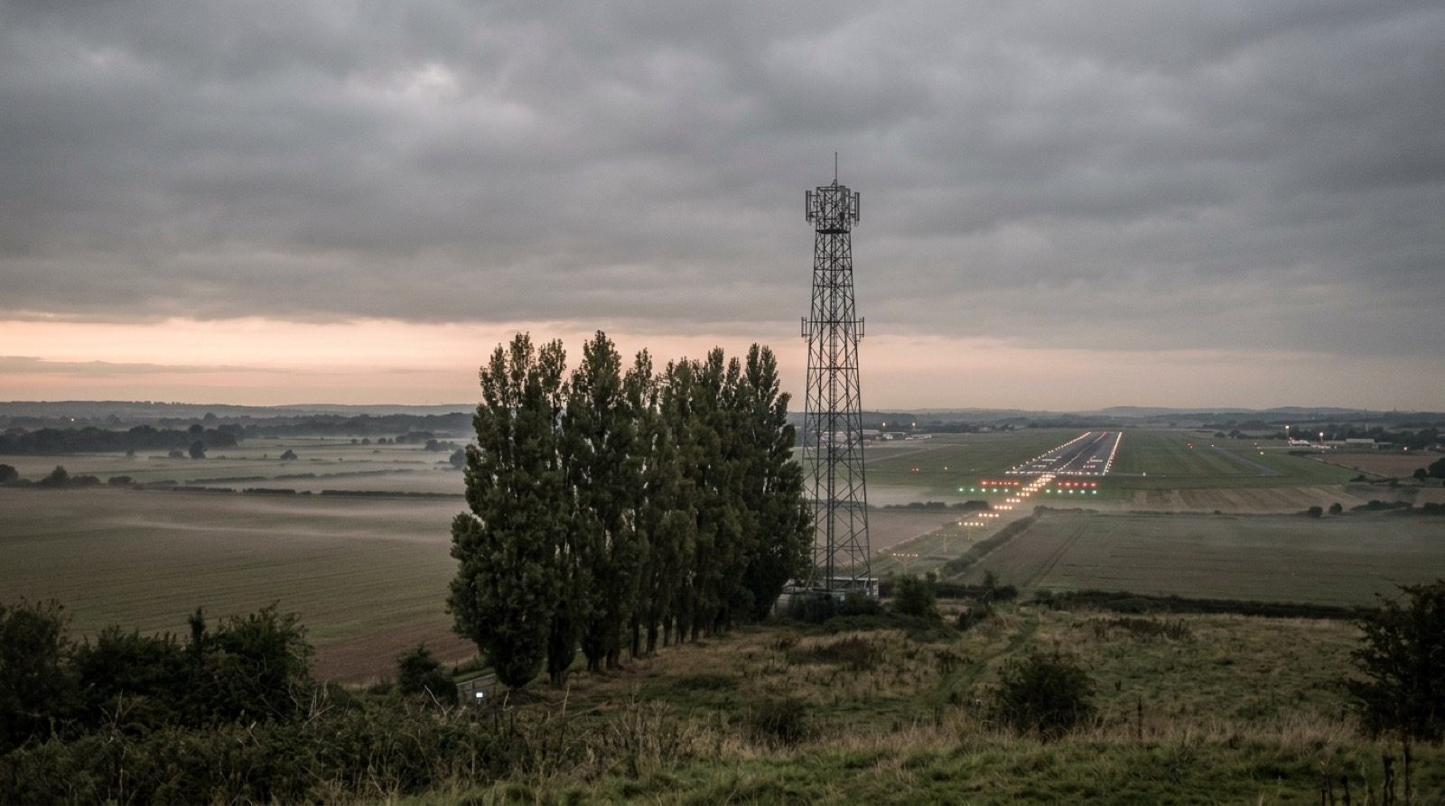
This service is bought by the person who has to answer for what surrounds the runway. It fits an operator whose last full obstacle survey dates from certification, a safeguarding officer who tests development applications against surfaces drawn on a plan, and a regional aerodrome where the obstacle limitation surface is penetrated by trees before anyone builds anything.
Outcomes and acceptance criteria
Three outcomes are what the survey is judged on, and each has a state you can check on delivery rather than a promise you have to trust.
Each limitation surface that applies to each runway direction, constructed from the threshold positions, the runway code, the approach classification and the Annex 14 dimensions, or from your own published values where you have them.
Every object in your existing data tested against the model, and every candidate flown, each with a surveyed position, a top height with its uncertainty, the surface concerned and the clearance or penetration in metres.
The flown record for every penetration and every marginal object, so the finding can be shown to the object's owner and to the authority rather than asserted.
What is inside the survey
Each deliverable with the party that owns it and the state it has to reach before the survey is accepted.
Every applicable limitation surface per runway direction, with the geometry, slope and source of each parameter, delivered as a model your planning team can test applications against.
Every object in the aerodrome's existing obstacle data tested against the model, with clearance or penetration per surface.
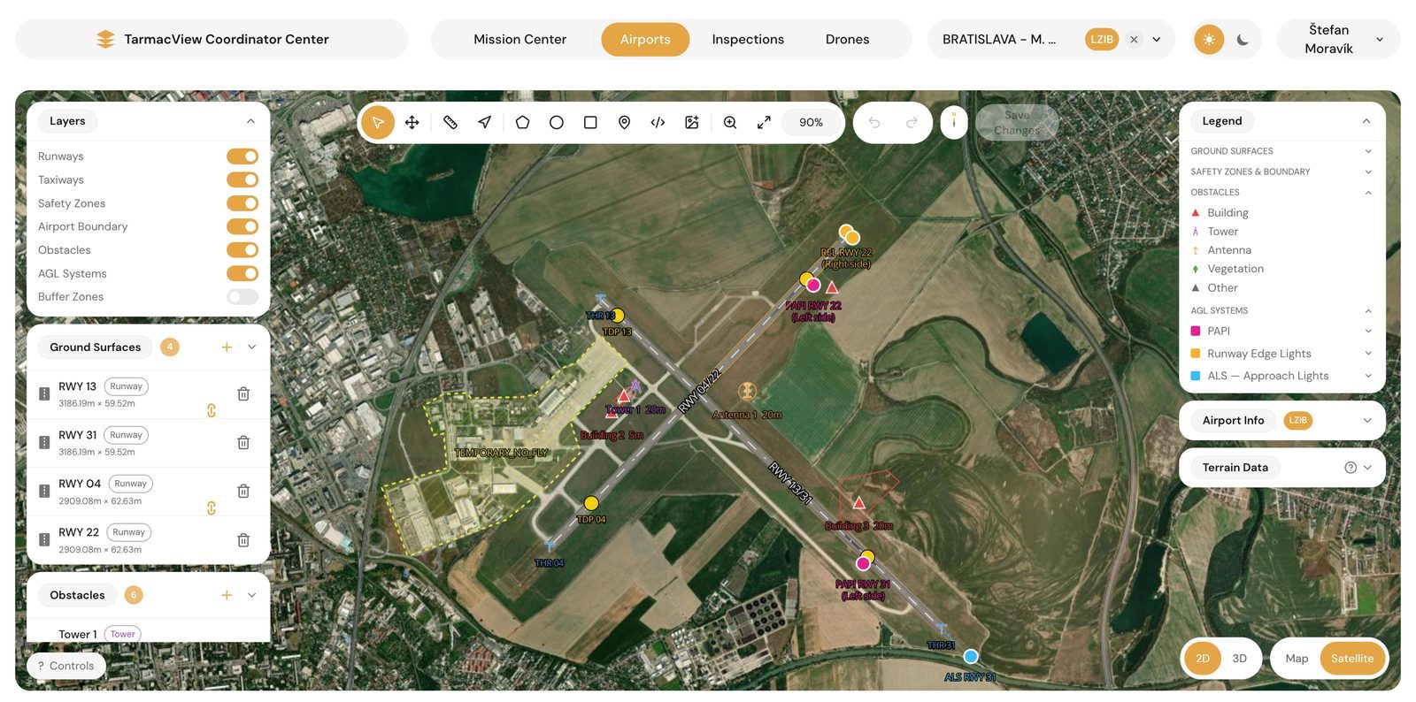
The objects and areas to be flown: penetrations, marginal objects, and zones where the register is too old to trust. Agreed before the visit.
Each approach and take-off climb surface flown as a recorded sightline on the plane, so anything crossing it is seen rather than inferred.
Surveyed position and top height with stated uncertainty for every flown object, tied to the aerodrome's geodetic frame.
The combined register: existing objects, flown objects, verdict per surface, margin in metres, and the evidence reference for each.
On a repeat survey, objects that appeared, grew into a surface, or were removed since the previous baseline.
Tower coordination for the sightline flights and landowner or municipal permission where a candidate sits off the aerodrome.
Not included. Publication-grade data under Annex 15 needs a licensed surveyor and a formal data chain. The register tells that surveyor where to go.
Not included. Whether a penetration is acceptable, and what mitigation applies, is the operator's and the authority's decision.
Not included. Instrument procedure obstacle assessment uses procedure-specific surfaces and is a separate discipline.
From runway geometry to a defended register
You name the runway directions, their approach classifications and the state of the obstacle register. We agree which surfaces apply, whose parameters are used, and who signs off the model. Output is a scope note. If the surface set cannot be agreed, the survey does not start, because a register tested against surfaces nobody accepts is worthless.
Each surface is built from the threshold positions, the runway code and the Annex 14 or CS-ADR-DSN dimensions, or from your published values. Output is a model with every parameter and its source listed, sent to you for sign-off before anything is tested against it.
Every object in your existing data is tested against the model. Output is a verdict per object per surface and the candidate flight list: penetrations, marginal objects, and areas the register cannot vouch for.
Approach and take-off climb sightlines are flown between aircraft movements. Candidates are flown from outside the movement area with RTK positioning. If weather or light prevents a measurement, the object is reflown rather than estimated.
Each flown object gets a position, a top height with its uncertainty and a verdict against each surface it approaches. Objects whose margin is inside the uncertainty are reported as marginal, with the ground survey that would settle them named.
The model, the register, the change report and the evidence land together, and we walk your safeguarding officer through every penetration and every marginal object. Anything disputed is re-examined against the retained record rather than re-flown.
The claim worth checking is the height
The geometric chain is the strong part. Threshold positions, runway code and approach classification fix the surfaces, and the ICAO Annex 14 dimensions for them are published. A surface built from those is a defined solid, and testing a surveyed point against a defined solid is arithmetic. That is why the register test happens before anyone flies, and why it is the part of the survey that is never in doubt.
The height of an object is the claim that carries weight, and it deserves its qualification. The aircraft knows where it is to a centimetre. The top of a mast or a roofline can be fixed against that position tightly. The crown of a tree cannot, because it has no single top, it moves, and it grows between the survey and the report. The survey therefore reports a height and an uncertainty for every object, and lets an object be marginal. A register that only knows pass and fail is hiding the objects that matter most.
The sightline flights are the part a spreadsheet cannot do. An arc flown on the approach surface with the camera held on a point that also lies on it makes the recorded view a physical sample of the surface: anything penetrating passes in front of the camera. That is how a penetration the register never had, such as vegetation or a structure nobody notified, is found rather than assumed absent.
Retained flight records are what make a disputed entry checkable. If the owner of a mast disagrees with the height, the frames and the positioning log that produced it are still there. A figure in a register with nothing behind it cannot be defended, and an obstacle finding is one of the few outputs of an aerodrome survey that ends up in front of someone with a reason to contest it.
Four things move the quote
There is no published rate for this service and there is not going to be one, because the work scales with the number of surfaces and with the state of your register rather than with a line item, and a published figure would be wrong for most of the aerodromes that read it.
Risks and dependencies
Three things can stop or degrade a survey, and each has an owner.
The survey starts from your threshold coordinates, runway code and existing obstacle data. Where those are missing or in a frame nobody can name, the surface model cannot be signed off and the candidate list grows to the whole surroundings. This is the dependency worth settling before a date is booked.
Candidates on the outer surfaces sit on land the aerodrome does not control. Flying them needs the landowner's or the municipality's permission and, in some countries, a separate airspace approval. Objects that cannot be flown are reported from the register test only, and marked as such.
A sightline flight in fog or against low sun records nothing usable, and an obstacle top in poor light measures loosely. The flight is repeated rather than rated through the conditions. This is the most common reason a date moves.
Frequently Asked Questions
- Which surfaces does the survey cover?
- The set that Annex 14 defines for the runway's code and approach classification: the approach surface and inner approach where applicable, the take-off climb surface, the transitional and inner transitional surfaces, the inner horizontal surface, the conical surface and, for precision approach runways, the balked landing surface. Which of them exist for your aerodrome, and how far out each reaches, follows from the runway code number and whether the approach is non-instrument, non-precision or precision. That is settled at scoping, from your published data, and it is written into the scope note so the survey is against a named set of surfaces rather than a general impression of the surroundings.
- Do you fly the whole conical surface?
- No, and nobody should. The outer surfaces reach kilometres from the runway, and flying every square metre of them would be a very long way of finding out what the obstacle register already says. The survey tests every surveyed obstacle against the constructed surfaces first, which is a computation, and then flies the candidates: the objects that penetrate or come within a margin of a surface, and the areas where the register is old enough that vegetation or new construction cannot be ruled out. The approach and take-off climb surfaces are flown as sightlines in full, because that is where an undetected penetration costs the most and where the flown record is the strongest evidence.
- How accurately is an obstacle's height measured?
- Position comes from RTK GNSS on the aircraft, tied to a base station and to your geodetic frame. The top of an object is measured from the imagery against that position, and the survey states the uncertainty of the height it reports rather than a single figure. A hard-edged object such as a mast or a roofline measures more tightly than the crown of a tree, which moves and has no single top. Where an object's height is close to the surface and the decision depends on centimetres, the survey says so, and a ground survey of that one object is the right next step. The survey is honest about which objects are clearly through, clearly clear, and marginal.
- Is this a substitute for the certified obstacle survey?
- No. Obstacle data that goes into the AIP or into an electronic terrain and obstacle data set has to meet the accuracy, integrity and traceability requirements of Annex 15, and that is the work of a licensed surveyor operating a formal data chain. This survey answers a different question: what is out there today, what penetrates the aerodrome's own limitation surfaces, and what has changed since the last time anyone looked. It feeds the certified survey by telling the surveyor where to go, and it feeds the operator's safeguarding by giving them a current picture between certified surveys.
- How long does the aerodrome have to give us?
- The approach and take-off climb sightlines are flown between aircraft movements in coordination with the tower, the same way the lighting inspection is, so no closure is booked. Candidate obstacles away from the runway are flown from outside the movement area under the aerodrome's normal drone coordination. Budget a day on site for a single-runway aerodrome and add time in proportion to the number of runway directions and candidates. The surface construction and the register testing happen before the visit, so the time on site is spent only on what has to be seen.
- What do we get when something penetrates?
- An entry in the obstacle register with the object's surveyed position, its measured top height and the stated uncertainty, the surface it penetrates and by how much, and the flight record that shows it. That is enough to notify the authority, to instruct a cut, or to start an aeronautical study, and it is enough to defend the finding if the owner of the object disputes it. What you do not get is a decision about whether the penetration is acceptable. That is an aeronautical study, and it belongs to the operator and the authority.
- What about the new obstacle free and obstacle evaluation surfaces?
- ICAO has adopted a revised obstacle surface framework for Annex 14 that replaces the limitation surface set with obstacle free surfaces and obstacle evaluation surfaces, with a transition period during which states move across. Until your authority adopts the new framework, your certification is against the surfaces this page describes, and that is what the survey tests. The surface construction is parametric, so when your authority publishes the new geometry the survey is run against it rather than against a surface that no longer applies.
References
- icao-annex-14-v1
- Annex 14 to the Convention on International Civil Aviation, Volume I: Aerodrome Design and Operations International Civil Aviation Organization
- icao-doc-9137-p6
- Doc 9137, Airport Services Manual, Part 6: Control of Obstacles International Civil Aviation Organization
- easa-cs-adr-dsn-7
- Certification Specifications and Guidance Material for Aerodrome Design, CS-ADR-DSN Issue 7 European Union Aviation Safety Agency
- icao-annex-15
- Annex 15 to the Convention on International Civil Aviation: Aeronautical Information Services International Civil Aviation Organization
- tarmacview-pricing
- Pricing: one visit, every light and every surface TarmacView
Get a scope note and a price within two working days
Send the aerodrome, the runways and their approach categories, and whether an obstacle register already exists. That is enough to scope. You get a written scope note and a price back within two working days, and the scope note is not binding until you accept it.