The observation flight is built, the analysis is not
In active development and not offered yet. The app already plans a 60° sweep, 30° either side of the runway bearing, from a point on the approach, at glide path height, and exports it to the drone. Nothing yet detects, locates or assesses the lights it records.
Real captures from real inspections
Every picture below comes from an inspection we flew: drone frames, field photos and app screens. The brackets mark what the analysis reads.
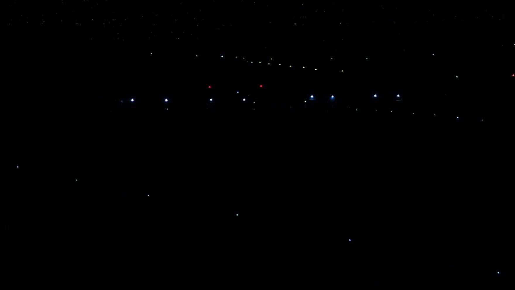
Night view, lights across the airfield
4K frame from the 18 Sep 2026 night session, cropped to the lit area at 100 %, brightness lifted slightly (gamma 0.8). Brackets on detected lights.
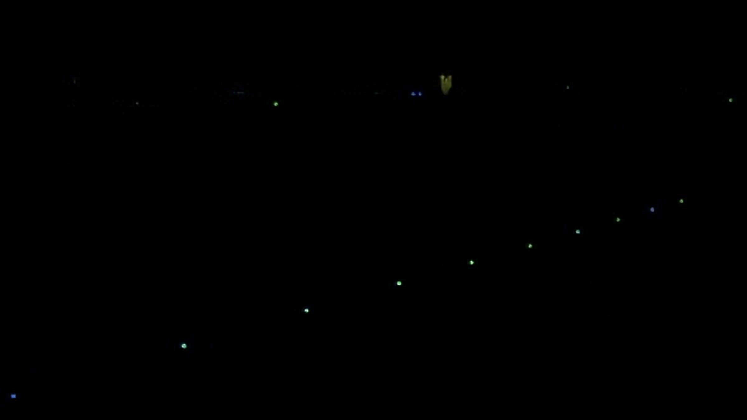
Night fly-over, a diagonal row of lights
4K frame from the 18 Sep 2026 night session, cropped to the lit area at 100 %, brightness lifted slightly (gamma 0.8). Brackets on detected lights.
Who this is for
A light that looks harmless from the road can sit in line with the approach and read like part of the lighting pattern from the cockpit. The question is what it looks like from the air.
Outcomes and acceptance criteria
Only the flight is built, so only the flight can be held to account today. Three outcomes describe what a pilot would deliver and what it would not.
A sweep of 30° either side of the bearing to the runway touchpoint, from a point on the approach at glide path height, recorded as photos or video.
The pass is planned from the runway in the airport model, so the same viewpoint can be flown again on another night or after a light has been changed.
Detecting the lights in the recording, placing them on the ground and assessing them is not built. A pilot scope says what will be done with the recording and by whom.
A list of lights, their positions and a statement of which ones conflict with Annex 14 are not part of this service today. The recording is the deliverable.
Nothing here extinguishes, screens or modifies a light. That is for the owner of the light, the aerodrome operator and the competent authority, and a survey that quietly becomes an enforcement notice is one nobody asked for.
What is inside a pass
Each part with what it contains and who owns it, including the parts that are not built and the parts that are deliberately outside the scope.
Built. On the approach to the chosen runway, by default 300 m out, measured from the outermost runway light, the threshold or the touchpoint.
Built. On the published glide path, or 60 m above the touchpoint where the runway publishes no glide path angle.
Built. The camera is aimed at the runway touchpoint and the drone yaws 30° either side of that bearing in one uninterrupted rotation, with no dwell.
Built. Photo or video capture, a suggested night camera setting, and the mission exported for a DJI drone.
Arranged before the date where local rules require a permit for a night drone flight on the approach.
Not built. Nothing finds the lights in the recording.
Not built. Nothing places a light seen in the recording on the ground.
Not built. No assessment against 5.3.1 and no report of the lights.
Not included. It needs a calibrated photometer, and TarmacView has no calibrated camera yet.
Not included. The survey records the view, it does not act on a light.
Not included. Laser-beam protected flight zones are a separate recommendation, 5.3.1.2.
From runway model to a recorded approach view
You tell us which approach worries you and why, a crew report, a complaint or a new development near the extended centre line. We agree which runway directions to fly and what is done with the recording. Output is a written pilot scope.
The runway, its threshold, touchpoint, published glide path and lighting are set up in the airport model. The observation point is computed from them rather than picked on a map.
Night flight permissions are arranged where local rules need them, and the pass is planned for each agreed approach. Output is a validated mission and confirmed dates.
The drone climbs to the observation point and sweeps 30° either side of the bearing to the touchpoint while it records. Each approach direction is its own pass.
Detecting the lights in the recording, placing them on the ground and assessing them against Annex 14 is not built. Nothing in this step is automated today.
The recording and the flown plan are handed over together, so anyone can see where the view was taken from and repeat it.
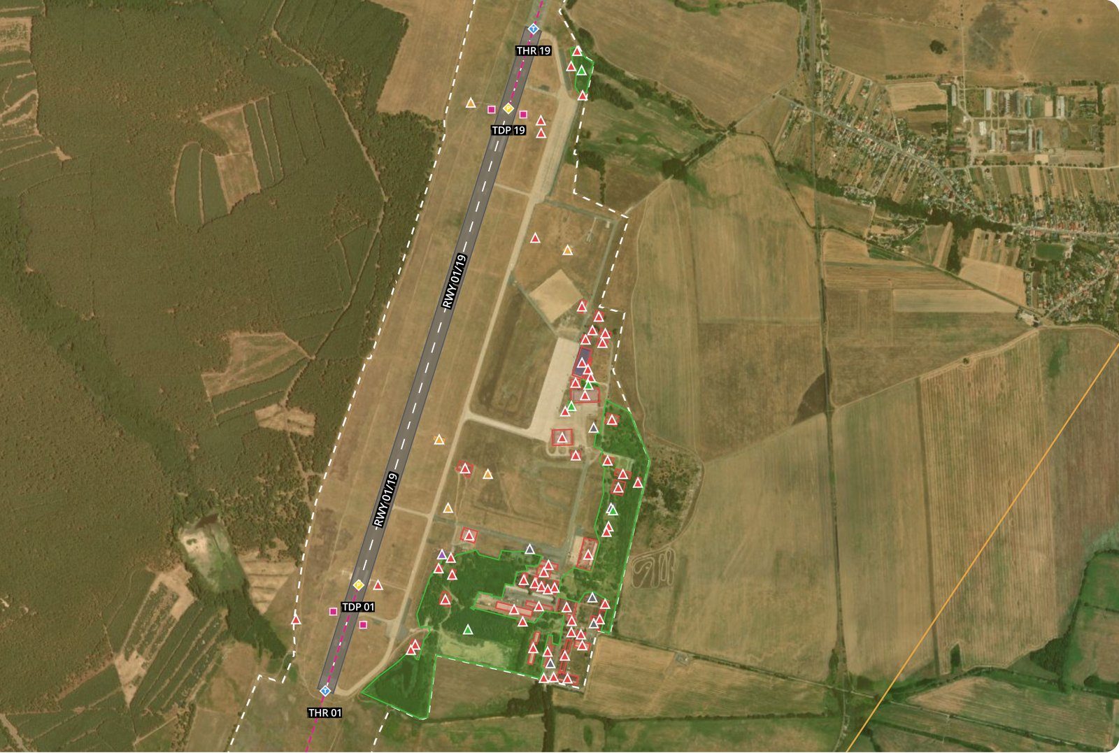
Airport model on the map: runway, thresholds, obstacles and safety zones
Why the view from the approach
A light that confuses a pilot does so because of where it sits relative to the approach and what it looks like from there. A row of street lights that runs parallel to the extended centre line can read as an approach lighting pattern, and a coloured light can read as a signal. Annex 14 Volume I, 9th edition, puts it in two provisions. 5.3.1.1 is a Standard: a non-aeronautical ground light near an aerodrome which might endanger the safety of aircraft shall be extinguished, screened or otherwise modified. 5.3.1.3 is a Recommendation about lights that, by intensity, configuration or colour, might prevent or confuse the clear interpretation of aeronautical ground lights .
5.3.1.3 also says where to look. For a code 4 instrument runway, attention should go to lights visible from the air within at least 4,500 m before the threshold and beyond the runway end and 750 m either side of the extended centre line. For code 2 or 3 the length is at least 3,000 m, and for code 1 and non-instrument runways it is the approach area. In the EU the duty sits with the aerodrome operator, which monitors hazards from human activity and land use under ADR.OPS.B.075, and with the Member State, which under Article 9 of Regulation (EU) No 139/2014 consults on the use of hazardous, confusing and misleading lights.
The flight the app plans puts the camera where a pilot’s eyes would be. It holds the drone on the glide path a fixed distance out on the approach and turns the camera through 60° about the runway, so the recording shows the scene the approach presents at that point, at night, with the lights that are actually switched on. A flight inspection aircraft sees the approach from the air too, and EASA guidance treats a flight check as a chance to spot misleading lights. The drone’s view is held at one known point and can be flown again.
What it is not is a survey of the whole area. One pass is one viewpoint, and the area 5.3.1.3 describes is kilometres long. Finding the lights in the recording, placing them on the ground and judging them is not built, and intensity in candela needs a calibrated photometer that TarmacView does not have. And a light that is switched on only for an event or a season may simply be dark on the night of the pass, while night operations on the runway still meet it on other nights.
Not offered yet
This service is in active development and is not offered yet, so there is no price, rate or quote. Three things shape a pilot instead.
Risks and dependencies
Four things can stop a pass or weaken what it shows, and each has an owner.
Mist, low cloud and rain change what a light looks like and hide some of them altogether. High wind blurs the recording. A pass flown in poor visibility is reflown rather than read through the weather.
A night flight on the approach is regulated, and a permit that does not arrive is a night that does not happen. That work sits with us, but it depends on the authority granting it.
Advertising, sports grounds, construction sites and seasonal displays are not always lit. If the light in question keeps hours, the pass is planned for those hours, which is decided at scoping rather than discovered afterwards.
A recording shows a light. Deciding that it conflicts with Annex 14, and getting it extinguished, screened or modified, runs through the operator and the competent authority.
Frequently Asked Questions
- What does the survey look for?
- Ground lights near an aerodrome that are not aeronautical lights but could endanger aircraft or be confused with aeronautical ones. ICAO Annex 14 Volume I, 9th edition, sets a Standard in 5.3.1.1 that such a light which might endanger the safety of aircraft shall be extinguished, screened or otherwise modified. 5.3.1.3 adds a Recommendation for lights that, by their intensity, configuration or colour, might prevent or confuse the clear interpretation of aeronautical ground lights.
- What is built today?
- The observation flight. The TarmacView app has a non-aeronautical ground lights method that places the drone on the approach to a chosen runway, by default 300 m out from the outermost runway light, at the height of the published glide path, or 60 m above the touchpoint where no glide path angle is published. From there the camera sweeps 30° either side of the bearing to the runway touchpoint in one uninterrupted rotation, and the mission is exported for a DJI drone. That is all that is built.
- What arrives at the end of a pass?
- The photos or video from the sweep, and nothing more yet. No software finds the lights in that recording, works out where they are on the ground or judges them against Annex 14. The service is in active development and not offered yet, so what would be done with the recording in a pilot is agreed at scoping rather than promised here.
- Does one pass cover the whole area Annex 14 describes?
- No. For a code 4 instrument runway, 5.3.1.3 directs attention to lights visible from the air within at least 4,500 m before the threshold and beyond the runway end, and 750 m either side of the extended centre line. A pass is one viewpoint on one approach, looking towards the runway. It shows what is in view from that point, which is a different thing from a survey of the whole area.
- Doesn't flight inspection already check for this?
- It can. EASA guidance on maintaining visual aids, GM1 ADR.OPS.C.015(b), (f), notes that flight checks are also an opportunity to identify confusing or misleading lights in the aerodrome surroundings. A drone pass gives a recorded view from a fixed point on the approach that can be repeated on a night of your choosing. It does not replace the flight check.
- Who has to act on a light that is found?
- Not TarmacView. Under ADR.OPS.B.075 of Regulation (EU) No 139/2014 the aerodrome operator monitors hazards related to human activities and land use around the aerodrome, and its acceptable means of compliance lists a non-aeronautical ground light which may endanger aircraft among the risks to assess and mitigate. Outside the perimeter fence, who does what is set in coordination with the competent authority. A recording is evidence for that process, not a decision.
- Can you measure how bright the light is?
- No. TarmacView has no calibrated camera yet, so it does not report intensity in candela, and the drone's recording says nothing about brightness in absolute terms. Whether a light is bright enough to confuse is a judgement Annex 14 frames by intensity, configuration and colour together, and it is not one the app makes.
References
- icao-annex-14-vol-i
- Annex 14 to the Convention on International Civil Aviation, Aerodromes, Volume I, Aerodrome Design and Operations, Ninth Edition, July 2022, section 5.3.1 International Civil Aviation Organization
- easa-ear-aerodromes
- Easy Access Rules for Aerodromes (Regulation (EU) No 139/2014), March 2026: Article 9, ADR.OPS.B.075 with AMC1, GM1 ADR.OPS.C.015(b), (f) European Union Aviation Safety Agency
Talk to us about the development
This service is in active development and is not offered yet. If a light near your aerodrome worries you, or you want to try the observation flight early, tell us the runway and we will talk it through. Nothing is binding.