The capture is built, debris recognition is on the way
The service is in active development. The platform already plans a low pass over a runway or taxiway and captures georeferenced imagery of the full surface. Recognising debris in that imagery is in development, short of training data.
Real captures from real inspections
Every picture below comes from an inspection we flew: drone frames, field photos and app screens. The brackets mark what the analysis reads.
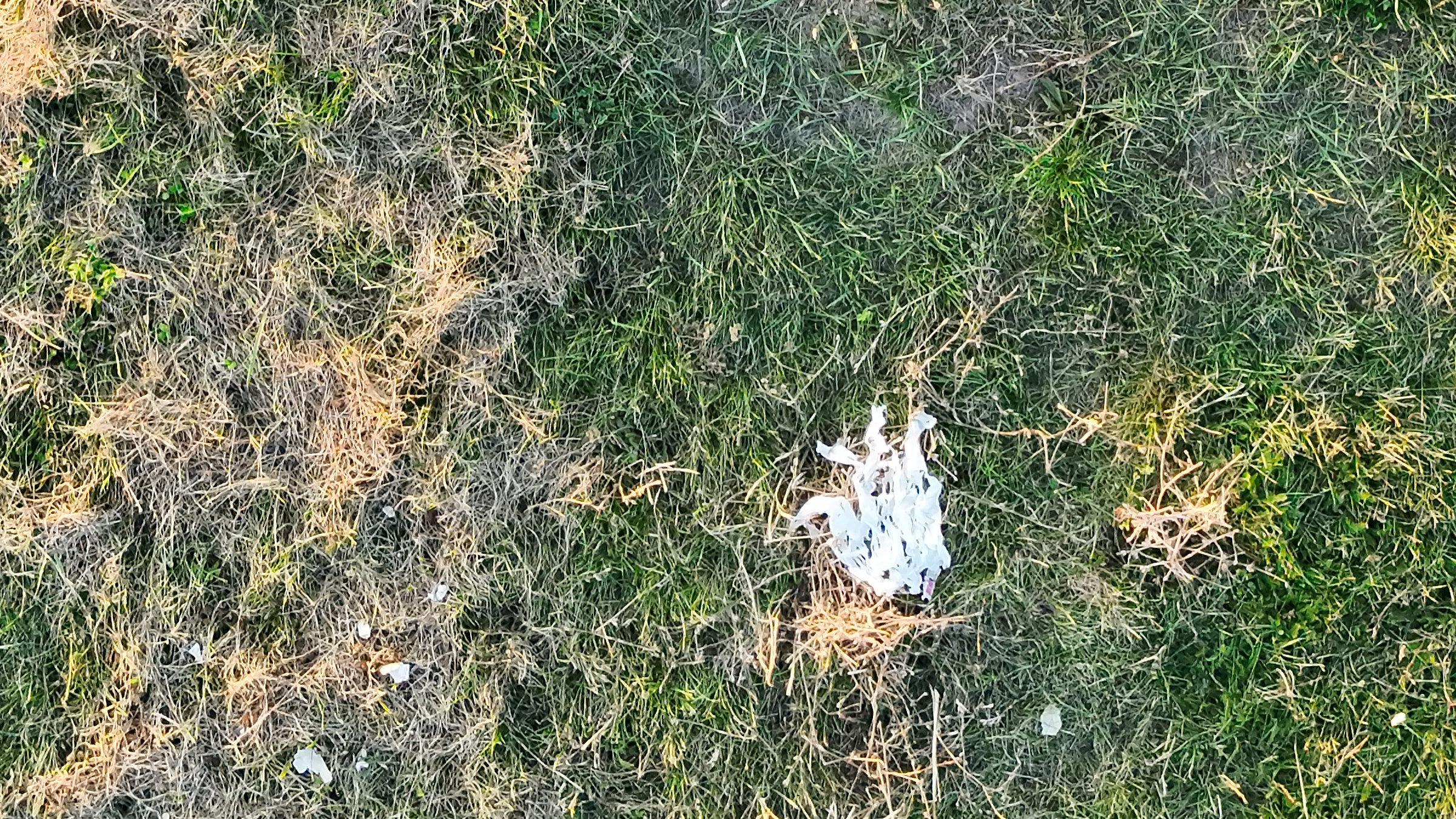
A loose object beside the pavement
Crop of frame 0001 of an 18 Sep 2026 surface scan, nadir, from the 8064 × 6048 original at 100 %.
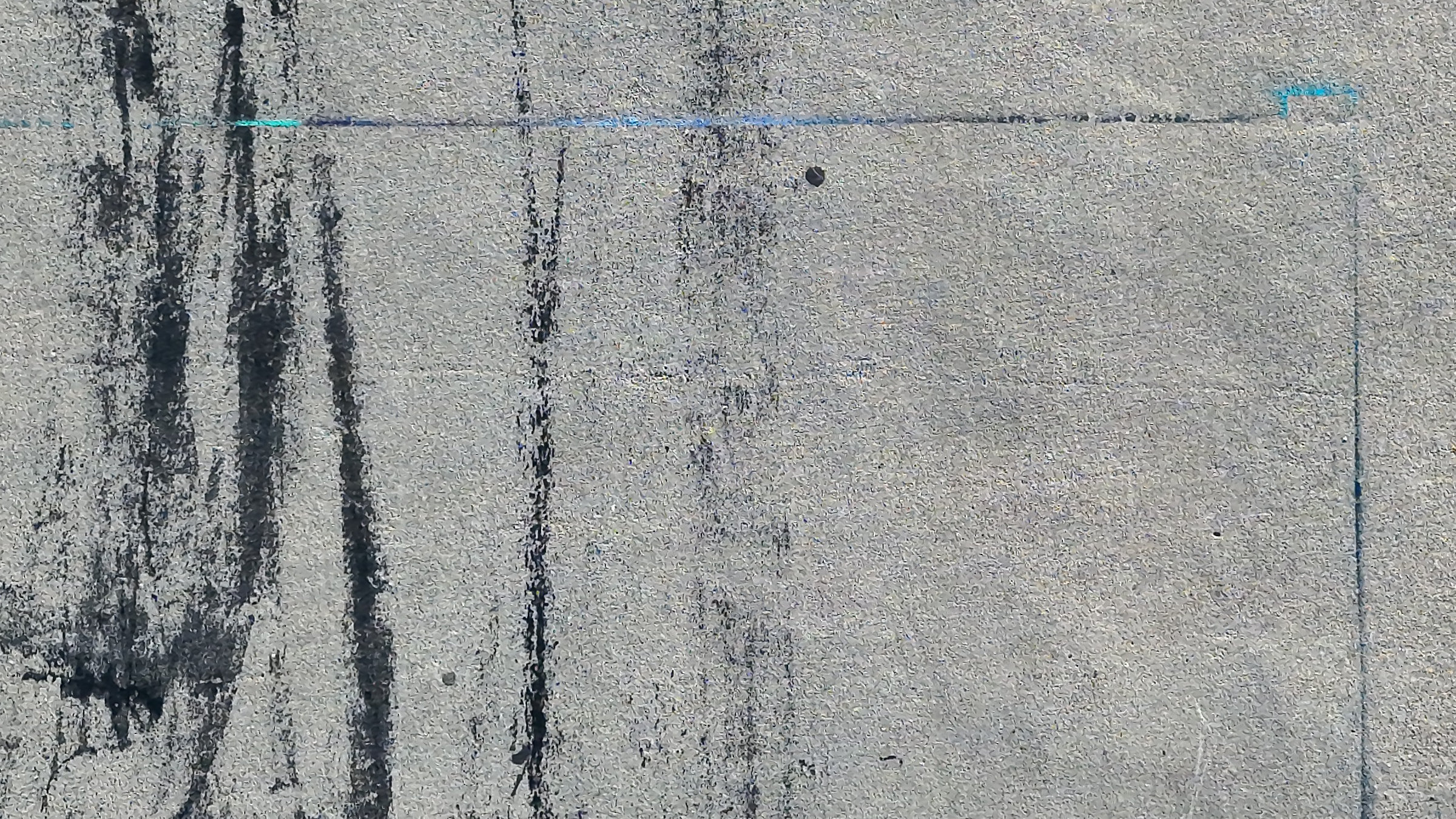
Concrete, dark tyre marks
Crop of frame 0478 of a 28 Sep 2026 surface scan, nadir, from the 8064 × 6048 original at 100 %.
Who this is for
A FOD programme already inspects, removes and logs. What it rarely has is a positioned image of the whole surface on a date, to set beside the log and the places where finds keep turning up.
Outcomes and acceptance criteria
Three outcomes carry the service. The first can be checked today. The second depends on a detector that is still in development, and the page says so.
The runway or taxiway agreed at scoping comes back as georeferenced imagery from one low pass, flown between movements in coordination with the tower.
Recognising debris in the imagery is in development, short of training data. Until it is delivered, a person looking at the imagery is what finds an object in it.
Each find, whoever made it, can be tied to a position and an image of the surface around it, which are among the details AC 150/5210-24A recommends collecting for every find.
What the service does not do is watch the surface between surveys, clear what it finds or replace the daily inspection. Those stay with the aerodrome’s FOD control programme.
Nothing here rates the pavement. If the question is which surface is shedding material, that belongs to the pavement source of FOD and the services behind it.
What is inside the survey
Each part with what it contains and its state today, including the parts that are deliberately outside the scope.
The surface scan method, a low serpentine pass over a runway or taxiway, computed from the camera and the flight height.
Photos from the drone's card imported and attached to the legs of the scan, every image with its position, retained.
A model that marks loose objects in the imagery. Short of training data.
Each find with its position and an image of the surface around it, in a form agreed at the pilot for your FOD log.
Orthomosaic, a map of findings and a report inside the platform. The app shows them as not available yet.
The scan method plans over runways and taxiways today. Aprons are scoped at the pilot.
Anything the crew sees on a movement area during the flight is passed to the tower at the time, with its location.
Not included. A survey sees the surface when it is flown, not between flights.
Not included. Both stay with the aerodrome's FOD control programme.
From the FOD programme to positioned imagery
You describe how your FOD programme runs today, which surfaces matter and where finds cluster. We agree the surfaces, the dates, who on the aerodrome is told on the day and how finds are handed over to your log. Output is a written pilot scope.
The pass is computed from the surface geometry and the camera, and the capture windows are agreed with the tower so the drone flies between movements and clears the surface when asked. Output is a validated mission and confirmed windows.
One low pass over each scoped runway or taxiway. If a movement interrupts a run, the run resumes from where it stopped. Anything the crew sees on the surface is passed to the tower at the time.
The photos from the drone's card are imported into the platform and attached to the legs of the scan, each with its position and its capture time. This step is built.
The imagery is run through the debris model. This step is in development and short of training data, so on a pilot it is run where it is ready and the scope says so. Where it is not, the imagery is what a person reviews.
The imagery and the outputs agreed in the pilot scope land together, keyed by position so your FOD manager can tie them to the log. Anything disputed is re-examined against the retained imagery rather than re-flown.
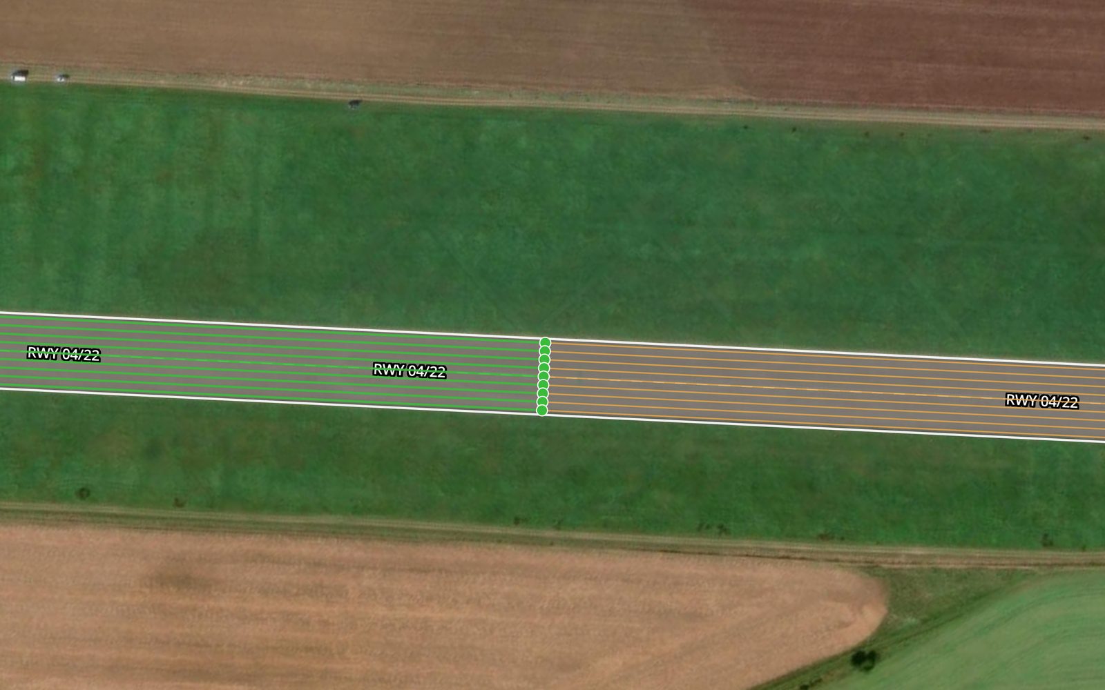
Two scan legs meeting mid-runway, each laid as parallel runs
What a survey can add to a FOD programme
Foreign object debris is found today in three ways: people inspecting the movement area , pilots and staff reporting what they see, and, at some aerodromes, a FOD detection system watching the runway. FAA AC 150/5210-24A treats all three as detection and says the outcome matters equally whichever way it happens. A drone survey is a fourth way with a narrower job, and the honest description of it starts with what it is not.
It is not continuous. A detection system can raise an alert between two movements. A survey sees the surface during its capture window and nothing after it. It is also not yet automatic. The capture is built, and recognising debris in the imagery is in development and short of training data. Until the model is delivered, nothing on this page should be read as a detection rate or a smallest object the survey will find.
What it does add is a record. AC 150/5210-24A recommends collecting, for each find, how it was detected, when, a description or an image, its location as coordinates, and its possible source. EASA’s acceptable means of compliance for ADR.OPS.B.016 asks that detection include the source and the location. A survey whose every image carries a position from RTK positioning , and whose imagery is retained, already holds the location and the image, and shows the surface around the find. The georeferencing of the capture is the part that is built.
The surface around a find is often where the source is. AC 150/5210-24A says asphalt and concrete pavements may be the most common source of FOD on an airport, and ADR.OPS.C.010 asks operators to maintain movement area surfaces with the objective of avoiding and eliminating FOD. Raveling asphalt and joint spalling in concrete are what shed it. Reading the pavement for them is the work of the runway surface scan , and the FOD survey and the surface scan come off the same capture.
Not offered yet
This service is in active development and is not offered yet, so there is no price, rate or quote. Four things shape a pilot instead.
Risks and dependencies
Four things can stop a survey or weaken what it shows, and each has an owner.
Standing water, snow and heavy contamination hide small objects from a camera. Results are best on a calm, sunny day, because high wind blurs images and low light forces a high ISO. The affected surface is recaptured rather than reviewed through the obstruction.
The survey needs tower coordination and, at most aerodromes, an escort. If the windows between movements do not appear, the capture does not happen, and that is worth confirming before travel is booked.
A drone flown low over a runway is itself an object over the movement area, and a part that comes loose would be FOD. That risk is TarmacView's to control, and how it is handled is written into the pilot scope.
A survey bought as a detection system disappoints. It is a dated, positioned record and, once the model is delivered, a check of that record. The pilot scope states which, so nobody relies on it for continuous cover.
Frequently Asked Questions
- Does a drone survey replace our daily FOD inspection?
- No. FAA AC 150/5210-24A states that the FAA and ICAO require a daily, daylight inspection of aircraft operating areas, and in the EU, ADR.OPS.B.016 requires FOD detection procedures that include monitoring and inspection of the movement area to an inspection schedule. A drone survey is flown on agreed dates, between movements, and sees the surface as it was at that time. It can add a positioned image record to the programme. It cannot stand in for the inspection the rules require.
- How is this different from a radar or camera FOD detection system?
- A fixed detection system watches the runway continuously and raises an alert between movements. A drone survey is a snapshot of the whole surface on a given date. The FAA's guidance for evaluating and procuring detection systems is AC 150/5220-24, Airport Foreign Object Debris (FOD) Detection Equipment, issued 30 September 2009, and nothing on this page claims that a drone survey meets it. The two answer different questions, and an aerodrome with a fixed system can still use positioned imagery of the pavement around the places its alerts cluster.
- What is actually built today?
- The capture. The platform plans the surface scan method, a low serpentine pass over a runway or taxiway computed from the camera and the flight height, and the photos from the drone's card are imported and attached to the legs of that scan. Recognising debris in the imagery is in development, short of training data, so the survey does not find debris for you yet. Processing inside the app, an orthomosaic, a map of findings and a report, shows as not available yet.
- What happens if the crew sees debris during the flight?
- It is passed to the tower at the time, with its location. That does not wait for any analysis. Debris on a movement area is an operational hazard with its own clock, and removing it, or deciding whether operations stop while it is removed, belongs to the aerodrome under its own FOD procedures. The crew reports what it sees and does not go onto the movement area to collect it.
- Does it cover aprons?
- Not yet. The surfaces the scan method plans over today are runways and taxiways. Aprons are part of the development and are scoped at the pilot conversation. An apron with aircraft on stand is also partly hidden from above, so which stands are flown, and when, is agreed with the aerodrome rather than assumed.
- Can the survey say where the debris comes from?
- It can show the pavement around a find, which is often where the answer is. EASA's acceptable means of compliance for ADR.OPS.B.016 asks that FOD detection includes the identification of the FOD source and its location, and AC 150/5210-24A lists the location and an image among the details to collect for each find. Positioned imagery holds both. Reading the pavement for raveling or a spalled joint is an engineering task, and the pavement services cover it.
- Is our imagery used to train the detection model?
- Only if you agree to it. Debris recognition is short of training data, and imagery from real movement areas is what improves it. Whether your imagery may be used that way is written into the agreement rather than assumed. If you do not want it used, say so at scoping and the capture is done on that basis.
References
- faa-ac-150-5210-24a
- AC 150/5210-24A, Airport Foreign Object Debris (FOD) Management Federal Aviation Administration
- faa-ac-150-5220-24
- AC 150/5220-24, Foreign Object Debris Detection Equipment Federal Aviation Administration
- easa-ear-aerodromes
- Easy Access Rules for Aerodromes (Regulation (EU) No 139/2014) European Union Aviation Safety Agency
- icao-annex-14-v1
- Annex 14 to the Convention on International Civil Aviation, Volume I: Aerodrome Design and Operations International Civil Aviation Organization
Talk to us about the development
This service is in active development and is not offered yet. If you want to follow it or try it early at your aerodrome, tell us the surfaces and how your FOD programme runs today and we will talk it through. Nothing is binding.