Military Airfield Lighting Inspection by Drone
Drone checks of PAPI angles and every runway, approach and taxiway light on an air base, flown between sorties, with an offline setup that keeps data on base.
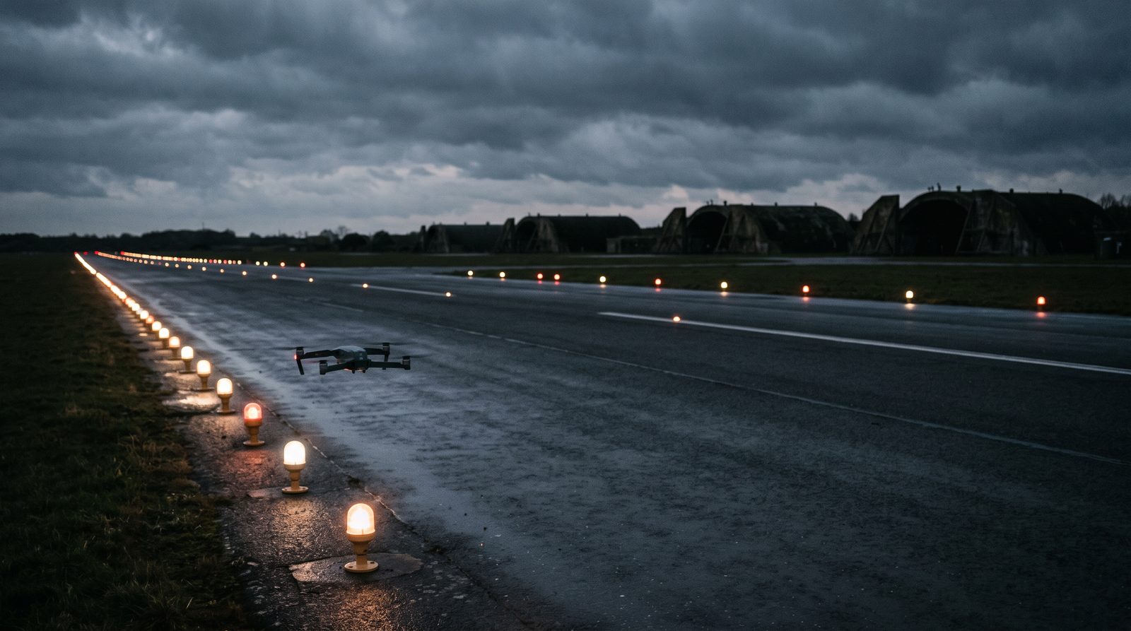
- 01 Aerodromes controlled and operated by the military fall outside the EU Basic Regulation, so the base works to its national military rules, which in NATO countries usually follow STANAG 3316 and Annex 14.
- 02 The drone checks each light for being lit, colour, output against its row and the commanded dimming step, and surveyed position, and it measures each PAPI unit's transition angle.
- 03 PAPI angles are known on site, because the field laptop runs the angle engine offline. A base technician can re-aim a unit and the drone re-measures it in the same visit.
- 04 The field deployment runs without a network, so the survey data can stay on the base. The base decides whether and when the drone flies.
- 05 Intensity in candela, NVG and infrared performance, regulator output and anything underground are not measured, and stay with the photometer, flight inspection and the electricians.
On this page · 12 sections
Who runs into this
On an air base the lighting is owned by the people who also keep the runway open for the flying programme. Base civil engineering or the airfield lighting team maintains the aeronautical ground lights , airfield operations schedules the work, and the flying units want the runway back as soon as anything is done to it. Night flying and low-visibility training make the lights matter more, and long closures for a ground survey are hard to fit around sorties.
Three questions come up again and again.
- Can every light on the runway, approach and taxiways be checked without taking the runway away from the flying programme for a night?
- Can the PAPI angles be known before the crew leaves, so a technician can fix a unit while everyone is still on the airfield?
- Can the survey run on a base whose rules keep operational data inside the perimeter, or where there is no usable network at the runway?
The PAPI inspection and the approach lighting inspection are the services behind this page. Both are offered today. The civil version of the same work is on the airfield lighting inspection page. This page covers what changes on a military airport .
Where this applies, and where it does not
This applies to air bases and to joint civil-military aerodromes with a PAPI, an approach lighting system, runway edge, threshold, end and centre line lights, touchdown zone lights where they are fitted, and taxiway lights. It applies most where the runway is busy with sorties, where the lights have to be shown serviceable for night or low-visibility flying, and where the survey data should not leave the base.
It does not give intensity in candela, because the camera is not calibrated. It does not test night vision goggle compatibility, infrared emitters or the heat signature of the lights. It does not measure regulator output, insulation resistance or standby power, and it sees nothing underground. Those stay with the base’s photometer contractor, its electricians and flight inspection.
What the survey checks on a military airfield
- Systems
- PAPI, approach lights, runway edge, threshold and end, runway centre line, touchdown zone where fitted, and taxiway lights.
- Per unit
- Lit or dark, colour against its position, output relative to its neighbours and to the commanded dimming step, and RTK-surveyed position against the layout.
- PAPI
- The transition angle of each unit seen from the approach, computed on site by the field laptop.
- Flights
- Between sorties, in coordination with the base tower, with no closure booked.
- Data
- An offline field deployment on a local network, so the imagery can stay on the base.
- Authorisation
- The base decides whether, where and when the drone flies.
- Not measured
- Candela, NVG or infrared performance, regulator output, insulation resistance, standby power and anything underground.
The rules a military aerodrome works to
Outside the EU aviation rules
In the EU, civil aerodromes work to Regulation (EU) No 139/2014 and the EASA design specifications in CS-ADR-DSN. Military aerodromes do not. Article 2(3)(b) of Regulation (EU) 2018/1139, the Basic Regulation, excludes aerodromes or parts of them that are controlled and operated by the military, together with their equipment, personnel and organisations. The national military authority sets the requirements instead.
At a joint civil-military aerodrome the split matters, because the exclusion covers the parts the military controls and operates. Which lights fall on which side, and whose maintenance programme they sit in, is worth settling with the authorities before the scope is written.
NATO and national standards
In NATO countries the common reference is STANAG 3316, Airfield Lighting. Edition 11 was promulgated by the NATO Standardization Office on 14 June 2018 and replaced Edition 10 of 2004. Its covering agreement names AATMP-07, Edition A as the standard, lists ICAO Annex 14 among the related documents, and states the aim as standardising runway, taxiway, apron floodlighting and miscellaneous lighting, and lighting for NVG operations. AATMP-07 sets no maintenance regime of its own. Its section 8.6, Maintenance of Visual Aids, reads in full “As ICAO Annex 14, Vol 1 Section 10.5”, so a NATO base keeps its lights serviceable to the same Annex 14 rules as a civil aerodrome. What it adds is chapter 9: before NVG operations start, the base needs an approved NVG lighting control plan, and a flight check confirms the plan works.
For the US Air Force and Army, the design criteria are in UFC 3-535-01, Visual Air Navigation Facilities. Paragraph 1-2 applies it to Air Force and Army installations, with the Navy working to NAVAIR 51-50AAA-2 instead. Paragraph 1-8.2.1 says NATO STANAGs take precedence at Army and Air Force facilities in NATO countries other than the US and Canada, and wherever NATO funds the work. Paragraph 3-7.11.1 says the UFC’s PAPI criteria satisfy STANAG 3316 Edition 11, except that the Air Force places its PAPI on one side of the runway only. Paragraph 1-14 says its photometric requirements are based on ICAO and FAA standards, modified for Air Force needs.
The civil baseline still shapes the check
Annex 14 is the shared reference behind most of these documents. Section 5.3.5 covers visual approach slope indicators such as the PAPI. Section 10.5 covers maintenance of visual aids. It requires a system of preventive maintenance (10.5.2), defines an unserviceable light by its main beam intensity against the specified value (10.5.1), and for a precision approach runway category I sets the objective per system, separately for the approach lighting, threshold, edge and end lights (10.5.10). For category II and III it recommends in-field measurement of all lights with a mobile measuring unit (10.5.3 to 10.5.5). These are civil Standards and Recommended Practices. A base applies them to the extent its own authority adopts them. The serviceability limits guide sets out the per-system figures.
The definition in 10.5.1 is about intensity, so a drone survey without a calibrated camera cannot declare a light serviceable on its own. What it does is find the dark units, the units that have fallen behind their row and the units that do not follow a step change, by position, so the photometer and the technicians go to the right fittings.
What the survey measures
Every unit, from the air
The survey covers the approach lighting , runway edge lights , threshold lights and runway end lights, the runway centre line and touchdown zone lights where fitted, and taxiway lights. For each unit it records whether the unit is lit, whether its colour matches its position, how its output compares with the neighbouring units and with the commanded dimming step, and where it sits against the layout, from RTK-surveyed positions. The result is a list by unit and position, which is the form a maintenance crew needs at night.
The lights have to be on at the steps being checked, so the base lighting control or the tower switches them as the passes are flown.
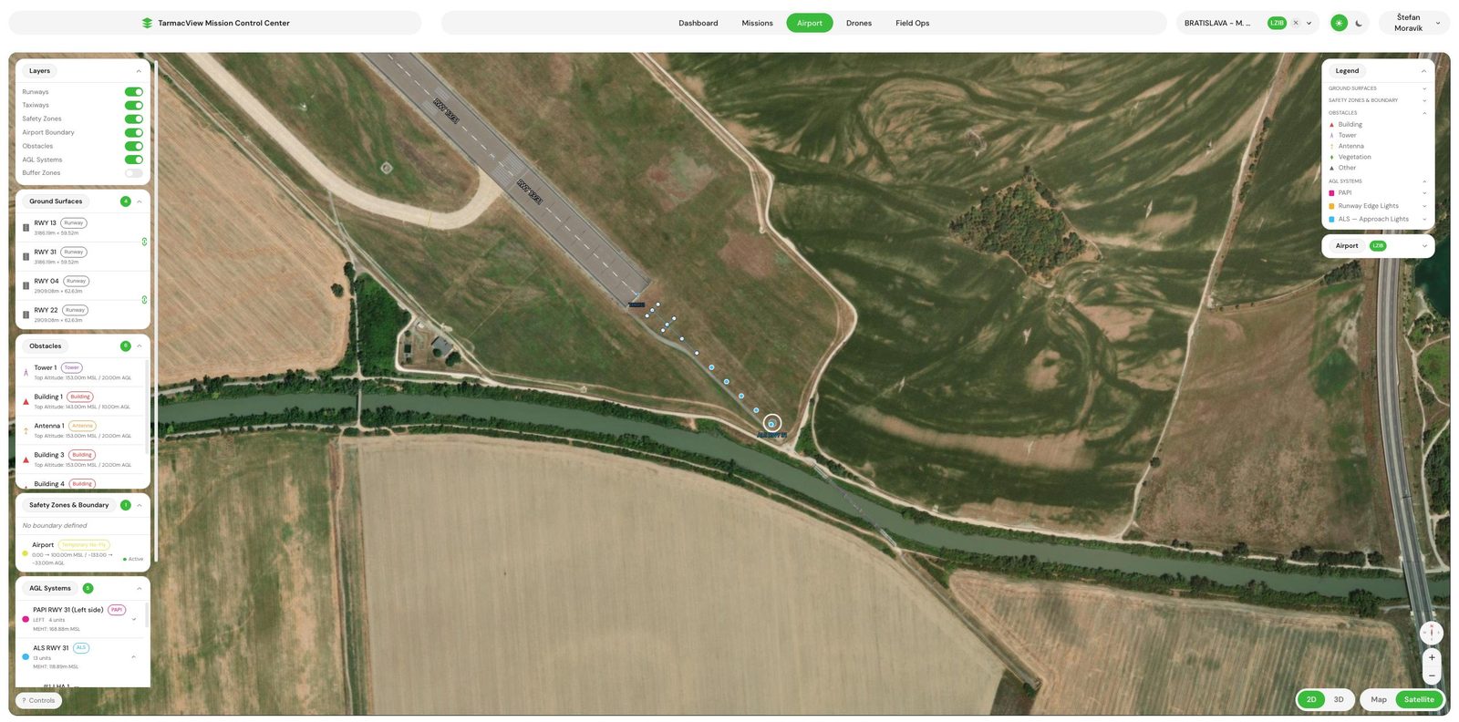
An approach lighting array seen from the approach. Every unit is in the frame, so a dark or dim unit is found by its position in the pattern.
PAPI angles known on site
For the PAPI the drone climbs through the colour change of each unit on the approach while every frame records the colour and the drone’s RTK position. The field laptop runs the angle engine offline, so the transition angle of each unit is known before the crew leaves the airfield. The formal report follows.
In practice a base is often not sure the PAPI is wrong until the figure is in front of it. When the survey reports a unit out of tolerance, the base calls its lighting technicians, they re-aim the unit, and the drone measures it again in the same visit. TarmacView measures. It does not adjust the units.
What is left to others
Intensity in candela needs a calibrated photometer. UFC 3-535-01 paragraph 13-15.5 describes the usual way to do it on a military airfield, a photometric vehicle driven along the lit runway, and says the test report gives the candela value of each light. Paragraph 13-15.6 recommends periodic testing of existing systems because output deteriorates over time. Regulator output per step, insulation resistance and standby power switch-over are electrical tests on the ground, and the constant current regulator sits in the vault where no camera reaches it.
Night vision lighting and LED conversions
Some bases fly with night vision goggles, and STANAG 3316 names NVG operations among its interoperability aims. UFC 3-535-01 Appendix C explains why this is a separate question from visible light. Goggles work in the near infrared, and the infrared emitters added to LED fixtures for them operate between 830 and 870 nm. Paragraph 2-5.1 of the UFC restricts LED conversions on Air Force airfields and asks bases to publish LED use in the Flight Information Publication so transient crews know the limits for NVG operations. Annex 14, in a note to 10.5, makes a related point for civil aerodromes about enhanced vision systems that rely on the heat of incandescent lamps.
The drone survey does not check any of this. It reports visible light only, and says nothing about how a fitting reads through goggles, whether an infrared emitter works or whether a lamp gives off heat.
How a visit runs
The first visit sets the layout and the data rules that every later one reuses.
From the data rules to a closed PAPI finding
- 01
Agree the data rules and the deployment
Agree with the base that the survey runs on the offline field deployment, where the imagery is kept after the visit, and where the formal report is written.
WhyWhere the imagery may go decides how the visit is set up.
Done whenA scope note naming the deployment, the storage of the data and who receives the report.
If notIf the rules are unclear, run offline. Nothing leaves the airfield until the base decides.
- 02
Get the base's decision on the flights
The base decides whether the drone may fly, the areas and heights, and the times. Access for the crew follows the base's own process.
WhyOn a base the drone flies only where and when the base allows it.
Done whenA written go-ahead from the base with the agreed areas and times.
If notIf a system cannot be flown, it is left out of this visit and named in the report.
- 03
Plan the passes around the flying programme
Agree with the base tower how the passes fit between sorties and which intensity steps the lighting control will set for each pass.
WhyThe runway stays in use, so the survey fits into the gaps.
Done whenA pass list matched to the tower's gaps and the lighting steps.
If notWhen a sortie needs the airspace, the drone clears and resumes at the next gap.
- 04
Fly the lights at each step
Fly the approach, runway and taxiway passes with the lights switched on at the agreed steps, and the PAPI climbs on the approach.
WhyOutput against the commanded step is only visible if the step is set.
Done whenEvery unit in scope recorded at every step, with an RTK position on every frame.
If notRain, fog or a light left off means the pass is reflown, not judged through it.
- 05
Read the PAPI angles on site
The field laptop computes each unit's transition angle offline and the crew reports any unit out of tolerance to the base.
WhyA base technician can only fix a unit while the crew is still there to re-check it.
Done whenThe base has the angles before the crew leaves.
If notIf the base re-aims a unit, the drone measures it again in the same visit.
- 06
Hand over the report
Write the formal report with every unit by position, the PAPI angles and any re-check, in the place agreed in step one.
WhyThe record is what a later visit and an auditor compare against.
Done whenA dated record per system, with the imagery kept where the base decided.
If notA disputed unit is checked against the retained frames rather than reflown.
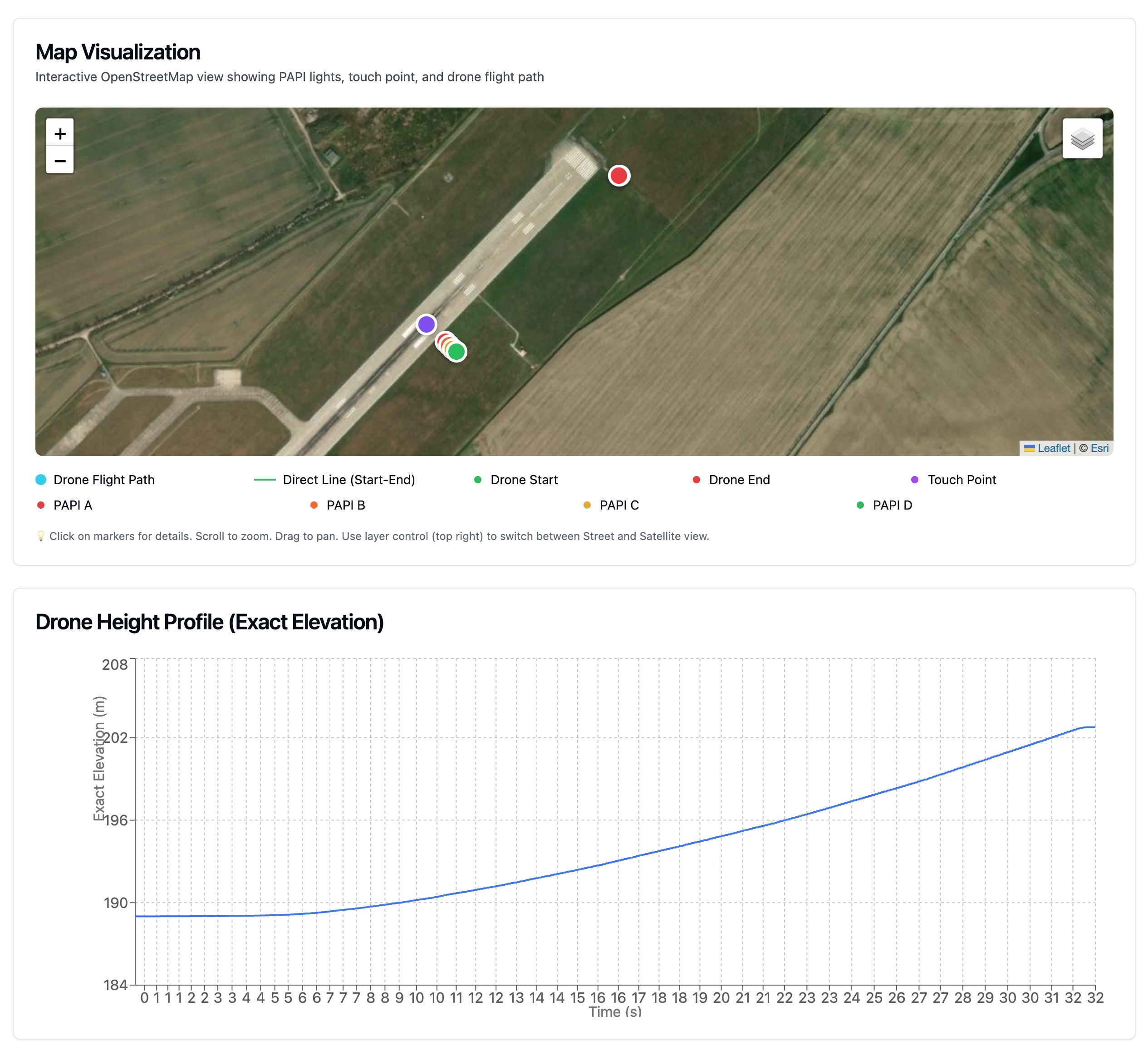
Transition angle per unit, computed from many positioned frames on the approach. On a base the figure is on the field laptop before the crew leaves.
Flight inspection, a photometric vehicle and the drone survey
| Question | Flight inspection | Photometric vehicle | Drone survey |
|---|---|---|---|
| PAPI | Checks the angles from the aircraft, and UFC 3-535-01 refers to it for commissioning | Not covered by this page | Transition angle per unit, known on site |
| Approach and runway lights | Checked from the aircraft as part of the inspection | Candela per light along the runway | Each unit lit or dark, colour, output against its row and position |
| Absolute intensity | Not covered by this page | Yes, from a calibrated photometer | No, output is relative |
| Position of each unit | Not covered by this page | Not covered by this page | RTK-surveyed against the layout |
| Runway use | Flown in the approach, no closure | A vehicle on the lit runway, usually at night in low traffic | Between sorties, in coordination with the tower |
| NVG and infrared | Not covered by this page | Not covered by this page | Not checked |
| Data | The inspecting organisation's report | The contractor's report | Offline deployment, data can stay on the base |
None of the three replaces the others. Flight inspection checks the PAPI and the approach and runway lights from the aircraft. The photometer gives candela. The drone checks every unit by position, often, and on the base’s timetable. The drone versus flight inspection guide compares the first and last in more detail.
Governance and the record
A base keeps its lighting records for its own authority, and the record has to survive an audit by people who were not there. The survey gives a dated list per system, with every unit by position, the step it was checked at and the frames behind it. The PAPI angles carry the positions and frames they were computed from, so a disputed figure can be recomputed rather than reflown.
Evidence and the honest limits
The strong claims are coverage, position and the PAPI angle. Every unit in scope is recorded at the steps checked, each with an RTK position, and a transition angle is geometry computed from positioned frames. Each of these can be checked in a first visit against the base’s own records.
The weaker claim is output. The camera is not calibrated, so output is reported relative to the neighbouring units and to the dimming step. That finds the units that matter, but it cannot say a light meets a candela minimum, and the Annex 14 definition of an unserviceable light is written in intensity. The photometric measurement guide sets out where a calibrated instrument has to enter.
Then the limits that do not move: no NVG or infrared check, no electrical tests and nothing underground.
Objections worth raising before a pilot
“Our data cannot leave the base.” Then the visit runs on the offline field deployment and nothing is uploaded. Where the imagery and the report are kept is agreed before the first flight.
“We cannot give up the runway.” The passes fit into the gaps between sorties in coordination with the tower, and no closure is booked.
“We already have flight inspection.” Keep it. The aircraft checks the PAPI and the approach and runway lights. The drone adds a light-by-light record with positions, as often as the base wants it.
“Our photometer contractor already gives us candela.” Keep that too. The drone finds the dark, dim and misplaced units by position between photometric runs, and it measures the PAPI angles.
Related tasks
If the question is the PAPI itself, the PAPI inspection describes the service and the PAPI out of tolerance page covers what to do with a bad angle. For the other systems there are the approach lights , runway edge lights , threshold and runway end lights , runway centre line lights and taxiway lights pages. After resurfacing, the return-to-service lighting check applies. For the runway surface on a base, see military airfield pavement inspection , and for the offline setup, inspecting an airfield with no internet . To scope a first visit, contact TarmacView .
Frequently Asked Questions
- Does EASA regulation apply to the lighting on a military aerodrome?
- Not where the aerodrome is controlled and operated by the military. Article 2(3)(b) of Regulation (EU) 2018/1139 excludes such aerodromes, or parts of them, from its scope, so the national military authority sets the rules. Those rules often follow ICAO Annex 14 and, in NATO countries, STANAG 3316. At a joint civil-military aerodrome, which parts fall under the EU rules is a question for the authorities to answer before the visit is scoped.
- Can the survey data stay on the base?
- Yes. The field deployment runs on a laptop that serves the app on a local network on the airfield, with offline map tiles and the PAPI angle engine on board. Nothing has to be uploaded for the flights to be planned, flown and the angles computed. Where the formal report is written and where the imagery is kept afterwards are agreed with the base before the visit.
- Does the drone check NVG-compatible lighting?
- No. The survey measures visible light: whether each unit is lit, its colour, its output relative to its neighbours and its position. It does not test infrared emitters, how the lights read through night vision goggles, or the heat signature some aircraft systems rely on. UFC 3-535-01 Appendix C explains that emitters for goggles work in the near infrared, outside what this survey reports.
- Do you measure light intensity in candela?
- No. The camera is not calibrated, so the survey reports output relative to the neighbouring units and to the commanded dimming step, not candela. That is enough to find dark units, units that have fallen behind their row and units that do not follow a step change. Absolute intensity needs a calibrated photometer, which UFC 3-535-01 paragraph 13-15.5 describes as a vehicle driven along the lit runway.
- Does a drone survey replace flight inspection?
- No. A flight inspection aircraft checks the PAPI angles and also the approach and runway lighting, and UFC 3-535-01 points to the flight inspection manual for PAPI commissioning. The drone measures light by light, more often and on the base's own timetable, and gives each unit a position. It sits between flight inspections and alongside the base's own maintenance checks.
- Who authorises the drone flights on a base?
- The base. Whether the drone may fly, where, at what times and under which local rules is the base's decision. The flights themselves are coordinated with the base tower and fit into the gaps between sorties, and the lights have to be switched on at the steps being checked. TarmacView makes no claim about security clearances or past military work.
- What happens if a PAPI unit is out of tolerance?
- The angle is known on site, so the base is told before the crew leaves. Often the base is not sure the unit is really wrong, so it calls its lighting technicians once the out-of-tolerance figure is reported. If they re-aim the unit during the visit, the drone measures it again the same day. The formal report follows with both measurements.
References
- eu-2018-1139
- Regulation (EU) 2018/1139 on common rules in the field of civil aviation and establishing a European Union Aviation Safety Agency Publications Office of the European Union
- stanag-3316
- STANAG 3316, Airfield Lighting, Edition 11 (AATMP-07, Edition A) NATO Standardization Office
- ufc-3-535-01
- UFC 3-535-01, Visual Air Navigation Facilities US Department of Defense, Unified Facilities Criteria
- icao-annex-14-v1
- Annex 14 to the Convention on International Civil Aviation, Volume I: Aerodrome Design and Operations International Civil Aviation Organization