Drone Airport Inspection: Method and Limits
How a drone inspects an aerodrome between aircraft movements: the mission profile, RTK positioning, tower coordination, the evidence chain, and where it stops.
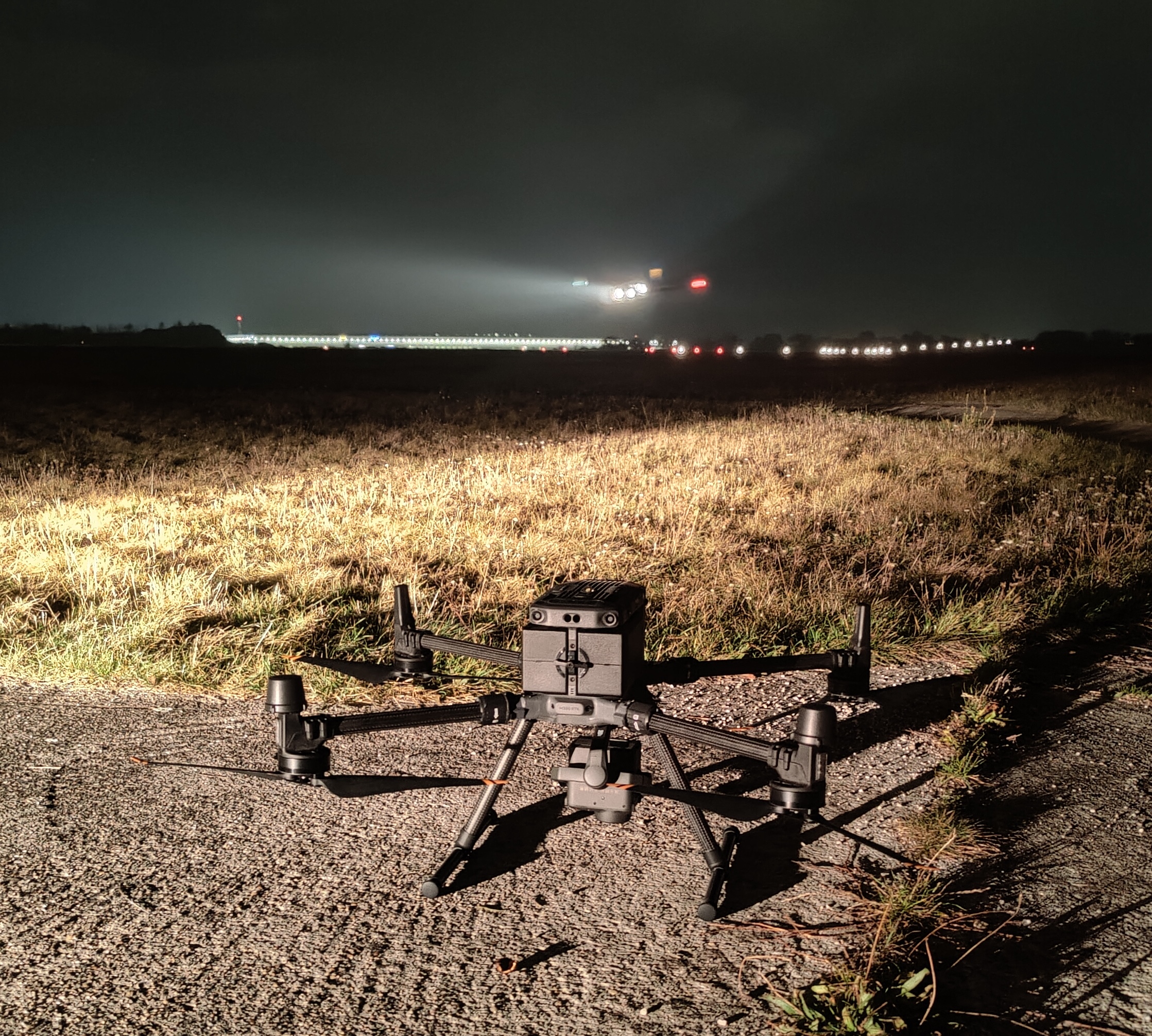
- 01 The method is a planned mission from an aerodrome profile, not a pilot with a camera, which is what makes the second visit comparable with the first.
- 02 Position comes from RTK GNSS tied to a base station, so every measurement is a geometry problem the aircraft's location settles, not an estimate from the image.
- 03 The flight is coordinated with the tower and flown in the gaps between movements. Aircraft always have priority and no closure is booked.
- 04 The evidence is the retained imagery and positioning log behind every number, which is what lets a disputed finding be recomputed rather than re-flown.
- 05 A drone measures geometry, relative photometry and surface condition well, and does not replace a calibrated photometer, an electrical test or a radio navigation aid calibration.
Who runs into this
The person reading this has usually already decided that something at the aerodrome needs verifying and is trying to work out whether a drone is a serious way to do it. The doubt is reasonable. The word covers everything from a hobby quadcopter to a survey aircraft, and most of what is written about drones at airports is about keeping them away.
The question arrives in four forms.
- A lighting or pavement check is due and the two known methods, an inspection aircraft or a vehicle on the runway, both cost more in occupancy than in fees.
- A regulator or an auditor has asked what method produced a record, and “a drone” is not an answer that survives the next question.
- A supplier has offered a drone survey and the operations manager wants to know what it will and will not deliver before signing.
- The aerodrome’s own maintenance programme needs a method it can name, repeat annually and defend.
What they have in common is that the method has to be understood before it can be trusted. This page is that understanding. The individual services, PAPI , approach lighting , runway edge lights , the surface scan and obstacle clearance , each describe what they deliver. This page describes what they all stand on.
Where this applies, and where it does not
The method applies to anything at an aerodrome that can be measured from imagery taken at a known position: the geometry of visual aids, their colour and relative output, the pattern integrity of an array, the condition of a paved surface, the penetration of a protection surface, the state of markings. It applies at a busy international airport and at a grass-strip aerodrome with one PAPI, because the physics is the same and only the coordination changes.
It does not apply to radio navigation aids, which are calibrated by flight inspection aircraft under a separate programme. It does not apply below the surface: cable insulation, regulator behaviour and pavement bearing strength are electrical and structural tests. And it does not replace a calibrated photometer where the question is absolute intensity in candelas against a published minimum.
What the method has to guarantee
- Planned mission
- The flight is generated from a stored aerodrome profile and an inspection template, not flown by hand, so it can be reproduced.
- Position
- RTK GNSS tied to a base station and the aerodrome's geodetic frame, with the fix quality logged per frame.
- Camera calibration
- Intrinsics from a target-based calibration, dated, so an angle in the image is an angle in the world.
- Coordination
- Tower coordination agreed in advance. The mission pauses for every movement and resumes from where it stopped.
- Authorisation
- The operator's specific-category authorisation and risk assessment, plus the aerodrome's permission.
- Retained data
- Raw imagery and positioning log kept with the report, so any result can be recomputed.
- Versioned method
- Each computation is tied to a method version, so a change in processing never silently changes a series.
- Stated limits
- Every report says what it does not measure: absolute photometry, sub-surface condition, radio aids.
What the aerodrome is trying to achieve
Three outcomes, and they are bought together and judged separately.
The runway stays open
Every hour of occupancy at a busy field costs more than the inspection fee. A method that does not need the surface, and that pauses for every movement, turns a booked closure into a series of gaps the tower already has.
The record survives the audit
A regulator does not ask whether a number is impressive. They ask where it came from, by what method, with what instrument in what state, and against which tolerance. A method whose evidence is retained imagery and a positioning log answers all of those. A method whose evidence is a signed PDF answers the last.
The next visit measures change
A single visit reports a state. Two comparable visits report a trend, and a trend is what a maintenance programme acts on. The value of a planned, regenerated mission is that visit two is comparable with visit one, which no hand-flown or walked survey can promise.
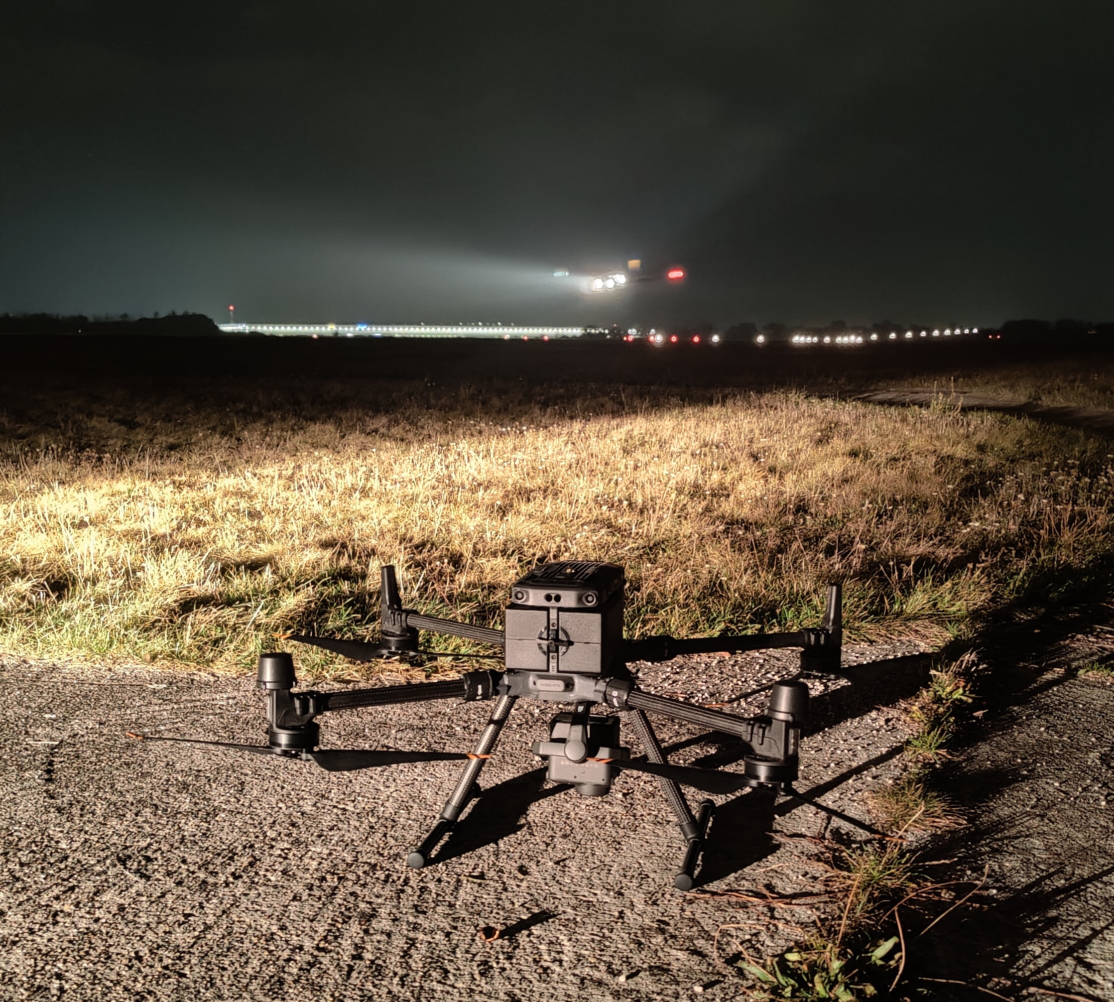
Flown between movements. The aircraft always has priority, and the mission resumes from where it paused.
How a visit runs
The visit is the visible part of a longer process, and most of the work is done before anyone drives to the aerodrome.
From aerodrome profile to signed report
- 01
Build the aerodrome profile
Load the runway geometry, thresholds, declared distances, fixture positions and published surfaces from the aerodrome's own data, and the no-fly and safety zones from the aerodrome map. Confirm the tolerances that apply under your authority.
WhyEverything downstream is generated from it: the mission geometry, the safety zones, the fixture positions the measurements are referenced to, and the tolerances the report is judged against.
Done whenThe profile reproduces the aerodrome's published geometry, and the operator has signed it off.
If notWhere fixture positions are not on record, the first visit surveys them and the profile is built from that survey.
- 02
Secure the authorisation and the coordination
The operator's authorisation and risk assessment are matched to the aerodrome. The aerodrome grants permission and the tower agrees the coordination procedure, the holding rules and the movement windows.
WhyA flight at an aerodrome is a specific-category operation and a tower's concern. Neither can be arranged on the day.
Done whenA written coordination procedure exists that names who calls whom, and when the mission holds.
If notIf the tower cannot offer windows on the proposed date, the visit moves. It is never flown on a promise of gaps.
- 03
Generate and validate the mission
Select the inspection templates that apply: an approach descent for a glide slope indicator, a fly-over for an array, a surface scan for pavement, an arc on a protection surface for obstacles. Generate the mission, check it against the safety zones, and compute the expected camera geometry and ground resolution.
WhyThe mission is what makes the visit reproducible and safe. It is computed from the profile and the template, not drawn by hand.
Done whenThe mission passes the safety-zone check and the expected resolution meets what the measurement needs.
If notIf a template cannot reach the required geometry within the zones, the measurement is scoped out and the report says so.
- 04
Fly between movements
The crew sets up the base station and confirms the RTK fix, runs the coordination procedure with the tower, and flies the mission. The aircraft holds clear at every movement and resumes. Every frame is logged with position, attitude and fix quality.
WhyThis is the step the aerodrome sees, and it is designed to be uneventful.
Done whenThe mission completes with every measurement captured at the planned geometry, and the log shows a fix on every frame used.
If notWind, precipitation or a lost fix pause the mission. Affected passes are reflown, not rated through the problem.
- 05
Process, check and report
Imagery and logs are processed, results are computed per fixture or per section, each is compared with its tolerance, and the report is assembled with the evidence behind every finding attached.
WhyThe measurement is computed from the retained data under a versioned method, and checked against the tolerances in the profile.
Done whenThe report can be handed to the authority the same day, and every number in it can be traced to frames and a method version.
If notA disputed result is recomputed from the retained data. Only if the data itself is inadequate is a pass reflown.
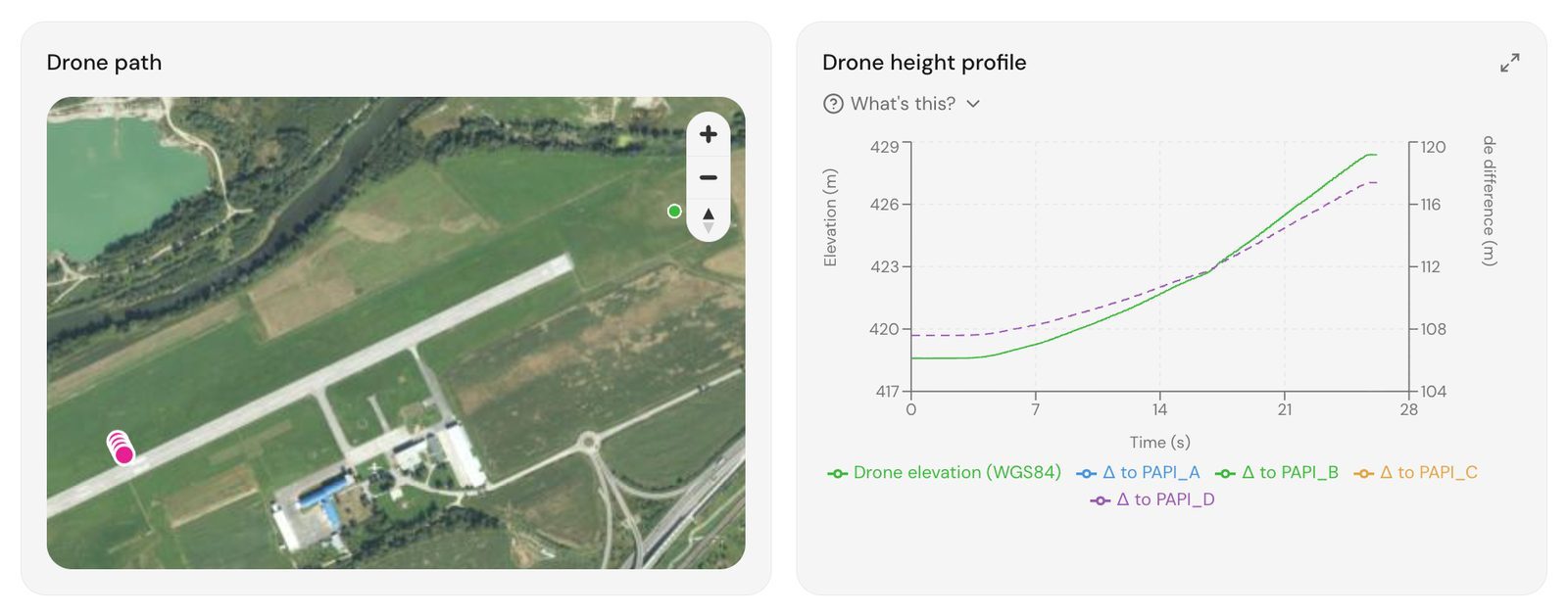
The mission and its height profile, generated from the aerodrome profile. The next visit regenerates the same path.
Drone, inspection aircraft, ground vehicle, walked survey
| Method | Measures well | Occupies | Evidence left | Stops at |
|---|---|---|---|---|
| Drone inspection | Geometry, colour ratios, relative output, pattern integrity, surface condition, surface penetration | Nothing booked, flown between movements | Retained imagery, positioning log, versioned method | Absolute photometry, sub-surface condition, radio aids |
| Flight inspection aircraft | Radio navigation aids, with visual aids from the pilot's eye as a check | The approach, for each run | Instrumented flight record | Fixture-level detail, while cost and scheduling put it on a long cycle |
| Ground photometric vehicle | Absolute intensity in candelas per fixture, chromaticity | The runway, as a booked closure | Calibrated instrument readings | Geometry from the pilot's view, obstacles, anything off the surface |
| Walked or driven inspection | Serviceability, obvious defects, loose material on the day | The surface, briefly | A checklist | Anything requiring measurement, coverage or positions |
| Electrical testing at the vault | Regulator output per step, insulation, switch-over time | The vault, not the surface | Instrument readings | Everything optical |
Governance and the record
The method is only as good as what it retains. A drone inspection that hands over a PDF and deletes the imagery has produced an opinion with a photograph on it. A drone inspection that retains the frames and the positioning log, versions its processing, and states its uncertainty has produced evidence. None of that requires a network connection: capture, processing and the report can run entirely on a laptop on the airfield , which matters where the site does not allow data to leave it.
That distinction is what an auditor tests, and it is worth writing into the contract. Ask for the retention period of the raw data, the method version on the report, the calibration date of the camera, and the uncertainty stated per measurement. A supplier who can answer those has a method. One who cannot has a drone.
Evidence and the honest limits
The strong claim is the geometric chain. A known camera position from RTK, a known camera calibration, and a known target position make an angle, a distance or an offset a computation with a bound on it. That is why transition angles, fixture positions, pattern spacing and surface penetration can be reported with an uncertainty rather than an adjective. The chain is explained in how a drone measurement becomes evidence .
The weaker claim is anything photometric. A camera records counts. Ratios between channels and between units under one exposure survive that, which is why colour and relative output are reported with confidence. Absolute intensity does not, and a report that states candelas has either a calibrated photometer in the chain or a problem.
Three things sit outside the method entirely. Radio navigation aids belong to the flight inspection aircraft. The electrical side of a lighting system, the regulator, the series circuit and the standby supply, is tested at the vault. And pavement bearing strength is a structural question that no camera answers. A programme that knows where its method stops is one that can be defended. One that claims everything cannot.
Objections worth raising before you buy
“Drones are what we keep away from the airfield.” Correct, and the same regulation that keeps an uncoordinated drone away is what puts a coordinated one on the field: an authorised operation, a tower procedure, a mission that holds for every movement. The difference is not the aircraft, it is the operation.
“Our authority has not accepted drone methods.” Ask about the parameter, not the platform. The standards say what has to be verified and to what tolerance, and are largely silent on the instrument. The visual aids manual has for some years named unmanned aircraft among the ways of checking glide slope indicator settings.
“We already pay for a flight inspection.” For the radio aids, keep paying. For the visual aids, ask what the aircraft measures at fixture level and how often it comes. The comparison is the subject of drone survey versus flight inspection .
“A photograph is not a measurement.” Agreed. A photograph from a known position, through a calibrated lens, of a target at a known position, is. The difference is the chain, and the chain is what to ask any supplier to show you.
Related tasks
If the immediate question is which lighting parameters have to be verified and how the year runs, airfield lighting inspection without closing the runway is the page. If it is the pavement, FOD that comes from the pavement itself sets out the source-control argument. If it is procedure, the photometric measurement procedure shows where a calibrated instrument enters the chain. And if the field is due for a full visit, the shape of one is on the pricing page .
Frequently Asked Questions
- Does the runway have to close for a drone inspection?
- No closure is booked. The mission is coordinated with the tower in advance and flown in the gaps between aircraft movements, with the aircraft always having priority. The drone holds clear when a movement is expected and resumes the mission from where it paused. A ground photometric vehicle or a walked survey occupies the surface for the duration and is booked as a closure, and that is the occupancy this method removes. An inspection aircraft does not book a closure either, so against the aircraft the saving is the transit it would charge and the scope one visit covers, not runway time.
- How is the drone positioned, and how accurate is it?
- By RTK GNSS on the aircraft, corrected against a base station on the aerodrome or a network service, and tied to the aerodrome's geodetic frame. Position accuracy is at the centimetre level in the horizontal and slightly worse in the vertical, and the fix quality is logged for every frame so a frame without a fix is excluded rather than trusted. That position is what turns an image into a measurement: an angle between a known camera position and a known fixture is geometry, not a guess about the picture.
- Is a drone camera a certified measuring instrument?
- No, and any supplier who says otherwise has skipped a step. A camera records counts, not candelas, and those counts depend on the lens, the exposure and the distance. What survives that limitation is anything based on geometry or on ratios: transition angles, positions, colour ratios, relative intensity between units under one exposure. Absolute intensity in candelas needs a calibrated photometer in the chain, either as a reference reading on site or a cross-calibration. The camera's own calibration, the intrinsics, is done against a target and dated, and that is what makes the geometry chain trustworthy.
- What authorisation does the flight need?
- In Europe, a drone flight at an aerodrome falls under the specific category of the EU drone regulation, which means an operational authorisation from the national authority on the basis of a risk assessment, plus the aerodrome's own permission and coordination with air traffic control. The authorisation and the risk assessment are the operator's, meaning TarmacView's, and the aerodrome supplies its permission and the tower coordination. Outside Europe the shape is similar under the national rules. What the aerodrome does not need is its own drone authorisation.
- What weather stops a drone inspection?
- Wind above the aircraft's limit, precipitation, and for lighting measurements, daylight or fog that changes what the camera sees of the fixtures. For pavement, standing water, snow and contamination hide the surface. In each case the mission is postponed or reflown rather than rated through the conditions, and the report says which frames were excluded and why. The drone's weather window is wider than an inspection aircraft's for low cloud, because it flies below it, and narrower for wind.
- How does one visit compare with the next?
- The mission is generated from a stored profile of the aerodrome: runway geometry, fixture positions, safety zones and the inspection templates that apply. The next visit regenerates the same mission from the same profile, so the aircraft flies the same path, holds the same camera geometry and produces a data set that lines up with the last one. That is what lets a report state change rather than a fresh opinion, and it is the property of the method that a manual survey cannot reproduce.
- What happens to the data afterwards?
- The raw imagery and the positioning log are retained alongside the report, and the method used to compute each result is versioned. If a number is disputed, it is recomputed from the retained data rather than re-flown, and if the method changes, the old data can be reprocessed under the new one so the series stays comparable. The report is the summary. The retained data is the evidence, and an audit months later reads the second.
References
- eu-2019-947
- Commission Implementing Regulation (EU) 2019/947 on the rules and procedures for the operation of unmanned aircraft Publications Office of the European Union
- icao-annex-14-v1
- Annex 14 to the Convention on International Civil Aviation, Volume I: Aerodrome Design and Operations International Civil Aviation Organization
- icao-doc-9157-p4
- Doc 9157, Aerodrome Design Manual, Part 4: Visual Aids International Civil Aviation Organization
- icao-doc-10019
- Doc 10019, Manual on Remotely Piloted Aircraft Systems (RPAS) International Civil Aviation Organization