solutions
US Military Airfield Pavement PCI Surveys by Drone
A PCI for every sample unit of a US military airfield, from drone imagery and the D5340 definitions. Early access, in development, with the limits…
OCT 18 2026
13 MIN
One drone flight, and the software finds, measures and rates every crack by the D5340 definitions, then computes the Pavement Condition Index of every sample unit. Not a sample, every unit, rated the same way whoever runs the survey. Running today on our own flights, offered as early access.
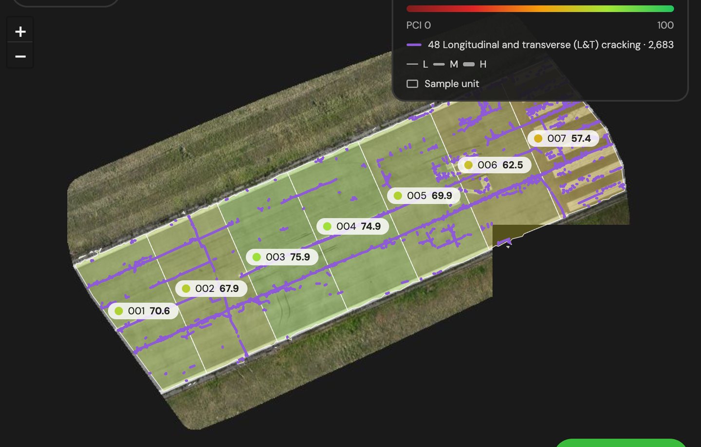
Three screens from TarmacView Pavement Center, on our own flights at Žilina and Trenčín.
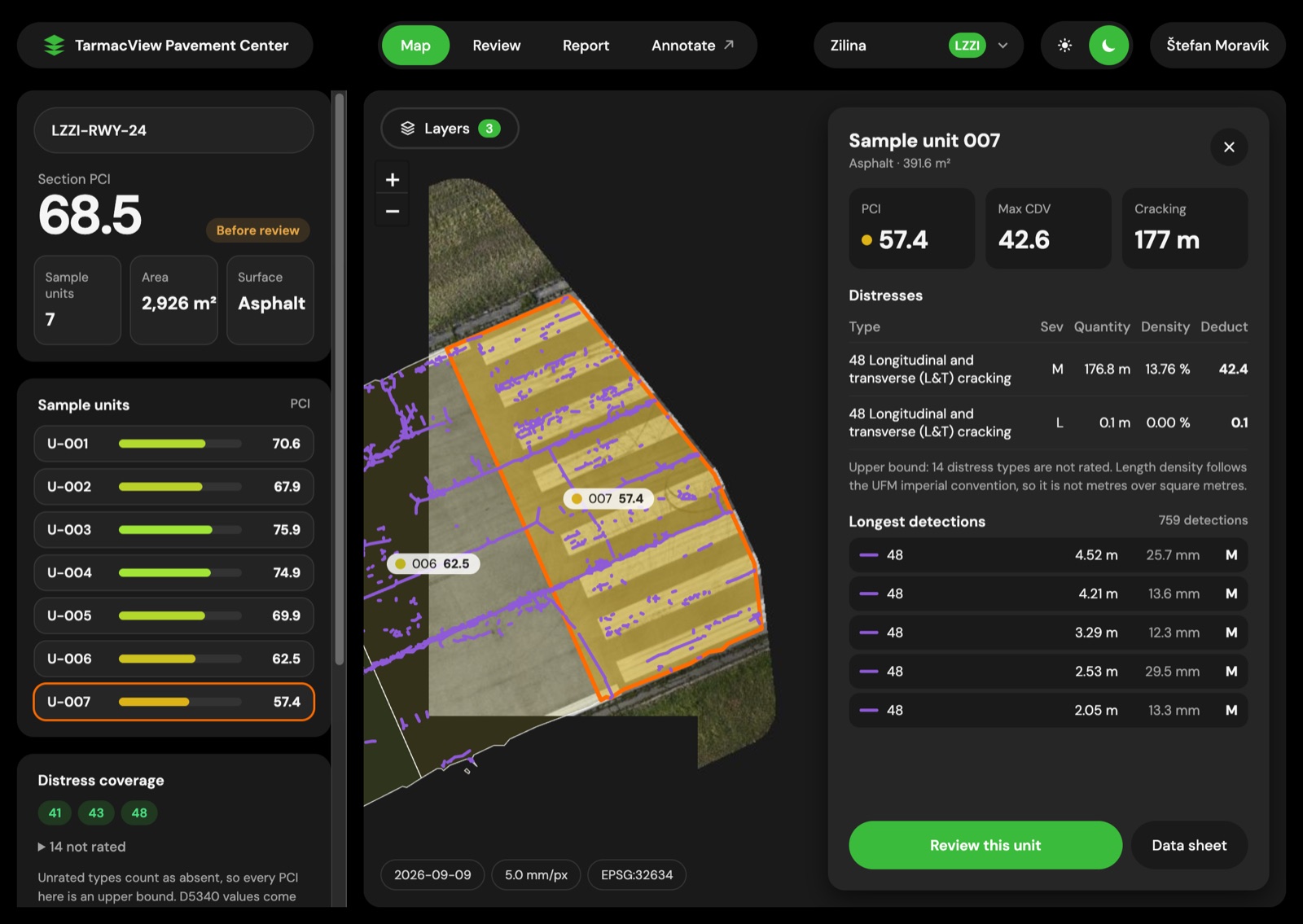
The section opens on a map. Each sample unit is filled by its PCI on one 0 to 100 scale, and every crack is drawn where it lies, coloured by distress type, with line width for severity. Open a unit and you see its distresses, their quantities and the deduct calculation behind its number. Here, sample unit 007 on Žilina's runway: 177 m of longitudinal and transverse cracking at medium severity, a max corrected deduct of 42.6 and a PCI of 57.4.
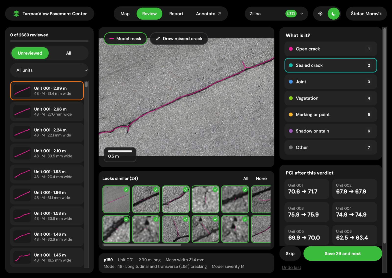
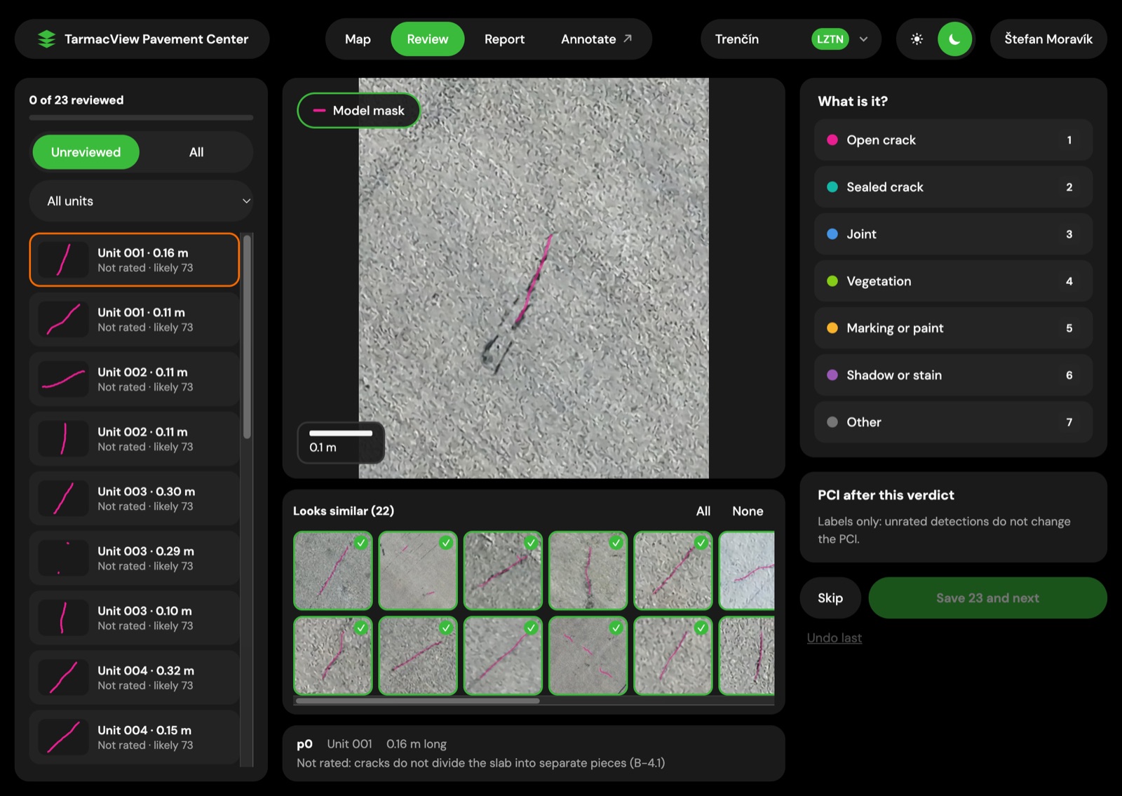
The review queue shows each detection next to the cracks that look like it, found by comparing their image vectors. The analyst marks a 31 mm dark band as a sealed crack, and the 24 similar detections take the same verdict in one save. The PCI of every affected unit updates before the next crack loads. The report never waits for review. Review is how the model learns each airfield's sealant, paint and joints, because every verdict becomes a training label.
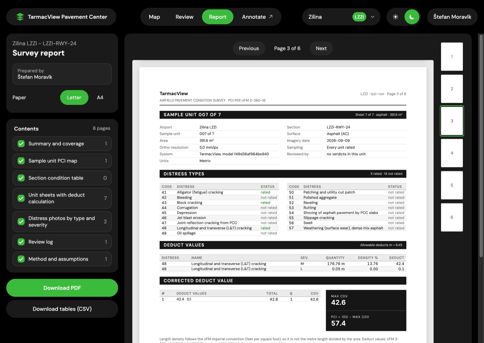
Every run writes a report: a summary and coverage page, the sample-unit PCI map, the section condition table, one sheet per unit with the deduct values and the corrected deduct iteration, distress photos by type and severity, the review log, and the method and its assumptions. It lists the types rated and the types not rated, in metres, ready as PDF and as CSV tables.
The person who has to say what condition the pavement is in and which sections get money. Three buyers have their own pages: government and state airports , NATO and allied airfields and US military airfields .
An RTK drone flies 6 to 18 m above the pavement on a mission planned from the surface geometry and the camera, so the pixel size is computed, not assumed. Finer pixels show finer cracks and take longer, so the survey is fitted to the narrowest crack it must catch and to the traffic window on the day.
The images become an orthomosaic at 1 to 5 mm per pixel. An orthomosaic built from the drone's own positions is 6 times faster than photogrammetry on the same photos, with the PCI within 1 point.
The crack model marks crack pixels over the whole orthomosaic. A classifier labels each tile with the other D5340 distress types.
Geometry code measures each crack's centreline length in metres, its width in millimetres and the cells it encloses. On concrete it fits the slab grid, so every crack is counted against the right slab.
A rule engine assigns the D5340 type and severity from one catalogue transcribed from UFM 3-260-16, then computes the deducts, the corrected deduct value and the PCI of every sample unit and of the section.
A GeoJSON inventory, the PCI per sample unit, condition sheets with the deduct calculation, CSV tables, and a list of the types rated and not rated.
An analyst confirms or corrects detections in batches of similar cracks. The PCI updates with each save, and every verdict becomes a training label.
Every figure comes from our own flights and hand-checked tiles, not from public benchmarks.
Our PCI arithmetic run on the asphalt and concrete worked examples of UFM 3-260-16.
The same runway section flown and processed twice.
Held-out tiles, hand-checked by two people, model scored against their agreement.
60 crack-free concrete tiles, our two crack models combined.
Against photogrammetry on the same photos.
17 asphalt and 16 concrete distress types.
On a MacBook, at 1 mm and at 5 mm per pixel.
ASTM D5340 is a visual method. Inspectors walk the sample units the sampling rules pick, judge each distress by eye and add up the deducts by hand. It works, and it has three costs: the result depends on who walks, the units nobody walked are inferred, and the runway is closed while people are on it.
A drone flight changes all three. The camera images every square metre at the same pixel size, the software applies one catalogue to every crack, and the runway is open again as soon as the aircraft lands. The PCI that comes out uses the same definitions and the same deduct values, computed for every unit instead of a sample.
Because every distress keeps its position, its length and its width in millimetres, a second survey is not just a second number. It shows which cracks grew and by how much, which is what moves maintenance from repair after failure to planned repair.
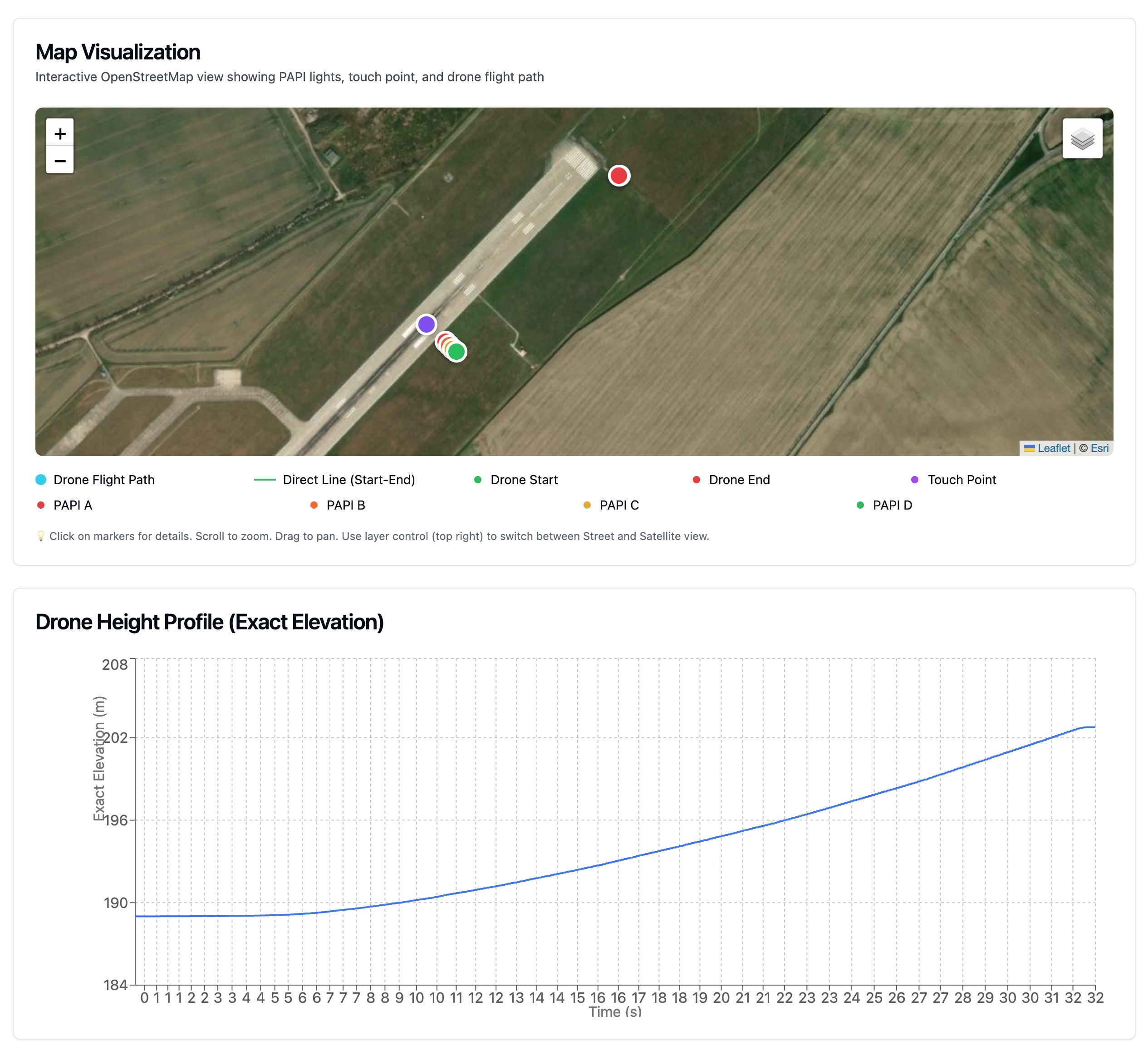
The method is the one civil and military airfields already share. The PCI was developed for the US Army Corps of Engineers, is used by the FAA, is set out for NATO in STANAG 7181 / AEP-56, and its distress catalogue is the one in UFM 3-260-16. The same flight also does more than pavement. PAPI and navigation aid inspection run on the same platform today.
What runs today is above. These are the directions the next work goes in, in no promised order.
Every D5340 distress type rated automatically, not only the cracking types, with foreign object debris flagged in the same pass.
Repeat surveys of the same sections, with a growth forecast per crack that each next survey checks.
Results loading straight into PAVER and into the owner's geographic information system.
Crack depth from angled photos, and craters and spalls measured in depth and volume, so a damaged airfield knows within tens of minutes which runway takes which aircraft.
Drone docks at the airfield that launch on command from the base or from a central dispatch.
Processing on the owner's own cloud under its security controls, for networks of airfields.
Three limits worth knowing before a first flight, and who each one belongs to.
We fly in daylight, preferably on a dry surface. Wind, temperature and rain limits are the aircraft maker's. Snow, sand, standing water or heavy contamination hide the pavement, and the mission is reflown rather than rated through them. Sealant and paint edges can read as cracks, and the analyst clears them in minutes.
Imagery rates what is visible. Structural capacity needs deflection testing, coring or a penetrometer, and friction and roughness need equipment on the surface. A PCI says nothing about a pavement's ACR-PCR strength rating.
Where a funding programme or an instruction names a survey signed by a certified PCI inspector, that survey is still what satisfies it, until a certified inspector has rated our sections side by side. We want that comparison and will publish it.
A PCI for every sample unit of a US military airfield, from drone imagery and the D5340 definitions. Early access, in development, with the limits…
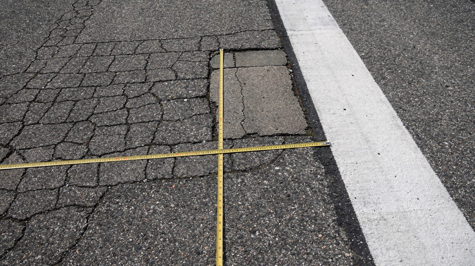
ASTM D5340 is the definitive standard for conducting Pavement Condition Index (PCI) surveys on airport pavements. It defines 17 asphalt and 16…
What ASTM D5340 requires for an airport PCI survey, how the procedure runs, and which parts of it drone imagery can support and which stay with a…
The pavement survey is in development and offered as early access. Tell us the airfield, the surfaces and the narrowest crack you need to see, and we will plan the flight with you. Nothing is binding.
Cookie Consent
We use cookies to enhance your browsing experience and analyze our traffic. See our privacy policy.