eTOD: What Accuracy Obstacle Data Has to Meet
What accuracy eTOD asks of obstacle data: 0.5 m in Area 3, 5 m and 3 m in Area 2, 2.5 m and 1 m in Area 4, 50 m and 30 m in Area 1, and who supplies it.
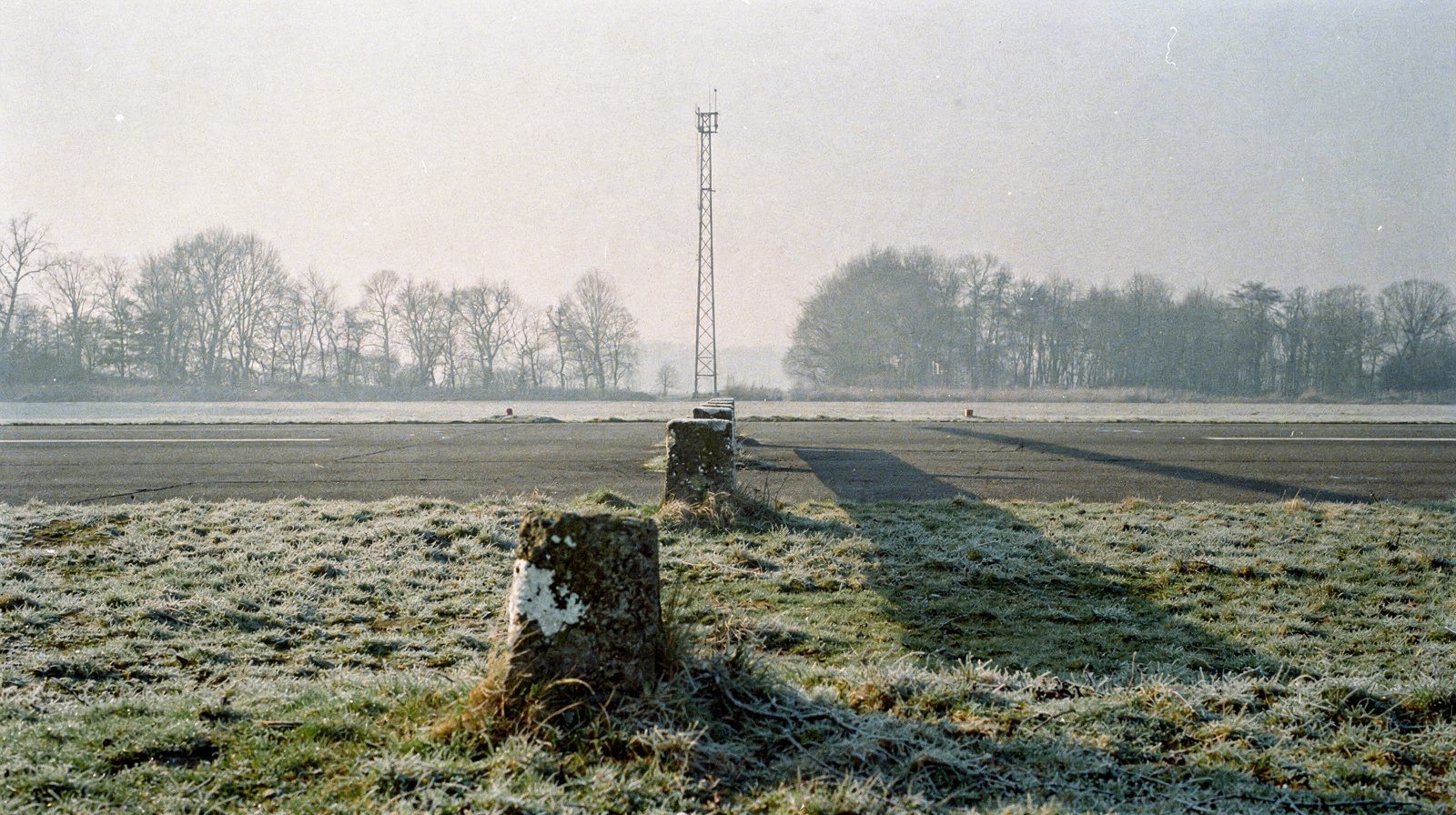 AREA 3 · BOUNDARY MARKERS · MAST BEYOND
The short answer
Under eTOD, accuracy depends on the area. In EASA’s guidance, Area 3 beside the movement area asks 0.5 m horizontal and 0.5 m vertical. Area 2 asks 5 m and 3 m. Area 4 asks 2.5 m and 1 m. Area 1 asks 50 m and 30 m. Every area uses a 90 per cent confidence level.
These values come from guidance material, so check them against the binding data catalogue before you scope a survey. The acceptable means of compliance says the aerodrome operator should report obstacles inside the aerodrome boundary. Outside it, the operator should make arrangements with air traffic services and the competent authority. The rest of this post sets out where each number comes from and what status it has. For the same table read area by area, see our page on ICAO PANS-AIM and eTOD .
What eTOD covers
eTOD stands for electronic terrain and obstacle data. It is the digital data set that procedure designers, flight planning and cockpit systems draw on. Annex 14 points to Annex 15, Chapter 5, for the provisions on terrain and obstacle data sets. A Note in the Annex 14 Chapter 4 introduction (applicable 21 November 2030) adds that the extent of the obstacle limitation surfaces is being used in defining the requirements for collecting these data sets. It is a Note, not a Standard.
The data travels through the aeronautical information service of the State. The aerodrome supplies its part. Others supply the rest.
The four areas
GM4 to ADR.OPS.A.005(a) defines the coverage areas:
- Area 1 is the entire territory of the State.
- Area 2 is the aerodrome surroundings. Area 2a is the runway strip plus any clearway. Area 2b runs 10 km from the ends of Area 2a in the direction of departure, with a 15 per cent splay each side. Area 2c lies outside 2a and 2b, no more than 10 km from Area 2a. Area 2d reaches 45 km from the aerodrome reference point or to the TMA boundary, whichever is nearer.
- Area 3 runs from the runway edge to 90 m from the runway centre line, and 50 m from the edge of all other parts of the movement area.
- Area 4 is the 900 m before the threshold of a Category II or III precision runway, 60 m each side of the extended centre line.
Which obstacles count is set by collection surfaces. In Area 2a it is anything above 3 m over the nearest runway elevation. In 2b and 2c the surface rises at 1.2 per cent. In 2d it is 100 m above ground. In Area 3 it is 0.5 m above the horizontal plane through the nearest point of the movement area. In Area 1 it is every obstacle 100 m or higher.
The numbers
Table 2 of the same GM gives the obstacle data requirements. The vertical resolution is the step in which the value is recorded.
| Area 1 | Area 2 | Area 3 | Area 4 | |
|---|---|---|---|---|
| Horizontal accuracy | 50 m | 5 m | 0.5 m | 2.5 m |
| Vertical accuracy | 30 m | 3 m | 0.5 m | 1 m |
| Vertical resolution | 1 m | 0.1 m | 0.01 m | 0.1 m |
| Confidence level | 90 % | 90 % | 90 % | 90 % |
| Data classification (integrity level) | Routine | Essential | Essential | Essential |
Three readings matter in practice.
First, Area 3 is the demanding one. Half a metre in both horizontal accuracy and vertical accuracy is what the guidance asks of data collected beside the movement area.
Second, resolution follows accuracy. GM1 to ADR.OPS.A.010(d) says a resolution 10 to 100 times finer than the accuracy preserves it, and that a finer one can mislead, because it suggests an accuracy the data does not have.
Third, the integrity classification is a process requirement. ADR.OPS.A.010(c) keeps integrity throughout the data process from origination to transmission. For essential data, (c)(2) says corruption does not occur at any stage of the entire process.
What status these values have
The status needs care. ADR.OPS.A.010(b) is a rule. It says the accuracy of aeronautical data is as specified in the aeronautical data catalogue, and ADR.OPS.A.030 ties that catalogue to Appendix 1 to Annex III of Regulation (EU) 2017/373. We did not open that appendix for this post. The table above is guidance material, GM4, which EASA prints beside the rule. Guidance explains, and the rule binds.
The reporting duty in Annex 14 is a Standard. Paragraph 2.5.5 says the coordinates of obstacles in Area 2 (the part within the aerodrome boundary) and in Area 3 shall be measured and reported to the aeronautical information services authority in degrees, minutes, seconds and tenths of seconds. The top elevation, type, marking and lighting of each obstacle shall be reported too. The Note points to PANS-AIM, Appendix 8, for the determination requirements. PANS-AIM is a paid ICAO document and we have not read it.
Who provides what
In the EU, ADR.OPS.A.005 says the aerodrome operator shall, as appropriate, determine, document and maintain aerodrome data and provide it to users, air traffic services and aeronautical information services. The acceptable means of compliance, AMC1 ADR.OPS.A.005, fills in the detail with “should”:
- measure and report obstacles and terrain in Area 3, and in Area 2 within the boundary, in degrees, minutes, seconds and tenths of seconds, as in Annex 14 2.5.5
- provide electronic obstacle data for every Area 2 obstacle inside the boundary assessed as a hazard to air navigation
- provide electronic data for what penetrates the Area 2a collection surface, the take-off flight path area identification surfaces and the aerodrome obstacle limitation surfaces
- provide Area 4 data where Category II or III operations are established and operators need terrain detail for radio altimeter use
- make arrangements with air traffic services and the competent authority for data outside the boundary
The last point matters. The operator is not asked to survey a State alone. The European ATM Master Plan objective for eTOD lists separate lines of action for State authorities, air navigation service providers and airport operators.
An operator that buys the survey also has duties. ADR.OPS.A.010 requires formal arrangements with the organisations it exchanges data with, and AMC2 names providers of survey data origination and of electronic obstacle data. AMC2 says the arrangement should state which quality requirements apply and how conformity is shown. GM1 points to ATM/ANS.OR.085 of Annex III to Regulation 2017/373 for the requirements on contracted origination.
Datums decide whether a number is usable
ADR.OPS.A.020 requires WGS-84 as the horizontal reference and mean sea level as the vertical one. AMC1(b) says to use the EGM-96 gravity model, and to describe any other geoid in the AIP. GM2 to ADR.OPS.A.020(b) separates gravity-related heights from ellipsoidal heights, which are distances above the ellipsoid. A height measured on the ellipsoid has to be converted before it can go in a data set. The geodetic datum and vertical datum are part of the accuracy claim. A height left on the ellipsoid is off by the geoid undulation at that point. Our post on why coordinates disagree covers the mechanics.
GM2 to ADR.OPS.A.020(a) adds that coordinates transformed into WGS-84 from field work that does not meet the catalogue requirements should be identified as such until they comply.
The FAA does it differently
The FAA has its own survey standard, AC 150/5300-18B. It is not mandatory in general. Paragraph 4 says its “shall” and “must” terms apply to those who buy data collection with Airport Improvement Program or Passenger Facility Charge funds, or who use its method to show compliance. It also calls the AC one, but not the only, acceptable means of meeting 14 CFR Part 139 for the collection of such data. The version read here is the consolidated text with Change 1 of 24 February 2014.
| EASA GM, Area 3 | FAA AC 150/5300-18B | |
|---|---|---|
| Objects collected | above 0.5 m over the horizontal plane through the nearest point of the movement area | vertical objects above 1.5 ft over the nearest movement area surface (the nearest runway surface beside runways) |
| Accuracy | 0.5 m horizontal and vertical | “the greater of” the feature’s own accuracy or 1.5 ft horizontal and vertical, with 0.25 ft resolution |
| Confidence level | 90 % | 95 % |
For the Category II and III operation area, the FAA’s paragraph 2.9.1 asks terrain only, in an area 3,000 ft by 400 ft, at 4.0 ft horizontal and 2.6 ft vertical accuracy at 95 per cent. The FAA states that both survey types meet the Annex 15 requirements for Area 4 and Area 3. Both systems frame the data by area, but the numbers and the confidence level differ, so an operator working under both must know which applies.
Where a drone survey fits
A survey feeding this data must show its accuracy at the stated confidence, in the right datum, with the traceability, timeliness and completeness that ADR.OPS.A.010 lists beside accuracy. A point cloud is not yet that. The data has to be originated and verified as aeronautical data.
Our approach obstacle clearance check is in development and is not offered yet. It tests whether an obstacle rises into a protection surface. It is a clearance check, not an eTOD data set. The two meet where the acceptable means of compliance says an obstacle that penetrates the aerodrome obstacle limitation surfaces should be provided as electronic data. For the surfaces themselves, read obstacle limitation surfaces: surveying the approach .
Frequently Asked Questions
- What accuracy does eTOD require for obstacle data?
- It depends on the area. EASA's guidance (GM4 to ADR.OPS.A.005(a), Table 2) asks 0.5 m horizontal and 0.5 m vertical in Area 3, 5 m and 3 m in Area 2, 2.5 m and 1 m in Area 4, and 50 m and 30 m in Area 1. Every area uses a 90 per cent confidence level. This is guidance. The binding accuracy is the one in the aeronautical data catalogue. We did not read ICAO's PANS-AIM, which is a paid document.
- Which eTOD area has the tightest obstacle accuracy?
- Area 3, next to the movement area, has the tightest values at 0.5 m horizontal and 0.5 m vertical, with a vertical resolution of 0.01 m. Area 3 runs from the runway edge to 90 m from the runway centre line, and 50 m from the edge of the other parts of the movement area.
- What confidence level and integrity class does eTOD obstacle data need?
- The guidance table gives a 90 per cent confidence level in all four areas. Area 1 data is classed as routine and Areas 2, 3 and 4 as essential. For essential data, ADR.OPS.A.010(c)(2) says corruption does not occur at any stage of the entire process.
- Who provides obstacle data outside the aerodrome boundary?
- The operator is not asked to survey it alone. AMC1 ADR.OPS.A.005(f) says the operator should make arrangements with the air traffic services provider and the competent authority for data outside the boundary. The operator should measure and report obstacles in Area 3, and in Area 2 within the boundary.
- Does the FAA use the same eTOD accuracy numbers?
- No. For vertical objects beside the movement area, FAA AC 150/5300-18B asks the greater of the feature's own accuracy or 1.5 ft horizontal and vertical, at 95 per cent confidence. EASA's Area 3 guidance asks 0.5 m at 90 per cent. The two systems frame the data by area, but the numbers and confidence level differ.
- Can a drone survey supply eTOD obstacle data?
- Only as an input. The data must show its accuracy at the stated confidence, in the right datum, and be originated and verified as aeronautical data. TarmacView does not build eTOD data sets. Its obstacle clearance check is in development and is a clearance check, not a data set.
References
- easa-ear-aerodromes
- Easy Access Rules for Aerodromes (Regulation (EU) No 139/2014) European Union Aviation Safety Agency
- icao-annex-14-vol-1
- Annex 14 to the Convention on International Civil Aviation, Volume I, Aerodrome Design and Operations International Civil Aviation Organization (copy hosted by the Swiss Federal Office of Civil Aviation)
- atm-master-plan-inf07
- INF07 - Electronic Terrain and Obstacle Data (eTOD) European ATM Master Plan, SESAR Joint Undertaking
- faa-ac-150-5300-18b
- AC 150/5300-18B, General Guidance and Specifications for Submission of Aeronautical Surveys to NGS: Field Data Collection and Geographic Information System (GIS) Standards Federal Aviation Administration
Founded by flight-inspection veterans who spent decades measuring PAPI lights for aviation authorities across Europe.
Learn more
Related terms
03 TERMSElectronic Terrain and Obstacle Data (eTOD)
What eTOD is. The four data areas, the accuracy tables for terrain and obstacle data, the collection surfaces, who provides the data and the EU quality rule.
Coverage Area
A coverage area is the region in which a service, signal or dataset applies. For an aerodrome, it sets where terrain and obstacle data are collected.
Aerodrome Obstacle Chart
An aerodrome obstacle chart is an ICAO chart that shows obstacles near an aerodrome. Type A, Type B and the electronic chart, what counts as an obstacle, accuracy, and the link to obstacle limitation surfaces.
Further reading
03 ARTICLES
ICAO PANS-AIM (Doc 10066) and eTOD: Obstacle Data Accuracy by Area
What accuracy eTOD requires for obstacle data, area by area, from EASA guidance and Annex 14, and what ICAO PANS-AIM (Doc 10066) leaves to the data…
Who Can Carry Out an Aerodrome Obstacle Survey?
Who can carry out an aerodrome obstacle survey? What the EU and UK rules say about contractors, the operator's duty, formal arrangements and drone…
Obstacle Limitation Surfaces: Surveying the Approach
What obstacle limitation surfaces are, which ones matter at a regional aerodrome, and how the approach gets surveyed to prove nothing has grown into…