What is Precision Approach Radar (PAR)?
Precision Approach Radar (PAR)
A precision approach radar (PAR) is a ground radar that shows azimuth, elevation and range so a controller can guide an aircraft to land.
The FAA names three things on the radar scope. Azimuth is the position against the final approach course. Elevation is the position against the glidepath. Range is the distance from the touchdown point on the runway. The controller reads these values and gives instructions to the pilot by radio. ICAO defines it as primary radar equipment. It finds the position of an aircraft on final approach, as lateral and vertical deviations from a nominal path, and as range to touchdown.
A PAR approach is a precision approach , the same class as an ILS and a GBAS landing system. That page covers the categories, the decision heights and the lights of the class. This page covers the radar, the way the controller uses it and how the FAA inspects it. The ground controlled approach page covers the wider radar service that includes the PAR approach.
How a PAR approach works
The FAA describes the steps in AIM 5-4-11.
- The controller vectors the aircraft so that it aligns with the runway centre line.
- The pilot hears the headings to fly. The controller tells the pilot to expect the glidepath 10 to 30 seconds before the aircraft reaches it. The controller also says when to start descent.
- If the aircraft is above or below the glidepath, the controller says by how much, with the words “slightly” or “well”. The controller adds a trend, such as “coming down rapidly”.
- The controller gives the range from touchdown at least once each mile.
- The guidance continues to the published decision altitude. The controller gives the decision altitude only if the pilot asks for it. Advisory course and glidepath information continues until the aircraft passes the landing threshold.
The pilot needs only a working radio transmitter and receiver. If the aircraft goes outside the safety limits in azimuth or elevation and stays outside, the controller orders a missed approach. The pilot may continue if the runway environment is in sight. FAA Order JO 7110.65, 5-10-14, lists four reasons for a missed approach order. They are exceeded safety limits, doubt about the aircraft position, lost radar contact, and airport or traffic conditions. The first three do not apply after the aircraft passes the decision height on a PAR approach.
Acceptance of a radar approach does not waive the weather minima of the airport or of the aircraft operator. The pilot decides if the approach and landing are allowed under the reported weather.
PAR, ASR and ILS
| Item | PAR approach | ASR approach | ILS approach |
|---|---|---|---|
| Guidance | Azimuth and elevation | Azimuth only | Course and glide slope from the beams |
| Who gives it | The controller, by radio | The controller, by radio | Ground beams received by the aircraft |
| Aircraft equipment | A radio | A radio | An ILS receiver |
An ASR approach is a surveillance approach. The FAA says that the radar information for it is considerably less precise than the information for a PAR approach. The FAA lists PAR, ILS and the GBAS landing system (GLS) as precision approaches. It publishes PAR and ASR minima on separate pages of the Terminal Procedures Publication.
Where PARs stand
The FAA glossary says that PAR equipment is in some air traffic facilities that the FAA or the military services operate. They are at joint-use civil and military locations and at separate military installations. The FAA also says that its en route centres have radars with less precision than an ASR or a PAR. Their update rate is slower.
A PAR may also monitor an approach that another aid guides. At some joint-use and military locations, PAR facilities monitor instrument approaches. They issue radar advisories when the weather is below VFR minimums, at night, or on request. The service works only when the PAR final approach course matches the final approach of the aid. It works only during the hours of the PAR.
Radar types
The FAA flight inspection order sorts PARs into families for its checklists.
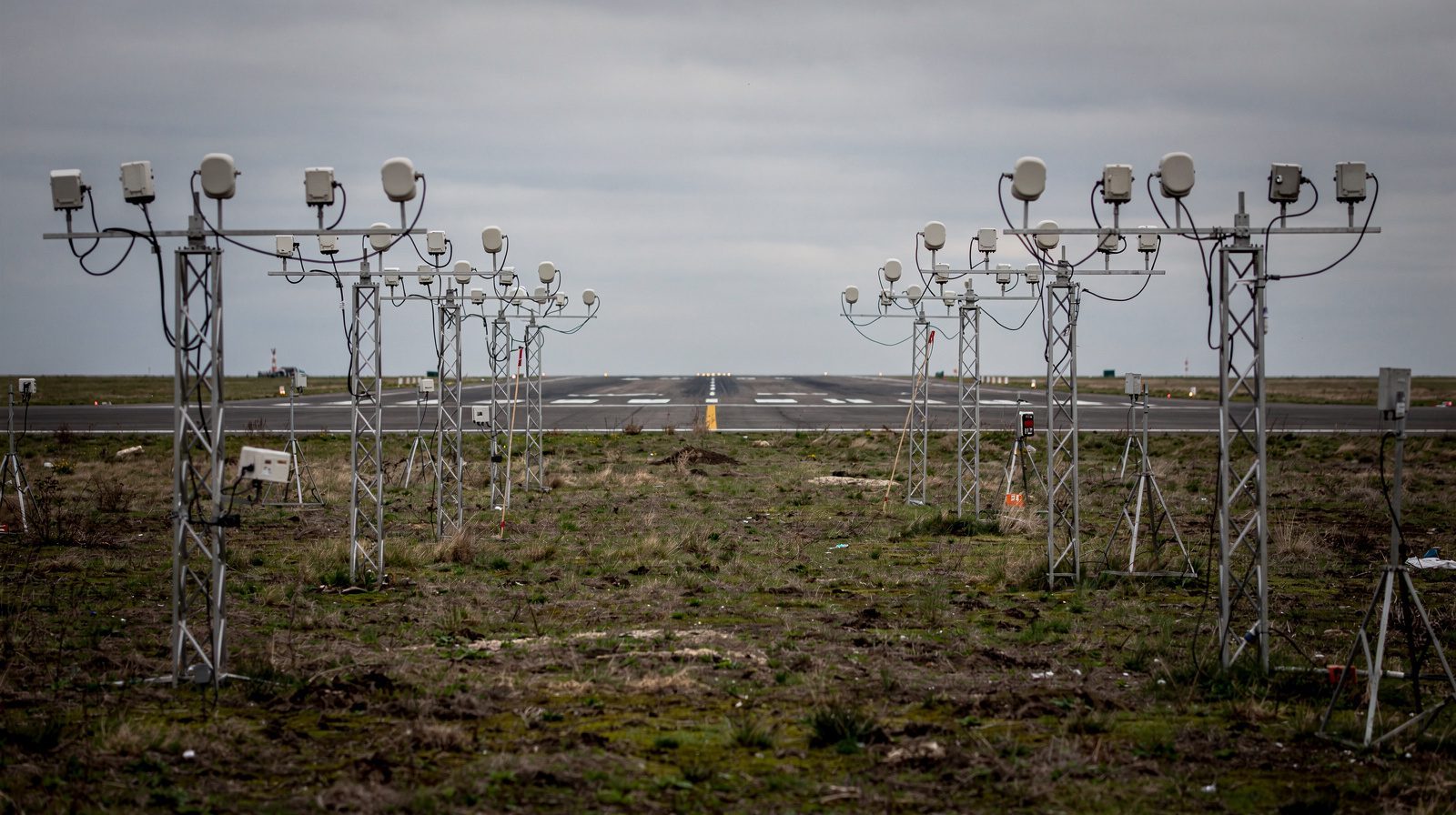
- Generic PAR. The FPN-40, FPN-62 and FPN-63, MPN-14, TPN-18 and TPN-44. These radars have mechanically scanned azimuth and elevation antennas. A PAR may be part of a larger system that includes an ASR.
- GPN-22 and TPN-25. These radars have an electrically scanned antenna that does not move.
The order names model designations and not makers.
What the FAA inspects
A PAR flight inspection has three parts. They are the azimuth radar, the elevation radar, and the system and controller performance. The commissioning inspection sets a baseline. Later periodic inspections compare against it.
The order sets these limits for a PAR that is classified unrestricted:
| Item | Limit |
|---|---|
| Course alignment at the threshold | 30 ft (9 m) from the runway centre line |
| Range accuracy | 2 percent of the true range |
| Usable distance, azimuth and elevation | At least 7.5 nm (13.9 km) to touchdown |
| Lateral coverage | 10 degrees each side of the procedural centre line |
| Glidepath angle | 0.1 degree of the published angle at commissioning, 0.2 degree at a periodic |
| Coincidence with a published ILS, GLS, LPV or VGSI angle | 0.2 degree |
| Standby equipment | The same as the primary equipment |
Normal PAR coverage is 20 nm (37 km). The order sets the coverage limits at commissioning with a 20-mile final approach. The controllers and maintenance staff then monitor coverage daily, with targets of opportunity.
The checklist uses two cursors. The A cursor is the commissioned glidepath angle. The B cursor is the lower safe limit, normally 0.5 degree below the A cursor. A special inspection follows an antenna change or a glidepath angle change. It also follows a change of the alignment, the radiation pattern, or the height or position of the reference reflector.
For the schedule, the order inspects a PAR at 90 and 180 days after commissioning, for each runway and alternate angle. After that, it alternates runways so that each runway gets a check at least once each 540 days.
What it means on an airfield
A PAR is an air traffic and radio navigation installation. A lighting inspection does not measure it. The visual aids still matter, because the pilot continues to the decision altitude and then needs the runway environment in sight.
The FAA order aims approach lights, except semi-flush lights, vertically at a point on the ILS or PAR glidepath. The point is 1,600 ft (488 m) ahead of the light. TarmacView inspects approach lighting with a drone and reports each light. It does not inspect or calibrate radio navigation aids or radars.
Frequently Asked Questions
- What is a precision approach radar?
- A precision approach radar (PAR) is a ground radar that shows azimuth, elevation and range so a controller can guide an aircraft to land. ICAO defines it as primary radar equipment. It finds the position of an aircraft on final approach, as lateral and vertical deviations from a nominal path, and as range to touchdown.
- How does a PAR approach work?
- The controller sees the aircraft on the PAR display and gives it headings to stay on the extended runway centre line. The pilot hears when to start descent and is told how far above or below the glidepath the aircraft is. The controller gives range from touchdown at least once each mile. The guidance continues to the published decision altitude.
- What is the difference between PAR and ILS?
- An ILS sends radio beams that the aircraft receives with its ILS equipment. A PAR is a radar on the ground and the controller gives the guidance by radio. The FAA says that a radar approach needs only a working radio transmitter and receiver in the aircraft.
- What is the difference between a PAR and an ASR approach?
- A PAR approach gives azimuth and elevation guidance. An airport surveillance radar (ASR) approach gives azimuth guidance only, and the pilot flies to a minimum descent altitude. The FAA says that the radar data for an ASR approach is considerably less precise than the data for a PAR.
- Who makes precision approach radars?
- The FAA flight inspection order names the radar types by their model designations. The generic family is FPN-40, FPN-62 and FPN-63, MPN-14, TPN-18 and TPN-44. The GPN-22 and TPN-25 are electrically scanned. The order does not name the makers.
- Who uses PAR today?
- The FAA glossary says that PAR equipment is in some ATC facilities that the FAA or the military operate. These are joint-use civil and military locations and separate military installations. A pilot may ask for a radar approach, and the approach does not waive the weather minima of the airport or the operator.
- How accurate must a PAR be?
- In the FAA flight inspection order, the glidepath angle has a limit of 0.1 degree from the published angle at commissioning. At a periodic inspection the limit is 0.2 degree. The course alignment at the runway threshold must be within 30 ft (9 m) of the runway centre line. The range accuracy limit is 2 percent of the true range.
References
- faa-pcg
- Pilot/Controller Glossary: P FAA
- faa-jo-7110-65
- Order JO 7110.65BB, Air Traffic Control, Chapter 5, Section 10: Radar Approaches - Terminal FAA
- faa-order-8200-1d
- Order 8200.1D, Change 2, United States Standard Flight Inspection Manual FAA
This is a reference entry. TarmacView provides drone inspection services and doesn't sell the equipment or materials described in this glossary.